Site Information

Welcome to Hertfordshire Walker

CPRE Hertfordshire double award winner 2022

Showing posts with label 1-3 miles. Show all posts

Walk 175: Hertford to Cole Green

5.5 miles (8.8 km) with 89m of total ascent


The Cole Green Way
The Cole Green Way
We mapped this route following a request on Twitter for a walk that is buggy friendly and involves a pub. The person who contacted us lives in Hertford. So we just put this walk together for any buggy pushers who live in Hertford and want a flat route with the option of refreshments at the start, middle point, and end.

The walk can be enjoyed one-way if you can get someone to pick you up at The Cowper Arms (2.6 miles), or, if you have the stamina, turn back from the pub and return the same way (5.5 miles). There is a pub, The Black Horse (location - https://w3w.co/names.muddy.successes) near the start of the walk. It has a lovely beer garden at the back and is a CAMRA freehouse.

The walk is mainly along the Cole Green Way, which follows what was the route of the old Hertford to Welwyn Junction Line. It's also part of the Lea Valley Walk. Here is the request we received on the Hertfordshire Walker Twitter feed.

Twitter request for a buggy friendly walk with a pub at the end
So this is what we produced.

Directions


Map for Walk 175: Hertford to Cole Green
(click here or on the map for larger version)
Created on Map Hub by Hertfordshire Walker
Elements © Thunderforest © OpenStreetMap contributors

There is an interactive map below these directions
Those with GPS devices can download GPX or KML files for this walk. We've added What3Words location references for those who use that system. If you print these walks you might want to use the green PrintFriendly icon at the bottom of these directions to delete elements such as photographs.

For those driving to the start of the walk, we saw several parking places near the the junction mentioned in point 2 below (location - https://w3w.co/venue.curiosity.loss) We didn't park there and we didn't check any parking restrictions.

The byway heading SW off West Street, Hertford
1: The route starts on West Street in Hertford, which is accessible from the town centre via a pedestrian crossing with traffic light control over the A414. Walk WSW along West Street passing the Black Horse pub freehouse on the left which has an lovely beer garden at the back and serves excellent real ale (location - https://w3w.co/names.muddy.successes).

Continue heading SW for 430m to reach a byway on the right (location - https://w3w.co/prop.gives.deaf). This is Hertford BOAT 54 (byway open to all traffic).

Hertford BOAT 54 heading SW towards the viaduct
2: Turn right on Hertford BOAT 54 then head SW and W for 400m, crossing the River Lea via a bridge (location - https://w3w.co/filer.pulled.vivid) then passing Hertford Town Football Club on the right (location - https://w3w.co/hats.truth.ships) and continuing until you reach a railway viaduct (location - https://w3w.co/decay.search.bring).

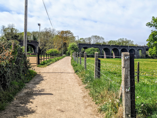
Once you reach the Cole Green Way follow it SW
3: Go under the viaduct then continue heading SW, now on Hertford footpath 55, for 80m until you reach the Cole Green Way (location - https://w3w.co/text.shells.lonely). Turn left on the Cole Green Way then follow it SW and W for 2.1 miles (3.4 km) until you reach the remains of the old Cole Green Station (location - https://w3w.co/sports.senior.chins).

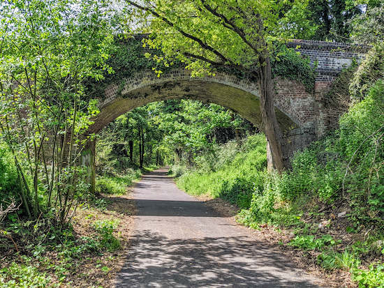
Continue heading WSW along the Cole Green Way
As you head along the Cole Green Way the former railway branch line will cross a number of lanes including St Mary's Lane (location - https://w3w.co/divisions.backs.emerge), Staines Green (location - https://w3w.co/raft.digits.leaves), and Birch Green at its junction with Chapel Lane (location - https://w3w.co/critic.teams.dairy). You will also notice several footpaths on the right and left; ignore them all.

The approach to Cole Green station with the platform on the right
4: Leave the Cole Green Way by by turning right and climbing up the ramp to reach what was the platform at Cole Green Station then turn left when you reach the car park and head W for 120m until you reach Station Road (location - https://w3w.co/medium.farm.ozone). Turn right on Station Road and The Cowper Arms is on your right (location - https://w3w.co/rarely.cities.bronze).

For those returning to Hertford just follow the route in reverse. 

Interactive map


Walk 162: Heartwood Forest Short Loop

3 miles (4.7km) with 64m of total ascent


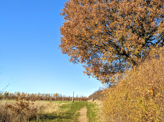
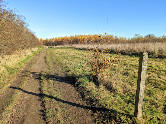
A footpath through Heartwood Forest
 
This short walk explores some of the woodlands that are part of Heartwood Forest, the largest continuous new native forest in England, which is managed by The Woodland Trust. Those who visit this area on a regular basis, as we do, will notice how quickly it has matured. This has been a good autumn for enjoying the spread of colour. There are some great paths weaving through the forest. It has a free car park, and there are various information boards scattered throughout the area. There are no toilets. Children will enjoy the 'Magical Meander' where they are encouraged to find wooden carvings along the way. We have a downloadable PDF of the route below.

Directions


Map for Walk 162: Heartwood Forest Loop Created on Map Hub by Hertfordshire Walker Elements © Thunderforest © OpenStreetMap contributors There is an interactive map below these directions
Map for Walk 162: Heartwood Forest Short Loop
Created on Map Hub by Hertfordshire Walker
Elements © Thunderforest © OpenStreetMap contributors

There is an interactive map below these directions
Those with GPS devices can download GPX or KML files for this walk. We've added What3Words location references for those who use that system. If you print these walks you might want to use the green PrintFriendly icon at the bottom of these directions to delete elements such as photographs.

Park in the free car park at Heartwood Forest off Wheathampstead Road, Sandridge (location - https://w3w.co/splash.unfair.land). Walk through the overspill car park to the N of the main, circular car park until you reach a junction at the NE end of the overspill field (location - https://w3w.co/belong.arts.erase).

Head NW and uphill for 670m stopping to check the view behind
1: Turn left on a path that heads NW and uphill for 670m. This is a steady climb with increasingly impressive views behind.

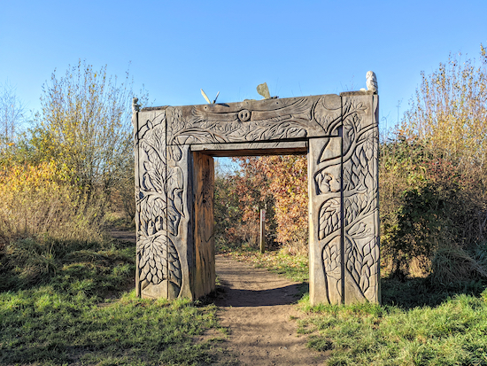
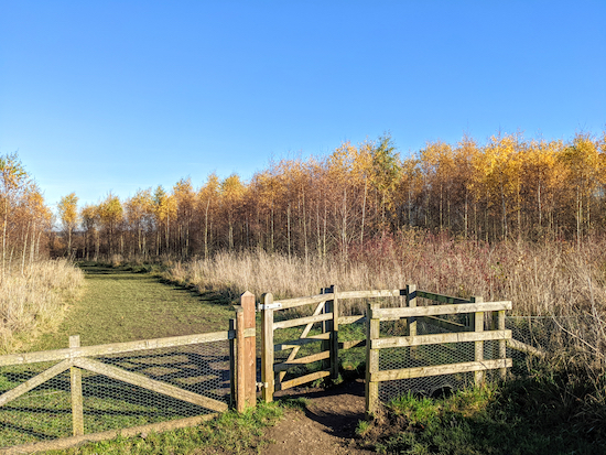
One of the three entrances to The Magical Wood
2: At a junction in the tracks (location - https://w3w.co/overnight.wiping.push) take the second path on the left, passing through the wooden carved archway to enter The Magical Wood then head SW and follow the path for 240m as it winds its way through a young woodland before reaching a three-way junction and a picnic area (location - https://w3w.co/army.unit.asking).

A carved owl, one of several wooden sculptures in Heartwood Forest
3: Turn right before the picnic area then head NW, still weaving through The Magical Wood, for 310m until you leave the woodland and reach a footpath junction (location - https://w3w.co/supply.nights.cones).

Head NE with the hedgerow on the left and field on the right
4: Five paths converge at this junction. You take the second on the right which heads NE with the hedgerow on the left and field on the right (see image above) for 320m until you reach a junction (location - https://w3w.co/audit.crown.react).

Turn left before the gate then head NW towards Round Wood
5: When you reach a gate, see image above, turn left, without going through the gate, then head NW for 170m until you reach a footpath junction (location - https://w3w.co/tower.drew.retire).

Head NW until you reach the gate leading to Round Wood
6: Continue heading NW entering Round Wood and following the path for 140m until you reach the end of the woodland (location - https://w3w.co/civil.hook.atomic).

7: Turn left then head SW with the woodland on your left for 410m until you reach a junction (location - https://w3w.co/ropes.chefs.shops).

There is an option for walking through the woods between points 8 & 9

The detour - in orange - through Pudler's Wood and Well Wood
8: Keep right at the junction and continue heading SW, then SE then SW again for 600m with Pudler's Wood and later Well Wood on the left and the field on the right until you reach a junction (location - https://w3w.co/advice.monks.gain).

9: Turn left then head ESE for 550m, now on Sandridge bridleway 8, and continue until you reach a junction (location - https://w3w.co/settle.stack.quick). On your left will be another entrance to The Magical Wood which you wandered through earlier in the walk.

10: At this point take the second path on the right through Langley Wood (location - https://w3w.co/bits.falls.staple), then follow it as it weaves its way through the woodland which is carpeted in bluebells in the spring. Continue following the path round to the left until you reach a junction (location - https://w3w.co/trades.broken.beyond).

11: Turn right on Sandridge bridleway 8 then head ESE for 280m looking out for a gate on the left (location - https://w3w.co/dive.transit.love).

12: Turn left at the gate then turn right and follow the path back to the car park.

There are three pubs in Sandridge, The Green Man (location - https://w3w.co/yappy.punchy.facing), The Queens Head (location - https://w3w.co/drama.slick.plan), and The Rose & Crown (location - https://w3w.co/tidy.book.spin).

Interactive map


Official walking routes


The Woodland Trust has put together three circular walks through Heartwood Forest. You can download them below.


Walk 138: Titmore Green Loop

2.8 miles (4.6 km) with 52m of total ascent


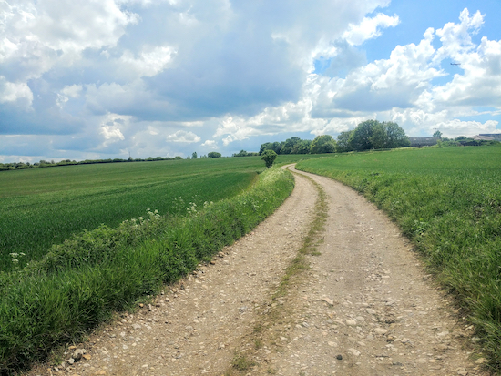
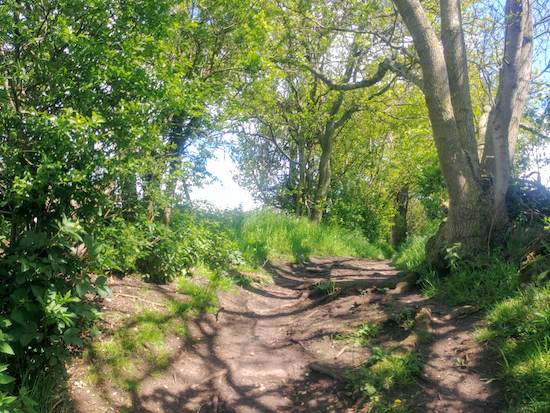
Wooded bridleway shortly after point 7
This is a great walk if you enjoy wide open views across rolling countryside and walking along wooded byways. The walk starts and finishes at the Hermit of Redcoats pub in Titmore Green and follows footpaths and bridleways to the south. Don’t be put off by the proximity of the A1(M), you can’t see it and the noise isn’t bothersome.

Directions


Map for Walk 138: Titmore Green Loop Created on Map Hub by Hertfordshire Walker Elements © Thunderforest © OpenStreetMap contributors There is an interactive map below these directions
Map for Walk 138: Titmore Green Loop
Created on Map Hub by Hertfordshire Walker
Elements © Thunderforest © OpenStreetMap contributors

There is an interactive map below these directions
Those who follow our walks using GPS on their mobile devices can download GPX or KML files for this walk. We've added What3Words location references for those who use that navigation system. If you print these walks you might want to use the green PrintFriendly icon at the bottom of these directions to delete elements you don't need.

Staff at the Hermit of Redcoats pub restaurant on Stevenage Road (location - https://w3w.co/fades.gold.paper) told us that those following this walk are welcome to park in the pub’s car park if they intend to take refreshments at the pub before or after their walk.

Alternatively, if you are not eating or drinking at the pub, there is another parking spot that involves a short detour to join the walk. We've placed a blue marker on the maps above and below showing the place where we parked in a nearby lane called Lower Titmore Green (location - https://w3w.co/skips.puts.horns). Be sure not to block any gates if you park down that lane.

If you use the alternative parking place start the walk by heading SE along Lower Titmore Green for 280m until you reach point 2 in the directions below, where you turn right, go through a gate, and pick up the route by turning left on Wymondley footpath 15.

The Hermit Of Redcoats in Titmore Green
The Hermit of Redcoats in Titmore Green

1: From opposite the Hermit of Redcoats pub restaurant take Wymondley footpath 17 (location - https://w3w.co/stray.wink.blast) and head SSE and downhill for 320m with the hedgerow on your left and the field on your right until you reach a junction where you turn right just before the gate and take Wymondley footpath 15 (location - https://w3w.co/yard.tigers.burst), see image below.

Wymondley footpath 15 heading SW from point 2
Wymondley footpath 15 heading SW
2: Follow Wymondley footpath 15 and head SW for 260m going through a gate, over a footbridge, and through another gate before continuing with the hedgerow on your right and the field on your left until you reach a footpath junction (location - https://w3w.co/nerve.detail.formal).

Head SW on Wymondley footpath 15 to a footpath junction
3: Turn right on Wymondley footpath 16 first heading WNW for 60m, with the hedgerow on the right and the field on the left, and then heading WSW for 300m, with an irrigation ditch on the right and the field on the left. Continue until the path climbs some steps where it becomes Ippollitts footpath 19 (location - https://w3w.co/stacks.intelligible.olive).

Continue on Ippollitts footpath 19 heading WSW for 310m with the hedgerow on your right and the field on your left until you reach a junction (location - https://w3w.co/radio.sits.twist).

4: Turn left on Ippollitts bridleway 20 then head SSE for 650m to Almshoe Bury and a junction (location - https://w3w.co/piano.doctor.design).

Ippollitts bridleway 20 between points 4 and 5
5: Turn left on Ippollitts bridleway 23 then head ENE and then SSE through a farmyard (see satellite image below) then continue along a track between the fields for 880m until you reach a junction soon after a copse and pond on the left (location - https://w3w.co/porch.posed.cargo).

The green line shows the route of Ippollitts bridleway 23 through the farmyard Source: Esri, DigitalGlobe, GeoEye, Earthstar Geographics, CNES/Airbus DS, USDA, USGS, AEX, Getmapping, Aerogrid, IGN, IGP, swisstopo, and the GIS User Community
The green line shows the route of Ippollitts bridleway 23 through the farmyard
Source: Esri, DigitalGlobe, GeoEye, Earthstar Geographics, CNES/Airbus DS, USDA, USGS,
AEX, Getmapping, Aerogrid, IGN, IGP, swisstopo, and the GIS User Community
6: Turn left at the junction on Ippollitts bridleway 24 then head NNE for 240m (this bit was muddy) until you reach woodland on your left. Here the path turns left (location - https://w3w.co/toward.zoom.forget) then heads NW with the woodland on the right and field on the left for 150m before turning right through a gap in the hedgerow (location - https://w3w.co/served.blend.porch).

7: You are now on Wymondley bridleway 22. Head NE then NW for 1.2km ignoring three footpaths on the right along the way and continuing until you reach Lower Titmore Green and are back at point 2 in these directions.

Wymondley bridleway 22 between points 7 and 8
8: Go through the gate and head NNW for 320m and uphill along Wymondley footpath 17 with the hedgerow on the right and field on the left until you reach the starting point.
* Those who parked in the lane called Lower Titmore Green should keep right at point 8 and head NE along Lower Titmore Green to reach their car.
The gate leading to Wymondley footpath 17 and the track up to the start point
The gate leading to Wymondley footpath 17 returning to the start point


Interactive map


Walk 101: Colney Heath Loop

2.4 miles (3.9 km) with 32m total ascent


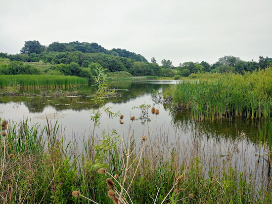
Willows Lakes
Willows Lakes
This is a short walk across Colney Heath, along the River Colne, and alongside Willows Lakes (renamed Albans Lakes in 2018), where anyone who enjoys bird-watching could be in for a treat depending on the season, particularly between points 5 and 6. There is free parking at the start and finish, and a pub, The Crooked Billet, in Colney Heath, a short diversion from the route. This walk is a shorter version of another walk on this site, Colney Heath South Loop.

Directions


Map for Walk 101: Colney Heath Loop Created on Map Hub by Hertfordshire Walker Elements © Thunderforest © OpenStreetMap contributors There is an interactive map below the directions
Map for Walk 101: Colney Heath Loop
Created on Map Hub by Hertfordshire Walker
Elements © Thunderforest © OpenStreetMap contributors

There is an interactive map below the directions
Those with GPS devices can download GPX or KML files for this walk. We've added What3Words location references for those who use that navigation system. If you print these walks you might want to use the green PrintFriendly icon at the bottom of these directions to delete elements you don't need.

Park along the track west of Coursers Road to the south of Colney Heath, (location - https://w3w.co/cabin.spoon.dozen). Please keep to the public rights of way on this walk. We have included a map at the foot of this page showing the public rights of way around Willows Lakes in green and the paths reserved for those fishing the lakes in red.

1: Take the footpath that leads across the heath but turn left after 15m on Colney Heath footpath 36, following it as it bends SW and then turns NW through the woods for 280m until you meet a footpath junction (location - https://w3w.co/baking.quick.jars). This is where Colney Heath footpath 36 heads SW across the field. You will return on this path, but for now, ignore it and continue NW through the woods for another 100m until you reach the open heath (location - https://w3w.co/agree.bricks.improving). You are now on Colney Heath footpath 35. Follow this path W for another 440m until you meet Church Lane (location - https://w3w.co/social.pose.awake).

2: Turn left on Church Lane for 20m before taking the footpath on your right (location - https://w3w.co/lazy.fines.offer). This is Ridge footpath 2, which passes a model railway on the left run by the North London Society of Model Engineers. This track is also the Watling Chase Timberland Trail. Follow the footpath SW for 550m until you reach a track (location - https://w3w.co/gent.adults.sums).

3: Cross the track and then cross a bridge over a conveyor belt (location - https://w3w.co/gear.socket.grant) carrying sand from a nearby quarry before continuing along Ridge footpath 2 for another 100m until you come to a junction with Ridge bridleway 6 (location - https://w3w.co/raced.tubes.cotton). Turn left and follow the bridleway SW for 400m looking out for a bridleway on your left (location - https://w3w.co/tester.nature.museum).

Heading SW on Ridge footpath 2 Image by Hertfordshire Walker released via Creative Commons BY-NC-SA 4.0
Head SW on Ridge footpath 2

The junction of Ridge bridleway 6 and Ridge footpath 2 mentioned in point 3 Image by Hertfordshire Walker released via Creative Commons BY-NC-SA 4.0
The junction of Ridge bridleway 6 and Ridge footpath 2
4: Unusually for a bridleway, this one involves wooden steps crossing over the conveyor belt from the quarry. Take this bridleway, still Ridge bridleway 6, and head SE for 400m.

* Once over the bridge you could take a 680m circular detour to the south through Garden Wood if you want to extend the walk. The detour brings your back to point 5.

The wooden steps on Ridge bridleway 6
The conveyor belt from the quarry mentioned in point 4 above Image by Hertfordshire Walker released via Creative Commons BY-NC-SA 4.0
The conveyor belt from the quarry
5: When you reach the next crossing (location - https://w3w.co/translated.stick.goes), turn left and head NE for 250m on Ridge footpath 4. This is a really nice path that goes between two lakes and is an ideal spot for birdwatchers.

Ridge bridleway 6 between the lakes as mentioned in point 5 above Image by Hertfordshire Walker released via Creative Commons BY-NC-SA 4.0
Ridge bridleway 6 between the lakes
6: When you reach the next footpath junction (location - https://w3w.co/tone.avoid.brings) there is a diversion that avoids crossing the field occupied by horses. The farmer has put a sign up here warning that dogs are loose in the field. Rather than take a risk we chose the diversion, Ridge footpath 47. Turn left on this path, to the left of the field, and follow it as it weaves its way around the field for 320m first NE, then NW, then NE, then NW, and eventually SE before it rejoins Ridge footpath 4 (location - https://w3w.co/valve.retail.lied).

Take the diversion on the left Ridge footpath 47 mentioned in point 6 above Image by Hertfordshire Walker released via Creative Commons BY-NC-SA 4.0
Take the diversion on the left, Ridge footpath 47
7: Turn left on Ridge footpath 4 and head NE for 530m until you reach a footbridge (location - https://w3w.co/save.launch.tree).

The footbridge mentioned in points 7 and 8 Image by Hertfordshire Walker released via Creative Commons BY-NC-SA 4.0
The footbridge mentioned in points 7 and 8
8: Cross the footbridge and continue heading NW for another 170m on Colney Heath footpath 36 until you reach the woods south of Colney Heath (location - https://w3w.co/highs.fell.hopes).

9: Continue heading NE on Colney Heath footpath 36 for 70m before branching off to the right and heading W back to the starting point.

Rights of way and private paths


Public rights of way in green, private fishing paths in red
The green markers show two land-bridge across the lakes

Click here or on image for larger version
Created on Map Hub by Hertfordshire Walker
Elements © Thunderforest © OpenStreetMap contributors

Interactive map


Walk 84: Waterford Heath Loop

2 miles (3.2 km) with 50m of total ascent


The River Beane on Walk 84: Waterford Heath Loop Image by Hertfordshire Walker released under Creative Commons BY-NC-SA 4.0
The River Beane on Walk 84: Waterford Heath Loop
This is a short walk through several fascinating geological areas including an old quarry which is now a nature reserve which features marshland alongside a rare chalk-bed river and deep woodland. The route has a fair amount of up and down as you loop across heaths, down to the river, and back up through the woods. There are notices along the way asking dog owners to keep their pets on a lead.

There is a free car park (at time of writing). We recommend you approach the car park on Vicarage Lane from the east and not the west. Click here for our suggested route.

Unlike most of our walks, this route doesn't pass close to a pub or a cafe, so take refreshments with you. There is an elevated picnic table three quarters of the way round affording great views. The nearest places to find refreshments are in Bengeo which is about a mile to the south of the start and finish point by road. They are The Greyhound (location - https://w3w.co/helps.blunt.calculating), The White Lion (location - https://w3w.co/golf.cabin.thick), and The Secret Garden cafe (location - https://w3w.co/define.knots.gift).

The starting point is two miles N from Hertford North station by road. We have another walk in this area. It's Walk 203: Waterford Heath South-West Loop.

Directions


Map for Walk 84: Waterford Heath Loop
Click here or on the map above for a larger version
Created on Map Hub by Hertfordshire Walker
Elements © Thunderforest © OpenStreetMap contributors

There is an interactive map below the directions
Those with GPS devices can download GPX or KML files for this walk. We've added What3Words location references for those who use that system. If you print these walks you might want to use the green PrintFriendly icon at the bottom of these directions to delete elements such as photographs.

From the car park off Vicarage Lane (location - https://w3w.co/truly.tooth.shiny). You will notice two paths leading out of the car park, one to the NE and the other to the NW. Before you set off, study the map on the information board. At least half of the walk is within the Herts and Middlesex Wildlife Trusts Waterford Heath reserve.

1: Leave the car park in the NE corner (location - https://w3w.co/sudden.quite.enhancement) and follow the path through the woods and out to open heath land. This is the North Heath. Head NNW then N for 430m until you reach a junction in the track (location - https://w3w.co/fried.enjoy.stud).

The route as it crossed North Heath Image by Hertfordshire Walker released under Creative Commons BY-NC-SA 4.0
The route as it crossed North Heath
2: Turn left at a gate leading to a path on your left with a signpost bearing the black Herts and Middlesex Trust arrow and head NNW then W for 160m down to the river.

Take the path on the left as it leads down wooden steps to the River Beane Image by Hertfordshire Walker released under Creative Commons BY-NC-SA 4.0
Take the path on the left as it leads down wooden steps to the River Beane
3: At the bottom of a series of wooden steps you reach a footpath T-junction. Here you turn left and walk SSW alongside the River Beane on Stapleford footpath 2. There is a bench on the left about 20m after turning left, see image below.
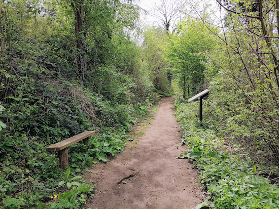
Bench along Stapleford footpath 2 Image courtesy of Gerry Gross
Bench along Stapleford footpath 2
Image courtesy of Gerry Gross
Continue walking alongside the river for 160m, ignoring a path on your left, and follow the path under the railway bridge (location - https://w3w.co/sling.invent.cars).

Continue alongside the River Beane and under the railway Image by Hertfordshire Walker released under Creative Commons BY-NC-SA 4.0
Continue alongside the River Beane and under the railway
4: You now cross open ground heading SSW for 140m before reaching Barley Croft (location - https://w3w.co/chairs.chops.spite). Continue heading S until you reach Vicarage Lane (location - https://w3w.co/doing.sand.remedy). Here you turn right and head W for 60m looking out for a path on your left before you reach the River Beane (location - https://w3w.co/rang.hooks.cried).

5: Turn left on this footpath, still Stapleford footpath 2, and follow it as it heads S alongside the river for 200m until you reach a fork in the path (location - https://w3w.co/vows.chin.vets).

Looking back along the River Beane - continue with the river on your right Image by Hertfordshire Walker released under Creative Commons BY-NC-SA 4.0
Looking back along the River Beane - continue with the river on your right
6: At the point where the path forks, take the right-hand fork keeping close to the river bank. You are now on Hertford footpath 26. Continue until you reach a wooden signpost (location - https://w3w.co/dice.eggs.home), see below at a pretty bend in the river (see top photo).

Turn left at the marker and follow the black arrow signs Image by Hertfordshire Walker released under Creative Commons BY-NC-SA 4.0
Turn left at the marker and follow the black arrow signs
7: Turn left on Hertford footpath 24, and walk E for 210m across the field, under the railway, through a gate, and then up through the woodland.

8: When you reach a footpath T-junction turn left, still on Hertford footpath 24, and head NE looking out for a marker post with yellow and black arrows. Here you turn left and follow the path as it bends round to the right and continues to South Heath.

At the top of the hill, turn left and follow the black arrow signs Image by Hertfordshire Walker released under Creative Commons BY-NC-SA 4.0
At the top of the hill, turn left and follow the black arrow signs
9: You will reach the Sacombe Road car park (location - https://w3w.co/they.chase.acted) with several paths heading off to your left. You take the path closest to the road (location - https://w3w.co/bugs.cliff.pads) which you follow it as it heads along the edge of woodland, first N then NW for 700m before reaching the car park alongside Vicarage Lane.

Getting to the car park


We recommend you approach the car park on Vicarage Lane from the east and not the west.

If you approach from the west the lane is narrow with few passing places and there is a sharp bend over the railway bridge where we got trapped in a traffic jam caused by an articulated truck getting stuck. It took half an hour to clear.

A local resident told us it is far better to approach the car park via Bulls Mill Lane, Sacombe Road, then Vicarage Lane. They were right. We rerouted that way. I have created a map (below) to show the recommended route to the car park in green and the narrower route in red. Click on the map for a larger version.

Recommended route to car park in green
Created on Map Hub by Hertfordshire Walker
Elements © Thunderforest © OpenStreetMap contributors
Click here to return to the start of the directions for the walk.

Interactive map


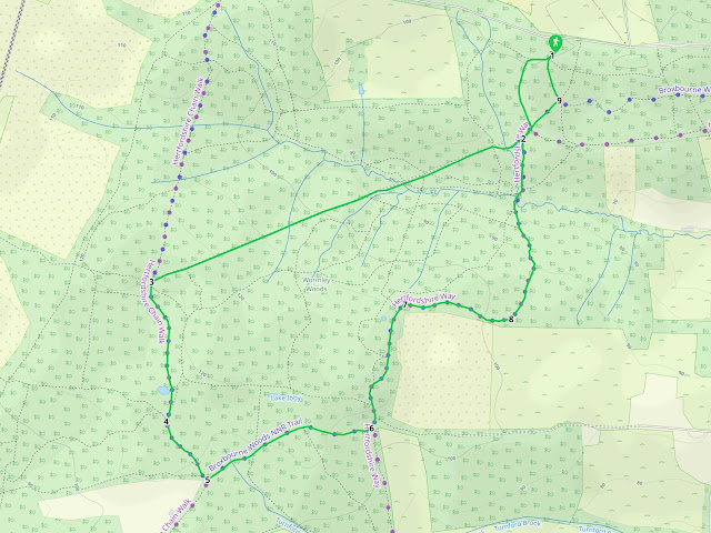
Walk 81: Wormley Wood Loop

2.5 miles (4 km) with 76m total ascent


Photograph of The sign at the entrance to Wormley Wood Image by Hertfordshire Walker, released under Creative Commons BY-NC-SA 4.0
 
A great walk for those hot sunny days when you want to escape the sun and enjoy a good ramble in the shade. Plenty of up and down along the way, with loads of bridges, elevated walkways and stairs. When we walked the route in August there were quite a few midges and flies bugging us, but we always carry insect repellant and didn't get bitten. Unlike most of our walks this one doesn't pass by a pub, so take refreshments with you. There is a picnic table at the end just before you reach the car park. Wormley Wood is managed by the Woodland Trust.

Fly through preview of walk


If you want to check what sort of landscape you will be crossing before you set off on this walk you can view a short 3D video of the route below. It's created using the free version of Relive.


Directions


Map for Walk 81: Wormley Wood Loo
Map for Walk 81: Wormley Wood Loop
Click on the map for a larger version
Created on Map Hub by Hertfordshire Walker
Elements © Thunderforest © OpenStreetMap contributors

There is an interactive map below the directions
Those with GPS devices can download GPX or KML files for this walk. We've added What3Words location references for those who use that system. If you print these walks you might want to use the green PrintFriendly icon at the bottom of these directions to delete elements such as photographs.

Park in Bencroft Wood (West) car park on the south side of White Stubbs Lane (location - https://w3w.co/candy.expose.couches). It's a free car park but has limited space. You will find a sign in the car park with a map showing two trail options for Bencroft Wood, but your route is not one of them, although the first section uses one of the paths on our route in order to access Wormley Wood.

1: From the car park head SW, following the wooden signs with the purple circle around the top. Continue as the path heads S downhill, first down some wooden steps and then along a wooden elevated walkway.

Photograph along Walk 81 Wormley Wood Loop
Follow the trail downhill and S
2: When you reach a footpath junction turn right and head SW down to a stream which you cross via a wooden footbridge and then climb the other side using wooden steps, see image below. This is quite a steep but short climb. You will now be following posts with a pink line around the top.

Photograph along Walk 81. Cross the footbridge and climb the steps as you continue to head south-west  Image by Hertfordshire Walker, released under Creative Commons BY-NC-SA 4.0
Cross the footbridge and climb the steps as you continue to head SW
Continue heading in a straight line WSW along this path for 980m as it crosses a couple of wooden footbridges, see image below.

Photograph along Walk 81. Continue heading south-west as the track climbs through the woodland Image by Hertfordshire Walker, released under Creative Commons BY-NC-SA 4.0
Continue heading WSW as the track climbs through the woodland
3: At the point where the track meets a footpath T-junction turn slightly left and head S then SSE and S for 390m following the signs with the green tops and white admiral butterflies. This is the only exposed part of the walk and you will spend about five minutes walking along an elevated walkway with flowers either side. Look out for butterflies along this part of the path. It's a charming section.

Photograph of A Silver-Washed Fritillary butterfly on brambles between points 3 & 4 Image by Hertfordshire Walker, released under Creative Commons BY-NC-SA 4.0
A Silver-Washed Fritillary butterfly on brambles between points 3 & 4
4: Continue heading SSE along this path for 190m ignoring smaller paths to your right and left.

Photograph along Walk 81. After the elevated walkway section you enter the woods again  Image by Hertfordshire Walker, released under Creative Commons BY-NC-SA 4.0
After the elevated walkway section you enter the woods again
5: At a footpath crossing turn left and head NE, ENE, then E through the woodland for 480m.

6: At the next footpath crossing turn left and head N and NE for 360m.

7: When you reach the coal post on your left (location - https://w3w.co/words.fact.struck), turn right and head E for 300m.

Photograph of The coal post at point 7 on the route Image by Hertfordshire Walker, released under Creative Commons BY-NC-SA 4.0
The coal post at point 7 on the route
8: Follow the path as it bends to your left and heads N and NE for 530m back to point 2 on the route.Turn right and follow the path NE for 130m.

9: At the point where a track crosses your path, turn left and head NNW for 110m back to the car park, see image below.

Photograph on Walk 81. Turn left and head north back to the car park Image by Hertfordshire Walker, released under Creative Commons BY-NC-SA 4.0
Turn left and head N back to the car park

Interactive map


Facebook group rules

Facebook group rules
We have set 10 rules for our Hertfordshire Walker Facebook group which are designed to help keep the group focused on walking in the Hertfordshire countryside

Supported Charity: The Trussell Trust

Supported Charity: The Trussell Trust
Supporting those locked in poverty

Search This Site