6.9 miles (11 km) with 47m of total ascent
 |
| The bridleway heading towards Arbury Banks Hill Fort |
Directions
 |
| Map for Walk 140: Ashwell West Loop Created on Map Hub by Hertfordshire Walker Elements © Thunderforest © OpenStreetMap contributors There is an interactive map below these directions |
1: This walk starts outside the Bushel And Strike pub on Mill Street opposite the church of St Mary. Take the footpath that heads W along the N side of the pub (location - https://w3w.co/expensive.decreased.shuttled). This is Ashwell footpath 26, which heads W through the pub car park for 60m until you reach Gardiners Lane (location - https://w3w.co/operation.thunder.grapevine).
Turn right on Gardiners Lane and head NW for 120m until the lane bends to the left (location - https://w3w.co/birds.keys.windpipe) and then heads WNW for 100m before reaching a fork in the road (location - https://w3w.co/reclining.helps.skewing). Turn right at the fork and head NNW for 220m until you reach a farm at which point the lane swings to the right and heads NNE, NNW, then NNE again for 230m before reaching a footpath on the left (location - https://w3w.co/tangling.dash.repeat).
2: Turn left on Ashwell footpath 8 and head NW for 300m, first across a field and then alongside woodland on your left. Continue until you reach the end of the woodland (location - https://w3w.co/crunching.forget.hook) at which point Ashwell footpath 8 heads straight and slightly to the right across a field in a NW direction (see image below) for 480m until it reaches Common Lane (location - https://w3w.co/slimming.medium.decisive).
 |
| Your path heads slightly to the right in a NW direction - point 2 |
 |
| Common Lane heading SW towards Bluegates Farm |
 |
| Ashwell bridleway 20 - point 4 |
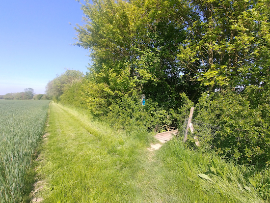
5: Turn right on Ashwell footpath 20 and head WSW for 170m looking out for a footpath on your right which is hidden in the hedgerow (location - https://w3w.co/commenced.madder.thrillers). Turn right on this path, Ashwell footpath 20, cross a footbridge, then head NW for 95m until you reach a second footbridge (location - https://w3w.co/stretcher.exhaling.sample).
 |
| Ashwell footpath 20 to the right - point 5 |
6: Cross the track and continue heading WNW, still on Hinxworth footpath 2 which is also known as Arnolds Lane along this stretch, for 620m until you reach a footpath junction (location - https://w3w.co/access.trailing.started). Ignore the path going off to your left and continue heading WNW along Arnolds Lane for 270m until you reach Chapel Street on your left (location - https://w3w.co/organs.jets.fabric).
7: Turn left on Chapel Street and head SW for 240m until you reach Ashwell Road in Hinxworth (location - https://w3w.co/keener.employer.expiring). The Three Horseshoes pub will be on the corner opposite and to your left. Cross Ashwell Road and take the footpath on the opposite side. This is Hinxworth footpath 1 which you follow SW, SE, then SW again for 270m until the path bends to the left (location - https://w3w.co/nods.seeing.grandson).
8: Turn left, still on Hinxworth footpath 1, and head ESE for 200m until you reach New Inn Road (location - https://w3w.co/almost.loaning.renting). Turn right on New Inn Road and head SE for 70m looking out for a track and footpath on the left.
9: Turn left on Hinxworth footpath 8 (location - https://w3w.co/explains.important.voted) and head ESE through some business units for 270m until you reach a footpath junction (location - https://w3w.co/condense.stated.adding).
10: Turn right on Hinxworth footpath 7 and head S then SSE for 520m until you reach a junction (location - https://w3w.co/general.umbrellas.backlog).
 |
| Hinxworth footpath 7 - point 10 |
12: Turn left on Ashwell Road and head NW for 180m until you reach a track on your right (location - https://w3w.co/chromatic.table.summaries).
* This stretch of road can be busy and it looks like walkers have chosen to tread a route along the edge of the field on the W side of the road to avoid the traffic.
Turn right on Ashwell restricted byway 3 and head SE for 470m passing a pig farm before reaching a junction (location - https://w3w.co/navy.sunflower.steady).
13: Turn left on Ashwell restricted byway 2 and head NE for 1.3km until you reach a junction (location - https://w3w.co/deferring.eventful.expressed).
* On your left after 900m along this stretch you will pass Arbury Banks Hill Fort where there is an information board about the former settlement (location - https://w3w.co/witless.dance.slogged).
 |
 |
15: Turn right on Ashwell BOAT 15, which is also known as Ashwell Street, and head ENE for 500m until you reach Bear Lane (location - https://w3w.co/dynamics.singles.stems).
16: Turn left on Bear Lane and head NNW for 250m back to Ashwell village centre and the starting point.
There are three pubs in Ashwell village, The Three Tuns (location - https://w3w.co/magnum.image.ironic), the Rose & Crown (location - https://w3w.co/reissued.informal.screening), and Bushel And Strike (location - https://w3w.co/ferried.hairpin.flitting) mentioned at the start of the
Thanks to our good friend Bernard for recommending that we add a walk in this area.


