Site Information

Welcome to Hertfordshire Walker

CPRE Hertfordshire double award winner 2022

Showing posts with label Queens Head - Sandridge. Show all posts

Walk 164: Heartwood Forest Outer Loop

4.2 miles (6.7 km) with 87m of total ascent


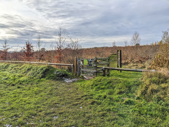
The gate leading out of Langley Wood at point 3 in the walk
 
This walk follows the boundary to the south, west, and north of Heartwood Forest. It starts and finishes in the free car park before looping through Langley Wood (which is carpeted in bluebells in the spring), then follows a bridleway along the southern edge of the forest and then heads along the western edge to reach Nomansland Common. This is one of four walks on this site that feature Heartwood Forest. There are three pubs in Sandridge village. The Green Man, The Queens Head, and The Rose and Crown.

Directions


Map for Walk 164: Heartwood Forest Outer Loop Created on Map Hub by Hertfordshire Walker Elements © Thunderforest © OpenStreetMap contributors There is an interactive map below these directions
Map for Walk 164: Heartwood Forest Outer Loop
Created on Map Hub by Hertfordshire Walker
Elements © Thunderforest © OpenStreetMap contributors

There is an interactive map below these directions
Those with GPS devices can download GPX or KML files for this walk. We've added What3Words location references for those who use that system. If you print these walks you might want to use the green PrintFriendly icon at the bottom of these directions to delete elements such as photographs.

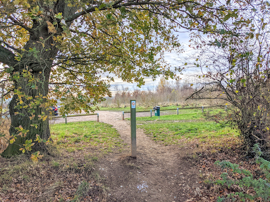
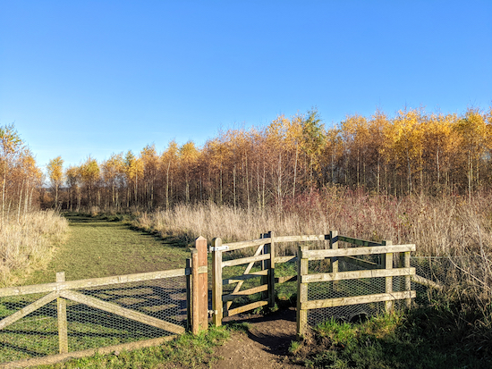
Take the path that heads W and slightly uphill from the car park
1: Park in the car park at Heartwood Forest (location - https://w3w.co/splash.unfair.land), then take the path that heads W and slightly uphill (location - https://w3w.co/famed.liver.boost), see image above. Follow the path for 220m until you reach a gate leading to a bridleway (location - https://w3w.co/dive.transit.love).

The wooden steps and gate leading to Langley Wood

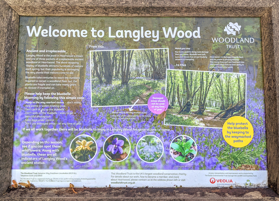
The information board at the entrance to Langley Wood
2: Go through the gate to leave Heartwood Forest then turn right on Sandridge bridleway 8. Head WNW and slightly uphill for 280m until you reach wooden steps on the left and a gate leading to Langley Wood (location - https://w3w.co/trades.broken.beyond).

Keep left at the junction in Langley Wood
Once in Langley Wood you are back in Heartwood Forest. Keep left then follow the path SW for 100m to a junction (location - https://w3w.co/shade.shack.zebra), see image above. Keep left at the junction then continue heading SW for 70m until you reach a gate leading out of the wood (location - https://w3w.co/snail.risen.object).

The gate leading to Sandridge bridleway 9
3: Leave the wood then keep left heading SSE for 90m until you reach a junction (location - https://w3w.co/wacky.game.roofs) where you go through a gate leading out of Heartwood Forest to reach Sandridge bridleway 9.

The path on the right off Sandridge bridleway 9
4: Turn right on the Sandridge bridleway 9 then follow it as it heads W for 780m until you reach a track on the right just before the railway line (location - https://w3w.co/radio.heave.storm).

Take the path to the left of the sign then head N with the fence on your left
5: When you reach the sign for Heartwood Forest (see image above), keep left taking the higher of two paths (not the one directly alongside the railway line) and keeping the fence on your right as you head NNW for 600m then N for 120m then NNE for 100m before reaching a junction (location - https://w3w.co/rather.flight.vest).

Cross Sandridge bridleway 8 then go through the gate
6: Cross Sandridge bridleway 8, go through a gate to re-enter Heartwood Forest, then head NE for 1.1km with the hedgerow on your left and field on your right until you reach a right-hand bend (location - https://w3w.co/stroke.feeds.placed). Turn right then follow the path as it heads SE for 150m to a junction (location - https://w3w.co/falls.minds.panic).

Continue with the hedgerow on the left until you reach the gate to the common
7: Turn left at the junction then head NE for 240m until you reach the gate leading to Nomansland Common (location - https://w3w.co/pass.causes.milk).

Follow the southern perimeter of the common for 1.3km
8: Go through gate leaving Heartwood Forest then take the fork on to the right (location - https://w3w.co/nests.strict.lasted). Keep to the right following the southern perimeter of Nomansland Common as the path heads NE, ESE, SE, NE, then SE again before reaching a junction (location - https://w3w.co/closed.locked.decent), see map below.

Keep to the right following the southern edge of Nomansland Common Map created on Map Hub by Hertfordshire Walker Elements © Thunderforest © OpenStreetMap contributors There is an interactive map below these directions
Keep to the right following the southern edge of Nomansland Common
Map created on Map Hub by Hertfordshire Walker
Elements © Thunderforest © OpenStreetMap contributors

Sandridge footpath 32 after leaving Nomansland Common
9: When you reach the SE edge of Nomansland Common you will come to a junction in the track. Turn right on Sandridge footpath 32. Don't be surprised if you come across cyclists and horse riders along this stretch of footpath. According to Hertfordshire County Council:
"Sandridge footpath 32 is recorded as a definitive footpath. The Woodland Trust owns the subsoil of approximately 95% of its length and allow bridleway use including cycle access. The remaining short middle section across Heartwood Manor’s drive is also a definitive footpath but bridleway use is by permissive agreement with the land owner.
Head S on Sandridge footpath 32 for 760m until you cross a farm track (location - https://w3w.co/pulled.intelligible.basic). Continue heading S for 120m looking out for a track on the right (location - https://w3w.co/sting.handle.wants).

The track off Sandridge footpath 32 leading into Heartwood Forest
10: Take this track to re-enter Heartwood Forest then head W for 260m until you reach a footpath on the left (location - https://w3w.co/squad.skirt.scope).

Approaching the overspill car park at the end of the walk
Turn left on this path then follow it SSW for 430m back to the Heartwood Forest car park overflow and continue to reach the main car park and the starting point.

There are three pubs in Sandridge, The Green Man (location - https://w3w.co/yappy.punchy.facing), The Queens Head (location - https://w3w.co/drama.slick.plan), and The Rose and Crown (location - https://w3w.co/closes.buddy.whites).

Interactive map


Walk 162: Heartwood Forest Short Loop

3 miles (4.7km) with 64m of total ascent


A footpath through Heartwood Forest
 
This short walk explores some of the woodlands that are part of Heartwood Forest, the largest continuous new native forest in England, which is managed by The Woodland Trust. Those who visit this area on a regular basis, as we do, will notice how quickly it has matured. This has been a good autumn for enjoying the spread of colour. There are some great paths weaving through the forest. It has a free car park, and there are various information boards scattered throughout the area. There are no toilets. Children will enjoy the 'Magical Meander' where they are encouraged to find wooden carvings along the way. We have a downloadable PDF of the route below.

Directions


Map for Walk 162: Heartwood Forest Loop Created on Map Hub by Hertfordshire Walker Elements © Thunderforest © OpenStreetMap contributors There is an interactive map below these directions
Map for Walk 162: Heartwood Forest Short Loop
Created on Map Hub by Hertfordshire Walker
Elements © Thunderforest © OpenStreetMap contributors

There is an interactive map below these directions
Those with GPS devices can download GPX or KML files for this walk. We've added What3Words location references for those who use that system. If you print these walks you might want to use the green PrintFriendly icon at the bottom of these directions to delete elements such as photographs.

Park in the free car park at Heartwood Forest off Wheathampstead Road, Sandridge (location - https://w3w.co/splash.unfair.land). Walk through the overspill car park to the N of the main, circular car park until you reach a junction at the NE end of the overspill field (location - https://w3w.co/belong.arts.erase).

Head NW and uphill for 670m stopping to check the view behind
1: Turn left on a path that heads NW and uphill for 670m. This is a steady climb with increasingly impressive views behind.

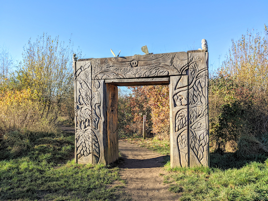
One of the three entrances to The Magical Wood
2: At a junction in the tracks (location - https://w3w.co/overnight.wiping.push) take the second path on the left, passing through the wooden carved archway to enter The Magical Wood then head SW and follow the path for 240m as it winds its way through a young woodland before reaching a three-way junction and a picnic area (location - https://w3w.co/army.unit.asking).

A carved owl, one of several wooden sculptures in Heartwood Forest
3: Turn right before the picnic area then head NW, still weaving through The Magical Wood, for 310m until you leave the woodland and reach a footpath junction (location - https://w3w.co/supply.nights.cones).

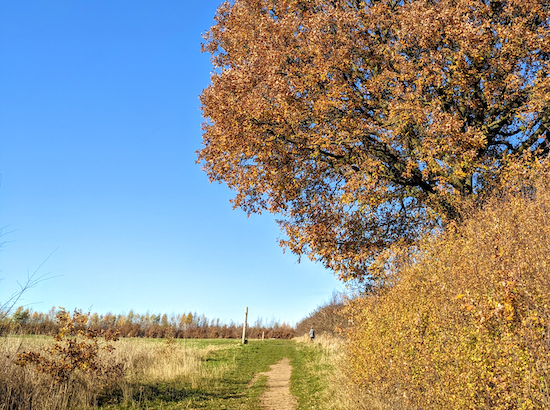
Head NE with the hedgerow on the left and field on the right
4: Five paths converge at this junction. You take the second on the right which heads NE with the hedgerow on the left and field on the right (see image above) for 320m until you reach a junction (location - https://w3w.co/audit.crown.react).

Turn left before the gate then head NW towards Round Wood
5: When you reach a gate, see image above, turn left, without going through the gate, then head NW for 170m until you reach a footpath junction (location - https://w3w.co/tower.drew.retire).

Head NW until you reach the gate leading to Round Wood
6: Continue heading NW entering Round Wood and following the path for 140m until you reach the end of the woodland (location - https://w3w.co/civil.hook.atomic).

7: Turn left then head SW with the woodland on your left for 410m until you reach a junction (location - https://w3w.co/ropes.chefs.shops).

There is an option for walking through the woods between points 8 & 9

The detour - in orange - through Pudler's Wood and Well Wood
8: Keep right at the junction and continue heading SW, then SE then SW again for 600m with Pudler's Wood and later Well Wood on the left and the field on the right until you reach a junction (location - https://w3w.co/advice.monks.gain).

9: Turn left then head ESE for 550m, now on Sandridge bridleway 8, and continue until you reach a junction (location - https://w3w.co/settle.stack.quick). On your left will be another entrance to The Magical Wood which you wandered through earlier in the walk.

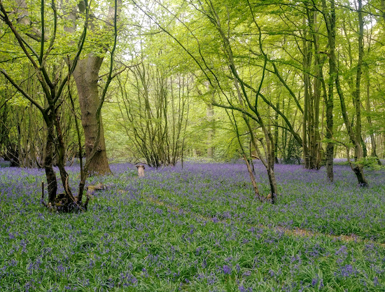
10: At this point take the second path on the right through Langley Wood (location - https://w3w.co/bits.falls.staple), then follow it as it weaves its way through the woodland which is carpeted in bluebells in the spring. Continue following the path round to the left until you reach a junction (location - https://w3w.co/trades.broken.beyond).

11: Turn right on Sandridge bridleway 8 then head ESE for 280m looking out for a gate on the left (location - https://w3w.co/dive.transit.love).

12: Turn left at the gate then turn right and follow the path back to the car park.

There are three pubs in Sandridge, The Green Man (location - https://w3w.co/yappy.punchy.facing), The Queens Head (location - https://w3w.co/drama.slick.plan), and The Rose & Crown (location - https://w3w.co/tidy.book.spin).

Interactive map


Official walking routes


The Woodland Trust has put together three circular walks through Heartwood Forest. You can download them below.


Walk 132: Sandridge South-West Loop

8.1 miles (13km) with 138m of total ascent


A walk from Heartwood Forest in Sandridge heading south through the fruit farm at Hawkswick Lodge, on down to Batchwood, across the golf course, up through Childwickbury and back via the Magical Wood and Langley Wood. This walk offers a mix of walking through woodland, parkland, and across fields with wide open views on all sides. There is the option of refreshments at three pubs in Sandridge at the end of the walk.

Directions


Note: This walk crosses over a golf course


Map for Walk 132: Sandridge SW Loop Created on Map Hub by Hertfordshire Walker Elements © Thunderforest © OpenStreetMap contributors There is an interactive map below these directions
Map for Walk 132: Sandridge South-West Loop
Created on Map Hub by Hertfordshire Walker
Elements © Thunderforest © OpenStreetMap contributors

There is an interactive map below these directions
Those with GPS devices can download GPX or KML files for this walk. We've added What3Words location references for those who use that system. If you print these walks you might want to use the green PrintFriendly icon at the bottom of these directions to delete elements such as photographs.

Park in the Heartwood Forest car park (location - https://w3w.co/flags.enable.offer) and head for the exit in the southern corner, see image below (location - https://w3w.co/oddly.goats.hits).

The exit from the car park to Sandridge bridleway 8
1: After leaving the Heartwood Forest car park turn right on Sandridge bridleway 8 and head WNW for 110m until you reach a track on your left (location - https://w3w.co/froze.help.rider).

Take this track and head SSW for 110m until the track meets Sandridgebury Lane (location - https://w3w.co/handed.ranked.parts). Turn right on Sandridgebury Lane and head SW for 200m looking for a bridleway on the right, see image below (location - https://w3w.co/wider.error.supper).

Sandridge bridleway 9 heading WNW off Sandridgebury Lane (point 2)
2: Turn right on this bridleway, Sandridge bridleway 9, and head WNW then W for 1km keeping the woodland on your right and the fields on your left until you cross the railway line (location - https://w3w.co/latter.hiking.school).

After crossing the railway continue heading W for 550m, still on Sandridge bridleway 9. Pass through Cheapside Farm, and continue until you reach a junction in the track (location - https://w3w.co/stays.hook.river).

Turn left then right and head SW, now on St Michael Rural bridleway 1A, for 380m until you reach Harpenden Road (location - https://w3w.co/studio.export.filed).

3: Cross Harpenden Road and take St Michael Rural bridleway 1 on the other side. Head SW through the Hawkswick Lodge Fruit Farm (see image below) for 350m and continue through the fruit fields until you reach woodland (location - https://w3w.co/snail.repair.sheets).

The bridleway through Hawkswick Fruit Farm (point 3)
Walk through woodland, still on St Michael Rural bridleway 1. This stretch was carpeted in bluebells when we tested this walk in late April 2021 (see image below).

Bluebells in the woodland S of Hawkswick Lodge Fruit Farm
Continue for 410m until you leave the woodland (location - https://w3w.co/ships.backed.remit). Here your path turns to the left and heads SE for 180m with the hedgerow on the left and the school playing fields on the right before reaching Townsend School (location - https://w3w.co/glad.storms.meal).

4: Head SSW, passing the school on the left before reaching a road. Continue heading SW along the road with housing on the left and fields on your right for 250m until you reach Batchwood on the right.

Just before you reach Batchwood, look out for a path (location - https://w3w.co/shades.chemistry.ozone) which runs through the woodland - which was also carpeted in bluebells in late April - and heads SSW parallel to the road you just left on your left.

Continue for 340m before exiting the woodland to your left just before reaching the golf course (location - https://w3w.co/neck.daring.translated), see image below.

Turn left and exit Batchwood and then head SE
Head SE with the hedgerow on your right and the field with a play area on your left and continue for 160m until you reach a gap in the hedge on your right (location - https://w3w.co/spray.boots.brief).

Turn right here and follow the bridleway across the golf course heading SSW for 940m until you reach a bridleway junction and a lane at the southern edge of the golf course (location - https://w3w.co/events.counts.moon).

5: Turn right on St Albans City bridleway 88, which is also a lane (although some people walk parallel to the lane either inside the golf course or on the other side of the lane).

Head NW for 300m until you reach St Michael Rural bridleway 2 on your left (location - https://w3w.co/island.chief.mess).

Bridleway 2 heading NW off bridleway 88 (point 5)

Take this bridleway then head NW. After 1.5km this bridleway becomes a metalled lane. Head NNE for another 1.3km, passing Childwickbury Manor on your right and continuing until you reach the hamlet of Childwickbury. Continue past the green on your left until you reach School Lane on your right (location - https://w3w.co/force.held.card).

6: Turn right on School Lane and follow it SE and then NE for 410m until you reach Harpenden Road (location - https://w3w.co/valve.dogs.last).

Turn right on Harpenden Road then head SE along a track on the S side of the road for 310m until you reach a bridleway on the left (location - https://w3w.co/slap.bring.grades). This is the track you walked along just before point 3 above.

7: Turn left on St Michael Rural bridleway 1A and follow it heading NE and then NNW for 380m until you reach the junction you passed earlier in the walk (location - https://w3w.co/bottle.daisy.tight), see image below.

The junction referred to in point 7
Head straight ahead and NW at the junction referred to in point 7

Here you ignore the path on the right and follow the footpath straight ahead as it heads NW for 550m.

8: Continue along this track as it reaches a right-hand bend (location - https://w3w.co/inform.rent.pine) and, after another 45m, comes to a left-hand bend (see image below).

The gap in the hedgerow mentioned in point 8 below

Go through the gap in the hedgerow and continue heading NNW and then N for 560m until you reach Ayers End Lane (location - https://w3w.co/song.lake.lifts).

9: Turn right on Ayers End Lane and head NE for 290m until you cross the railway track. Continue heading NE on Ayers End Lane for another 210m looking out for a bridleway on the right (location - https://w3w.co/loans.matter.lime). This is Wheathampstead bridleway 9.

10: Take this bridleway and head SSE for 540m until you reach a crossing in the track (location - https://w3w.co/shovels.awards.list).

11: Here the track becomes Sandridge bridleway 8 which you follow SE for 1.8km back to the car park.

Along the way you will pass the entrance to the Magical Wood on your left (location - https://w3w.co/flags.liability.locker) and Langley Wood on the right (location - https://w3w.co/bench.relay.speaks).

You can cut through Langley Wood and follow a track parallel to your route in order to enjoy the bluebells in spring (see images below).

The bluebell track through Langley Wood

The bluebells in Langley Wood
The bluebells in Langley Wood in late April
After your walk you can find refreshments at one of three pubs in Sandridge. The Green Man, The Queens Head, or the Rose and Crown.

The middle part of this walk around Batchwood, Childwickbury Manor and Hawkswick Lodge Fruit Farm was recommended by Nikki Walker of Brookmans Park Osteopaths.

Heartwood Forest brochure


Interactive map


Walk 90: Heartwood Forest Long Loop

5 miles (8 km) with 85m total ascent


The wild flower meadows at Heartwood Forest Image by Hertfordshire Walker shared via Creative Commons BY-NC-SA 4.0
The wild flower meadows at Heartwood Forest
A picturesque and varied walk taking in a part of Heartwood Forest that attracts fewer walkers - because it’s further from the car park - but which is an area rich in wildflowers and butterflies and well worth a visit. This Woodland Trust reserve has several smaller circular walks dotted around the 347-hectare (858-acre) site all close to the free car park.

Our route, which combines elements of some of our shorter walks in Heartwood Forest, takes in the part to the east of the B651 where grass meadows have been allowed to grow untamed. In this area you will also find a communal orchard of native fruit trees, and an arboretum laid out with several distinct areas of native trees.

According to the Woodland Trust, Heartwood Forest is the largest continuous new native forest in England; “a place where everyone can find space, peace, wildlife and miles of beautiful woodland to explore.”

This ramble follows the outer edge of the site and goes through the village of Sandridge where you can find refreshments.

Directions


Map for Walk 90: Heartwood Forest Loop Created on Map Hub by Hertfordshire Walker Elements © Thunderforest © OpenStreetMap contributors There is an interactive map below the directions
Map for Walk 90: Heartwood Forest Loop
Created on Map Hub by Hertfordshire Walker
Elements © Thunderforest © OpenStreetMap contributors

There is an interactive map below the directions
Those with GPS devices can download GPX or KML files for this walk. We've added What3Words location references for those who use that system. If you print these walks you might want to use the green PrintFriendly icon at the bottom of these directions to delete elements such as photographs.

Park in the free car park in Heartwood Forest (location - https://w3w.co/year.hang.jokes), accessible from High Street (B651).

1: Leave the car park at the gate just to the left of the disabled parking area at the point where the car park road bends round (location - https://w3w.co/grape.tested.soon). Once through the gate turn left and head ESE on Sandridge bridleway 8 for 300m until you reach High Street, Sandridge (location - https://w3w.co/agrees.tonic.sling).

2: Cross High Street and walk along Church End for 50m passing The Queens Head on your right and continuing until you reach the gates of St Leonard’s parish church (location - https://w3w.co/tube.buzz.noble).

Enter the churchyard and walk to the left of the church following the footpath to a metal barrier. Cross a lane, go through another metal barrier and turn right on Sandridge footpath 18. Follow this path as it heads ENE for 210m until you reach Langley Grove (location - https://w3w.co/space.mint.sorters).

3: Cross Langley Grove and continue heading ENE along Sandridge footpath 18 for 90m until you come to a wooden Heartwood Forest noticeboard (location - https://w3w.co/firm.nets.body).

Here you take the left fork then head NNE for 840m through the Community Orchard until the path bends to the right (location - https://w3w.co/faster.latest.join) and then bends to the left (location - https://w3w.co/rests.wizard.dared) then heads NNW to Coleman Green Lane (location - https://w3w.co/manage.beam.golf).

The Arboretum welcome sign at point 4 below Image by Hertfordshire Walker shared via Creative Commons BY-NC-SA 4.0
The Arboretum welcome sign
4: Cross Coleman Green Lane and head NW, N, then NE for 940m on a path that will eventually take you to the Arboretum (location - https://w3w.co/soda.models.gained).

When you reach the Arboretum stop and read the information board about the different trees growing in the area (see image above). Then continue walking to the right of the sign and following the path as it heads NE until you reach a gate leading to Drovers Lane (location - https://w3w.co/could.chained.banks).

Fields of wild flowers between points 3 & 5 Image by Hertfordshire Walker shared via Creative Commons BY-NC-SA 4.0
Fields of wild flowers between points 3 & 5

Many butterflies in the wild flower meadows between points 3 & 5 Image by Hertfordshire Walker shared via Creative Commons BY-NC-SA 4.0
Many butterflies in the wild flower meadows between points 3 & 5
5: Cross Drovers Lane, go through another gate and head N and uphill for 180m until you reach a T-junction where your footpath meets Sandridge bridleway 7 (location - https://w3w.co/noted.festivity.dice). Turn left here and follow this path W into woodland (location - https://w3w.co/leave.belly.plant). Continue heading W for 145m back to the B651 (location - https://w3w.co/surely.boom.below).

Wild flowers between points 3 & 5  Image by Hertfordshire Walker shared via Creative Commons BY-NC-SA 4.0
Wild flowers between points 3 & 5

Wild flowers between points 3 & 5  Image by Hertfordshire Walker shared via Creative Commons BY-NC-SA 4.0
Wild flowers between points 3 & 5
6: Cross the B651 and walk on the N side of Ferrers Lane for 15m until you reach a crossing. Turn left, cross Ferrers Lane, turn right and head WNW though the common land for 1.2km until you reach a fork in the track (location - https://w3w.co/puddles.teach.fall), see image below. Take the left fork, see yellow arrow on image below. Continue until you reach a T-junction (location - https://w3w.co/note.stays.activism).

Take the left fork following the direction of the yellow arrow
7: After turning left go through a gate and enter Heartwood Forest again. Head S and SW for 240m until you come to Round Wood (location - https://w3w.co/lakes.gains.lives). Turn right and NW for 140m ignoring the first path on your left. Continue until the path you are on bends to the left (location - https://w3w.co/tiles.agents.lived). Follow this path and head SW along the western edge of the reserve for 1km to a bridleway crossing (location - https://w3w.co/flops.snaps.cities) .

The track between points 7 & 8 Image by Hertfordshire Walker shared via Creative Commons BY-NC-SA 4.0
The track between points 7 & 8
8: Cross the bridleway continue heading straight WSW for 210m until the track bends to the left (location - https://w3w.co/fits.cliff.summer) and heads SSE and uphill for 800m until you reach a bridleway T-junction (location - https://w3w.co/radio.heave.storm).

9: Turn left on Sandridge bridleway 9 and head E for 990m along the S side of the forest until you reach Sandridgebury Lane (location - https://w3w.co/pits.attend.closet).

10: Here there is a cafe and farm shop on your right (location - https://w3w.co/rigid.ridge.behave). But if you don't need refreshments turn left when you reach Sandridgebury Lane and head NE and NNE for 280m until the lane turns right (location - https://w3w.co/round.necks.worm). At this point you take the track heading NNE past the scout hut and on to a T-junction in the track (location - https://w3w.co/remark.clocks.damp).

11: Turn right on Sandridge bridleway 8 and head ESE for 190m until you reach the gate you went through at point 1 in the walk. Turn left here and walk back to the car park.

For the young at heart


While you are at Heartwood Forest take the kids on the Magical Meander and up through the Magical Wood (see map below). When on the walk see if you can spot the post with the spy-hole and view the wooden owl in the tree beyond. Or see if the younger ones can find all the wooden animals along the way. And encourage them to discover and read the hidden nature notes that are slotted into some of the posts. Great fun - and not just for the young.

Animal carvings on the Magical Meander, Heartwood Forest. Image by Hertfordshire Walker released under Creative Commons BY-NC-SA 4.0
 

Animal carvings on the Magical Meander, Heartwood Forest. Image by Hertfordshire Walker released under Creative Commons BY-NC-SA 4.0
 

Animal carvings on the Magical Meander, Heartwood Forest. Image by Hertfordshire Walker released under Creative Commons BY-NC-SA 4.0
 

Animal carvings on the Magical Meander, Heartwood Forest. Image by Hertfordshire Walker released under Creative Commons BY-NC-SA 4.0


After your walk you can find refreshments at one of three pubs in Sandridge. The Green Man, The Queens Head, or the Rose and Crown.

Interactive map


Facebook group rules

Facebook group rules
We have set 10 rules for our Hertfordshire Walker Facebook group which are designed to help keep the group focused on walking in the Hertfordshire countryside

Supported Charity: The Trussell Trust

Supported Charity: The Trussell Trust
Supporting those locked in poverty

Search This Site