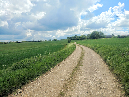
2.8 miles (4.6 km) with 52m of total ascent
 |
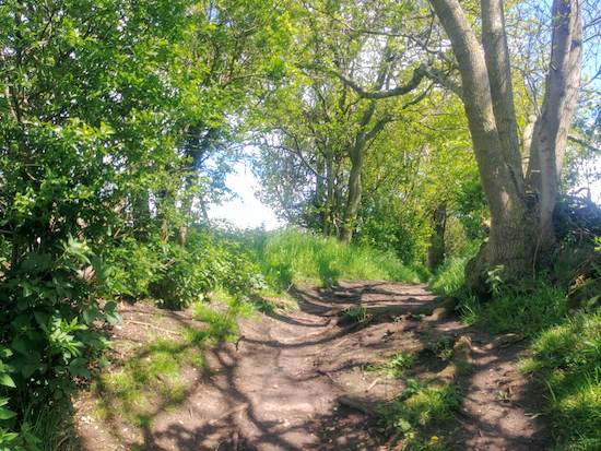
| Wooded bridleway shortly after point 7 |
This is a great walk if you enjoy wide open views across rolling countryside and walking along wooded byways. The walk starts and finishes at the
Hermit of Redcoats pub in Titmore Green and follows footpaths and bridleways to the south. Don’t be put off by the proximity of the A1(M), you can’t see it and the noise isn’t bothersome.
Directions
 |
Map for Walk 138: Titmore Green Loop
Created on Map Hub by Hertfordshire Walker
Elements © Thunderforest © OpenStreetMap contributors
There is an interactive map below these directions |
Those who follow our walks using GPS on their mobile devices can download
GPX or
KML files for this walk. We've added
What3Words location references for those who use that navigation system. If you print these walks you might want to use the green
PrintFriendly icon at the bottom of these directions to delete elements you don't need.
Staff at the
Hermit of Redcoats pub restaurant on Stevenage Road (location -
https://w3w.co/fades.gold.paper) told us that those following this walk are welcome to park in the pub’s car park if they intend to take refreshments at the pub before or after their walk.
Alternatively, if you are not eating or drinking at the pub, there is another parking spot that involves a short detour to join the walk. We've placed a blue marker on the maps above and below showing the place where we parked in a nearby lane called Lower Titmore Green (location -
https://w3w.co/skips.puts.horns). Be sure not to block any gates if you park down that lane.
If you use the alternative parking place start the walk by heading SE along Lower Titmore Green for 280m until you reach point 2 in the directions below, where you turn right, go through a gate, and pick up the route by turning left on Wymondley footpath 15.
 |
The Hermit of Redcoats in Titmore Green
|
1: From opposite the Hermit of Redcoats pub restaurant take Wymondley footpath 17 (location -
https://w3w.co/stray.wink.blast) and head SSE and downhill for 320m with the hedgerow on your left and the field on your right until you reach a junction where you turn right just before the gate and take Wymondley footpath 15 (location -
https://w3w.co/yard.tigers.burst), see image below.
 |
| Wymondley footpath 15 heading SW |
2: Follow Wymondley footpath 15 and head SW for 260m going through a gate, over a footbridge, and through another gate before continuing with the hedgerow on your right and the field on your left until you reach a footpath junction (location -
https://w3w.co/nerve.detail.formal).
 |
| Head SW on Wymondley footpath 15 to a footpath junction |
3: Turn right on Wymondley footpath 16 first heading WNW for 60m, with the hedgerow on the right and the field on the left, and then heading WSW for 300m, with an irrigation ditch on the right and the field on the left. Continue until the path climbs some steps where it becomes Ippollitts footpath 19 (location -
https://w3w.co/stacks.intelligible.olive).
Continue on Ippollitts footpath 19 heading WSW for 310m with the hedgerow on your right and the field on your left until you reach a junction (location -
https://w3w.co/radio.sits.twist).
4: Turn left on Ippollitts bridleway 20 then head SSE for 650m to Almshoe Bury and a junction (location -
https://w3w.co/piano.doctor.design).
 |
| Ippollitts bridleway 20 between points 4 and 5 |
5: Turn left on Ippollitts bridleway 23 then head ENE and then SSE through a farmyard (see satellite image below) then continue along a track between the fields for 880m until you reach a junction soon after a copse and pond on the left (location -
https://w3w.co/porch.posed.cargo).
 |
The green line shows the route of Ippollitts bridleway 23 through the farmyard
Source: Esri, DigitalGlobe, GeoEye, Earthstar Geographics, CNES/Airbus DS, USDA, USGS,
AEX, Getmapping, Aerogrid, IGN, IGP, swisstopo, and the GIS User Community |
6: Turn left at the junction on Ippollitts bridleway 24 then head NNE for 240m (this bit was muddy) until you reach woodland on your left. Here the path turns left (location -
https://w3w.co/toward.zoom.forget) then heads NW with the woodland on the right and field on the left for 150m before turning right through a gap in the hedgerow (location -
https://w3w.co/served.blend.porch).
7: You are now on Wymondley bridleway 22. Head NE then NW for 1.2km ignoring three footpaths on the right along the way and continuing until you reach Lower Titmore Green and are back at point 2 in these directions.
 |
| Wymondley bridleway 22 between points 7 and 8 |
8: Go through the gate and head NNW for 320m and uphill along Wymondley footpath 17 with the hedgerow on the right and field on the left until you reach the starting point.
* Those who parked in the lane called Lower Titmore Green should keep right at point 8 and head NE along Lower Titmore Green to reach their car.
 |
| The gate leading to Wymondley footpath 17 returning to the start point |
Interactive map


Hi - I think you might have loaded the wrong GPX & KML files for this route.
ReplyDeleteReally sorry about that. Thanks for letting me know. I have edited the directions and fixed. Apologies.
DeleteDavid