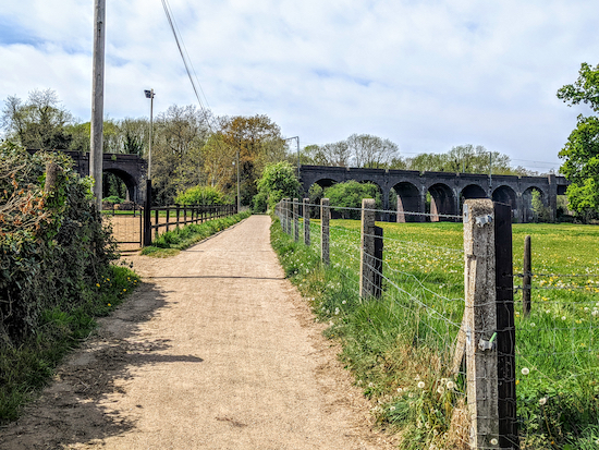
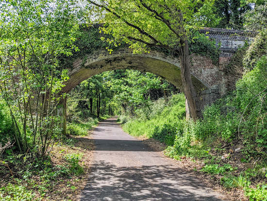
5.5 miles (8.8 km) with 89m of total ascent
 |
| The Cole Green Way |
We mapped this route following
a request on Twitter for a walk that is buggy friendly and involves a pub. The person who contacted us lives in Hertford. So we just put this walk together for any buggy pushers who live in Hertford and want a flat route with the option of refreshments at the start, middle point, and end.
The walk can be enjoyed one-way if you can get someone to pick you up at
The Cowper Arms (2.6 miles), or, if you have the stamina, turn back from the pub and return the same way (5.5 miles). There is a pub,
The Black Horse (location -
https://w3w.co/names.muddy.successes) near the start of the walk. It has a lovely beer garden at the back and is a
CAMRA freehouse.
The walk is mainly along the
Cole Green Way, which follows what was the route of the old
Hertford to Welwyn Junction Line. It's also part of the
Lea Valley Walk. Here is the request we received on the
Hertfordshire Walker Twitter feed.
 |
| Twitter request for a buggy friendly walk with a pub at the end |
So this is what we produced.
Directions
 |
Map for Walk 175: Hertford to Cole Green
(click here or on the map for larger version)
Created on Map Hub by Hertfordshire Walker
Elements © Thunderforest © OpenStreetMap contributors
There is an interactive map below these directions |
Those with GPS devices can download
GPX or
KML files for this walk. We've added
What3Words location references for those who use that system. If you print these walks you might want to use the green
PrintFriendly icon at the bottom of these directions to delete elements such as photographs.
For those driving to the start of the walk, we saw several parking places near the the junction mentioned in point 2 below (location -
https://w3w.co/venue.curiosity.loss) We didn't park there and we didn't check any parking restrictions.
 |
| The byway heading SW off West Street, Hertford |
1: The route starts on West Street in Hertford, which is accessible from the town centre via a pedestrian crossing with traffic light control over the A414. Walk WSW along West Street passing the Black Horse pub freehouse on the left which has an lovely beer garden at the back and serves excellent real ale (location -
https://w3w.co/names.muddy.successes).
Continue heading SW for 430m to reach a byway on the right (location -
https://w3w.co/prop.gives.deaf). This is Hertford
BOAT 54 (byway open to all traffic).
 |
| Hertford BOAT 54 heading SW towards the viaduct |
2: Turn right on Hertford BOAT 54 then head SW and W for 400m, crossing the River Lea via a bridge (location -
https://w3w.co/filer.pulled.vivid) then passing
Hertford Town Football Club on the right (location -
https://w3w.co/hats.truth.ships) and continuing until you reach a railway viaduct (location -
https://w3w.co/decay.search.bring).
 |
| Once you reach the Cole Green Way follow it SW |
3: Go under the viaduct then continue heading SW, now on Hertford
footpath 55, for 80m until you reach the Cole Green Way (location -
https://w3w.co/text.shells.lonely). Turn left on the Cole Green Way then follow it SW and W for 2.1 miles (3.4 km) until you reach the remains of the old Cole Green Station (location -
https://w3w.co/sports.senior.chins).
 |
| Continue heading WSW along the Cole Green Way |
As you head along the Cole Green Way the former railway branch line will cross a number of lanes including St Mary's Lane (location -
https://w3w.co/divisions.backs.emerge), Staines Green (location -
https://w3w.co/raft.digits.leaves), and Birch Green at its junction with Chapel Lane (location -
https://w3w.co/critic.teams.dairy). You will also notice several footpaths on the right and left; ignore them all.
 |
| The approach to Cole Green station with the platform on the right |
4: Leave the Cole Green Way by by turning right and climbing up the ramp to reach what was the platform at Cole Green Station then turn left when you reach the car park and head W for 120m until you reach Station Road (location -
https://w3w.co/medium.farm.ozone). Turn right on Station Road and The Cowper Arms is on your right (location -
https://w3w.co/rarely.cities.bronze).
For those returning to Hertford just follow the route in reverse.
Interactive map


Comments
Post a Comment