3.7 miles (5.9 km) with 44m of total ascent
 |
| Wheathampstead footpath 42 |
This is a lovely walk exploring the countryside to the south-east of Gustard Wood near Wheathampstead. We added this short route to the collection because it follows a number of public rights of way not visited by any of our other loops that feature Gustard Wood.
There is a short section of this route along a quiet and narrow lane where there isn't a pedestrian pavement, although there are grass verges and passing places that can be used if traffic approaches. There are sections of the route that can be extremely muddy after rain so perhaps best to save this walk for the drier weather; waterproof boots are essential. There are several sections of this walk where dog owners are required to keep their pets on a lead.
Fly through preview of walk
If you want to check what sort of landscape you will be crossing before you set off on this walk you can view a short 3D video of the route below. It's created using the free version of
Relive.
Directions
 |
Map for Walk 252: Gustard Wood South-East Loop
Click on the map above for a larger version
Created on Map Hub by Hertfordshire Walker
Elements © Thunderforest © OpenStreetMap contributors
There is an interactive map below these directions |
Those with GPS devices can download
GPX or
KML files for this walk. We've added
What3Words location references for those who use that system. If you print these walks you might want to use the green
PrintFriendly icon at the bottom of these directions to delete elements such as photographs.
There is a small car park off the B651 in Gustard Wood (location -
https://w3w.co/dozen.larger.loud) which, at the time we tested this walk, offered free parking for about five vehicles. Please check that restrictions haven't been introduced before leaving your car and starting the walk.
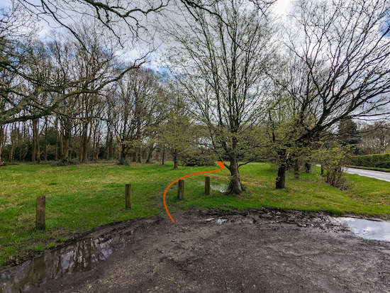 |
| Follow the path that heads SE out of the car park |
1: From the car park, and with your back to Lamer Lane, take the track on the right that heads SE (see orange arrow on the image above) and away from the B651. This track weaves SE for 85m before reaching a junction (location -
https://w3w.co/tone.wages.cove), see image below.
 |
| Turn right on Wheathampstead bridleway 101 |
Turn right at the junction then head S on Wheathampstead
bridleway 101. Continue for 275m until you reach Lamer Lane (location -
https://w3w.co/kind.object.rating).
2: Turn left on Lamer Lane then head SSE for 25m until you reach a lane on the left (location -
https://w3w.co/cove.bucked.minute), see image below.
 |
| Turn left on the lane then head E |
Turn left on the lane then head E for 75m until the lane becomes Wheathampstead
footpath 37. Continue along the lane, now heading ENE for 155m until you reach a footpath on the right (location -
https://w3w.co/divide.stump.learns), see image below.
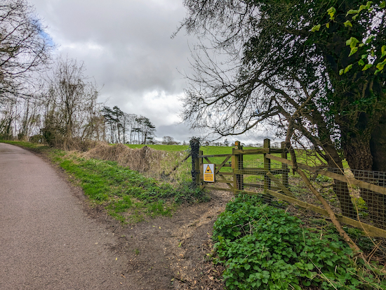 |
| Turn right on Wheathampstead footpath 38 |
3: Turn right on Wheathampstead footpath 38 then head SE and diagonally across a livestock field for 340m until you reach woodland (location -
https://w3w.co/cheeks.desk.loops), see image below.
 |
| Continue heading SE through the woodland |
Follow Wheathampstead footpath 38 through the woodland for 160m along a stretch which can be muddy and slippy after rain. Continue until you reach a junction (location -
https://w3w.co/than.stuff.manual).
4: Turn right at the junction then head SSW for 20m looking out for a footpath on the left (location -
https://w3w.co/scan.dogs.bucket), see image below.
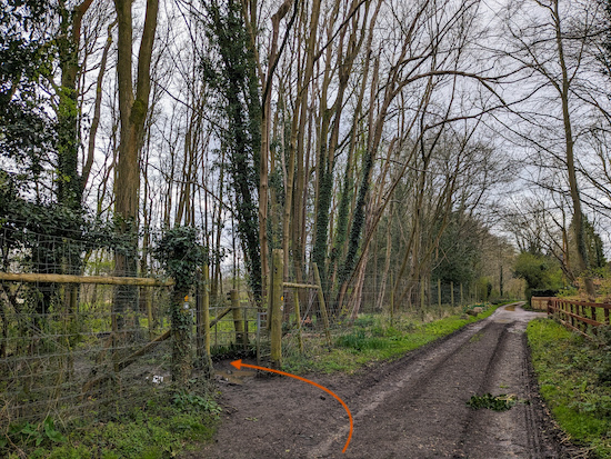 |
| Turn left, still on Wheathampstead footpath 38 |
Turn left, still on Wheathampstead footpath 38, then head E then SSE for 300m to a junction (location -
https://w3w.co/assure.woods.cafe), see image below.
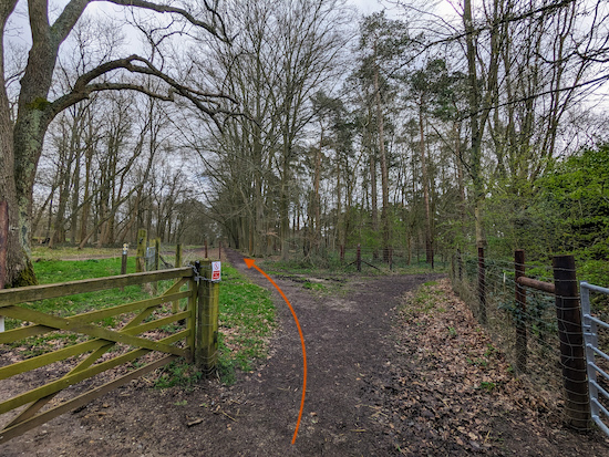 |
| Turn left, still on Wheathampstead footpath 38 |
5: Turn left, still on Wheathampstead footpath 38, then head E then SSE for 545m to a junction (location -
https://w3w.co/looked.picked.narrow), see image below.
 |
| Keep left at the junction, still on Wheathampstead footpath 38 |
6: Keep left at the junction, still on Wheathampstead footpath 38, then head ESE for 245m until you reach Bride Hall Lane (location -
https://w3w.co/sunk.teeth.pardon).
7: Turn left on Bride Hall Lane. This is a narrow but quiet lane with no pedestrian pavement but there are grass verges and passing places where you can stand to one side if traffic approaches. Head NNE for 390m then NNW for 350m until you reach a footpath on the left (location -
https://w3w.co/pound.over.stocks), see image below.
 |
| Turn left on Wheathampstead footpath 42 |
8: Turn left on Wheathampstead footpath 42 then head NNW for 40m where you follow the footpath as it turns left before a barn, see image below.
 |
| Wheathampstead footpath 42 turns left before the barn |
Turn left at the barn then follow Wheathampstead footpath 42 WSW for 160m until it bends right. There are signs along this section asking dog owners to keep their pets on leads because wild deer roam the grounds.
 |
| Dog owners are asked to keep pets on a lead |
Continue now heading NNW for 110m before bending left. Wheathampstead footpath 42 then continues between fences and through woodland.
* This stretch between (location - https://w3w.co/beard.open.parent) and (location - https://w3w.co/chief.slug.value) can be extremely muddy after rain. We ended up paddling ankle deep in water at one point when we tested this walk at the end of March 2024. But we have good boots and our feet stayed dry.
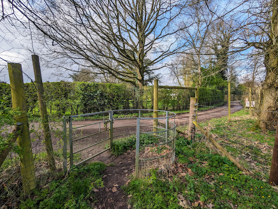
Continue heading W for 750m until you reach a junction (location -
https://w3w.co/foil.fallen.impose), see image below.
 |
| Turn right on Wheathampstead footpath 41 |
9: Go through the gate then turn right on Wheathampstead footpath 41. Head NNW for 95m until you reach a gate on the right (location -
https://w3w.co/tigers.shark.stamp), see image below.
 |
| Turn right at the gate |
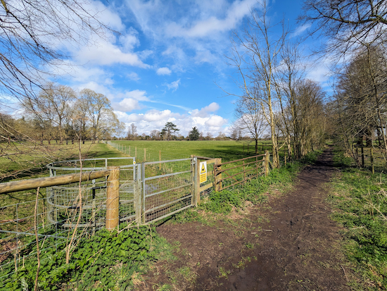
10: Turn right at the gate then head NE for 85m until you reach a gate on the left (location -
https://w3w.co/deeper.shop.icons), see image below.
 |
| Turn left at the gate, still on Wheathampstead footpath 41 |
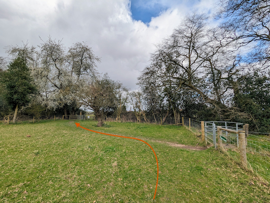
11: Turn left at the gate, still on Wheathampstead footpath 41, then head NNW across a livestock field for 465m until you reach a junction (location -
https://w3w.co/pokers.vibes.jeeps), see image below.
 |
| Turn left on Wheathampstead footpath 36 |
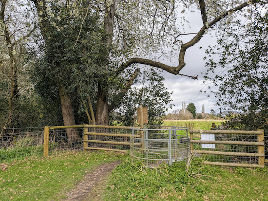
12: Turn left on Wheathampstead footpath 36, which is also Kimpton footpath 12 along this stretch, then head NW for 25m to a gate and a junction (location -
https://w3w.co/raced.begin.heap), see image below.
 |
| Go through the gate then turn left |
Go through the gate then turn left, still on Wheathampstead footpath 36 (Kimpton footpath 12) for 325m until you reach a gate (location -
https://w3w.co/sofa.spider.author), see image below.
 |
| Go through the gate then head SW |
13: Go through the gate then head SW for 160m across a livestock field to a gate (location -
https://w3w.co/tuned.forms.yappy), see image below.
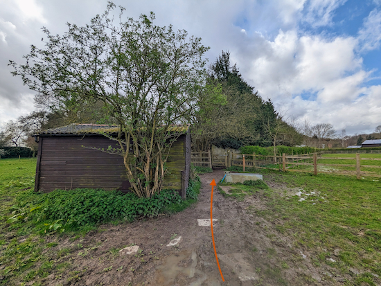 |
| Continue along a stretch which can be muddy after rain |
Continue on Wheathampstead footpath 36 (Kimpton footpath 12) now heading WSW for 205m along a stretch which can be muddy after rain until you reach Ballslough Hill, the B651 (location -
https://w3w.co/clock.apron.affair).
At this point those wanting refreshments could visit The Cross Keys pub/restaurant close to this junction (location - https://w3w.co/tests.serves.puff), see image below.
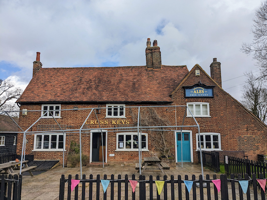 |
| Cross Keys at Gustard Wood |
14: Turn left on Ballslough Hill then head SW for 70m looking out for a bridleway on the left (location -
https://w3w.co/expect.decay.wiring), see image below.
 |
| Turn left on Wheathampstead bridleway 101 |
Turn left on Wheathampstead bridleway 101 then follow it SSE for 240m crossing a private drive along the way (location -
https://w3w.co/rested.poppy.chops) then turning right on a track soon after (location -
https://w3w.co/afford.influencing.hips), see image below
 |
| Turn right on the track then follow it back to the car park |
Turn right on the track then follow it as it winds its way S for 150m back to the car par and the start of the walk.
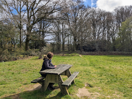 |
| The picnic table in a clearing just to the south of the car park |
There is a picnic table in a clearing just to the south of the car park for those who want to take a rest at the end of the walk.
If you enjoyed this walk please consider joining our
Hertfordshire Walker members-only Facebook Group where you can share photos and comments on your walking experiences.
Interactive map


No comments:
Post a Comment