3.5 miles (5.6 km) with 131m of total ascent
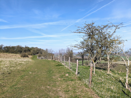 |
| Shillington footpath 17 at the top of the Pegsdon Hills |
This walk is the fourth in our collection exploring the Pegsdon Hills. It starts in the hamlet of Pegsdon in Bedfordshire, passes the Knocking Hoe Nature Reserve which is also in Bedfordshire, before heading south along the Hertfordshire border then climbing to the Pegsdon Hills & Hoo Bit Nature Reserve. About a third of the route is in Hertfordshire.
The walk starts and finishes in a layby in Pegsdon (location -
https://w3w.co/operating.solving.flinches) which, at the time of writing had unrestricted parking, but please do check when you arrive to make sure this has not changed.
The layby is accessed by taking a turn north off the B655 to the south-west of Pegsdon (location -
https://w3w.co/widen.headers.bend), see orange arrow on the image below.
 |
| The layby in Pegsdon at the start of the walk |
There are two other parking options. One just west of the start & finish point (location -
https://w3w.co/clear.sharp.letter), and another at point 10 in the walk (location -
https://w3w.co/marinated.martini.instance), although both have limited spaces and are well-used.
Fly through preview of walk
If you want to check what sort of landscape you will be crossing before you set off on this walk you can view a short 3D video of the route below. It's created using the free version of
Relive.
Directions
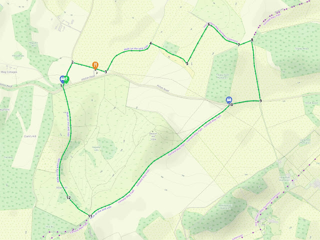 |
Map for Walk 251: Pegsdon Hills Loop
Click on the map above for a larger version
Created on Map Hub by Hertfordshire Walker
Elements © Thunderforest © OpenStreetMap contributors
There is an interactive map below these directions |
Those with GPS devices can download
GPX or
KML files for this walk. We've added
What3Words location references for those who use that system. If you print these walks you might want to use the green
PrintFriendly icon at the bottom of these directions to delete elements such as photographs.
1: From the layby at the start walk N (away from the B655) for 55m until you reach a lane (location -
https://w3w.co/sketch.iterative.reversed), see image below.
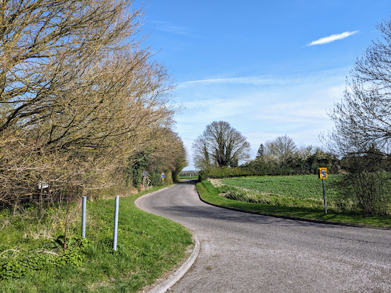 |
| Turn left on the lane then head NNE |
Turn left on the lane then head NNE for 120m until you reach a junction (location -
https://w3w.co/splendid.bibs.dunk), see image below.
 |
| Turn right at the junction then head ESE along Pegsdon Way |
2: Turn right at the junction then head ESE along Pegsdon Way for 285m until you reach a lane on the left (location -
https://w3w.co/subway.manage.baseline), see image below. Along this stretch you will pass
The View on the right (location -
https://w3w.co/falls.jousting.courtyard). The View used to be a pub called Live & Let Live and is now a bar, restaurant and inn.
 |
| Turn left on the lane then follow it in a northeasterly direction |
3: Turn left on the lane, which is also Shillington footpath 16, then follow it in a northeasterly direction for 480m until you reach a footpath on the right (location -
https://w3w.co/crashing.darts.takeovers), see image below.
 |
| Leave the lane by turning right, still on Shillington footpath 16 |
4: Leave the lane by turning right, still on Shillington footpath 16, then start your climb up to the hills.
 |
| Head ESE and uphill still on Shillington footpath 16 |
Continue on Shillington footpath 16, now heading uphill and ESE for 350m. This is a lovely stretch and it's worth stopping and looking back to the north once you reach the woodland at the top of the steps (location -
https://w3w.co/loved.factories.pulps), see image below.
.jpeg) |
| The view north from Shillington footpath 16 |
Continue until you reach a bend (location -
https://w3w.co/bearable.tickets.voting), see image below.
 |
| Follow Shillington footpath 16 as it bends left |
5: Follow Shillington footpath 16 as it bends left then heads NNE. This is another lovely stretch with excellent views.
.jpeg) |
| The view as Shillington footpath 16 heads NNE |
Continue on Shillington footpath 16 for 370m until you reach a junction (location -
https://w3w.co/convey.horn.seaside), see image below.
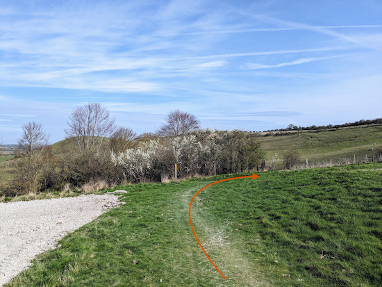 |
| Turn right, still on Shillington footpath 16 |
6: Turn right, still on Shillington footpath 16, then head SE for 310m to a junction (location -
https://w3w.co/browser.array.campus), see image below.
 |
| Turn left at the junction |
7: Turn left at the junction, but before you do you might want to take advantage of a bench with excellent views to the north.
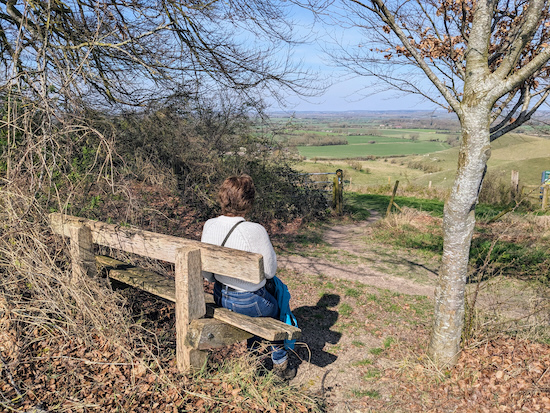 |
| The view from the bench at point 7 |
Also at this point you could take the gate on the left just before the junction to explore the
Knocking Hoe Nature Reserve (location -
https://w3w.co/aimlessly.severe.fighters).
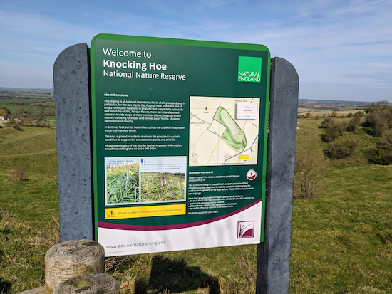 |
| The information board at Knocking Hoe |
Having taken the left turn at point 7 continue, now heading NE on Shillington bridleway 2, for 110m until you reach a junction (location -
https://w3w.co/upward.strutted.rents), see image below.
 |
| Turn right at the junction then head S |
8: Turn right at the junction then head S on Pirton bridleway 8 until the bridleway goes through the hedgerow to meet the B655 (location -
https://w3w.co/outfit.about.inherits), see image below.
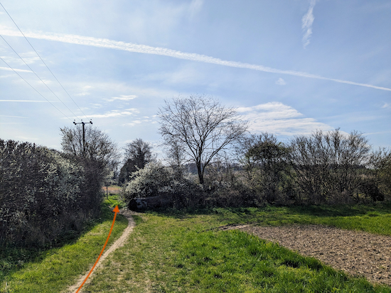 |
| Go through the gap then cross the B655 with care |
9: Go through the gap then cross the B655 with care. Once on the other side, turn right then follow the path along the grass verge on the south side of the road, see image below.
 |
| Follow the path along the verge heading W |
Follow the path along the verge heading W for 235m until you reach a car park on the left (location -
https://w3w.co/bead.helpers.bland), see image below.
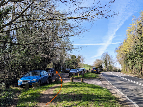 |
| Turn left at the car park then take the byway heading SW |
10: Turn left at the car park then take the byway heading SW (location -
https://w3w.co/jubilant.gripes.begun), see image below.
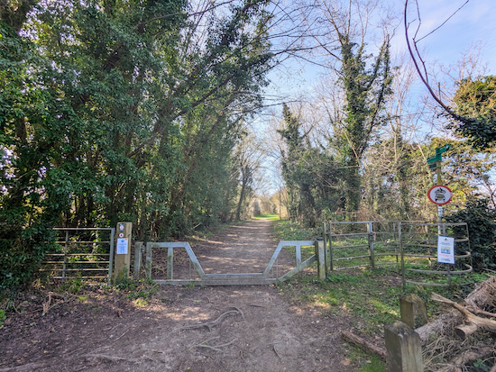 |
| Follow Offley BOAT 53 as it climbs for 1.5 km |
You now have a steady uphill stretch following Offley BOAT 53 (
byway open to all traffic) as it climbs for 1.5 km until you reach a footpath on the right (location -
https://w3w.co/fooling.digesting.harmless), see image below.
 |
| Turn right leaving Offley BOAT 53 to reach a gate |
11: Turn right leaving Offley BOAT 53 to reach a gate leading to the
Pegsdon Hills & Hoo Bit Nature Reserve.
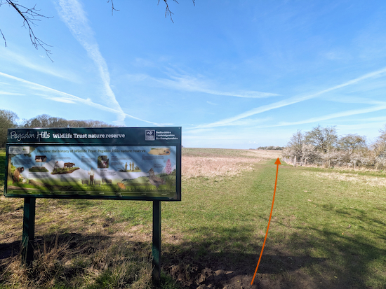 |
| Once in the reserve head NW on Shillington footpath 17 |
Once in the reserve head NW on Shillington footpath 17 (see orange arrow on the image above) for 265m until you reach a gate (location -
https://w3w.co/servicing.recitals.deferring), see image below.
 |
| Go through the gate, still on Shillington footpath 17 |
12: Go through the gate, still on Shillington footpath 17, then head NW for 100m looking out for a bench with a great view on your right (location -
https://w3w.co/fingertip.flames.headlight), see image below.
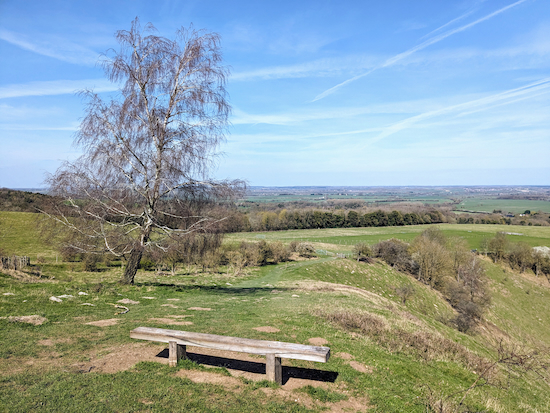 |
| The bench with a view off Shillington footpath 17 |
Continue, still on Shillington footpath 17 and heading downhill and NW for 110m until you reach a gate (location -
https://w3w.co/spellings.success.reframe) see image below.
 |
| Go through the gate then continue downhill |
Continue, still on Shillington footpath 17 heading downhill and in a northerly direction for 760m until you reach a gate leading to the B655 (location -
https://w3w.co/unheated.singles.breaches), see image below.
 |
| Cross the B655 with care |
Cross the B655 with care then the starting point will be straight ahead.
If you enjoyed this walk please consider joining our
Hertfordshire Walker members-only Facebook Group where you can share photos and comments on your walking experiences.
Interactive map


.jpeg)

.jpeg)


No comments:
Post a Comment