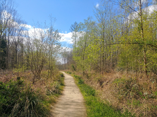
5.8 miles (9.3 km) with 37m total ascent
 |
Fly through preview of walk
If you want to check what sort of landscape you will be crossing before you set off on this walk you can view a short 3D video of the route below. It's created using the free version of Relive.
Directions
 |
| Walk 43: Datchworth Loop Created on Map Hub by Hertfordshire Walker Elements © Thunderforest © OpenStreetMap contributors There is an interactive map embedded at the end of these directions |
We have rerouted this walk (25 April 2021) because of the difficulty parking in Bulls Green at what used to be the start and finish of the walk near The Horns pub. Now the walk starts and finishes at a layby off Winding Shott (location - https://w3w.co/linked.wants.lives) where there is space for about six vehicles. At the time of writing there were no parking restrictions in place, but do check when you get there in case that has changed.
 |
| Walk round the gates and continue heading NE (point 2) |
2: Walk round the gate to the left and continue heading NE, now on Watton-at-Stone BOAT 29, for 1.5km until you pass Perrywood Farm on your right. After passing the farm look out for a footpath on your left (location - https://w3w.co/rent.legal.rails).
3: Turn left here on Watton-at-Stone bridleway 35 and follow it NNW for 240m until you reach a junction (location - https://w3w.co/dreams.search.often).
4: Turn right on Watton-at-Stone bridleway 22 and head NE for 910m until you reach Church Lane (location - https://w3w.co/notion.tulip.purely). * At this point you have the option of taking a 720m detour into Watton-at-Stone for refreshments at either The George and Dragon or The Bull.
5: Turn left on Church Lane and head NNW for 250m until you reach a T-junction with Watton Road (location - https://w3w.co/lace.glad.roses).
6: When you get to Watton Road (location - https://w3w.co/truck.leader.rivers) there is an option of turning left and walking along the road heading WSW for 210m looking out for a track on your right, or following a path the other side of the hedge in order to avoid the road - both end up in the same place.
7: Turn right on Watton-at-Stone bridleway 14 (location - https://w3w.co/buck.truck.unrealistic) and head NW for 920m until you reach Brook Hall Farm on the right. Follow the track past the farm and round to the right to a junction (location - https://w3w.co/works.stiff.scouts).
8: Turn left on Watton-at-Stone bridleway 16 (which is metalled at this point) and head W for 540m until you reach woodland and a junction (location - https://w3w.co/necks.boil.that).
9: Turn left and head SE on Watton-at-Stone bridleway 15 for 300m until you leave the woodland. At this point your path becomes Aston bridleway 6 and continues for 700m until you reach a junction (location - https://w3w.co/paying.tricky.strict).
10: Turn left and head SSW on Datchworth BOAT 25 for 640m until you reach Watton Road (location - https://w3w.co/goods.cargo.ankle).
11: Cross Watton Road and take Datchworth restricted byway 25 heading SSW for 250m to a junction in the track (location - https://w3w.co/breed.motion.gallons).
12: Turn right on Watton-at-Stone footpath 26 and head W for 90m to a junction (location - https://w3w.co/wants.orders.thus). * Here you have the option of a detour for refreshments at either The Plough or The Tilbury in Datchworth.
Turn left on Watton-at-Stone BOAT 30 and head SSE for 400m until you reach a footpath on your right (location - https://w3w.co/freed.pits.clash). * When you reach the footpath, Watton-at-Stone footpath 27, you have the option of turning right and taking a 530m detour for refreshments at The Horns in Burns Green.
13: If you don’t take the detour for refreshments continue heading SSE then SE on Watton-at-Stone BOAT 30 until you come to a junction where Bramfield bridleway 1 goes off to your right (location - https://w3w.co/leaps.purple.city).
 |
| Bramfield bridleway 1 on the final leg of the walk (point 14) |
Comments
Post a Comment