2.3 miles (3.7 km) with 62m of total ascent
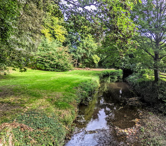 |
| The River Quin from the footbridge at point 2 |
This is a short walk from the village of
Braughing which loops round the
River Quin, starting and finishing outside
The Axe & Compasses on The Street. We have added this walk to the collection following requests in our recent survey for shorter routes. The starting point for this walk is 4.5 miles SSE from Buntingford town centre by road.
There are a number of signs along this route asking dog owners to keep their pets on a lead.
Directions
 |
Map for Walk 204: Braughing North-West Loop
(click here or on the map for larger version)
Created on Map Hub by Hertfordshire Walker
Elements © Thunderforest © OpenStreetMap contributors
There is an interactive map below these directions |
Those with GPS devices can download
GPX or
KML files for this walk. We've added
What3Words location references for those who use that system. If you print these walks you might want to use the green
PrintFriendly icon at the bottom of these directions to delete elements such as photographs.
 |
| The Axe & Compasses, The Street, Braughing |
1: With your back to The Axe & Compasses (location -
https://w3w.co/foresight.ambushes.puff) turn left then head SSW down The Street for 20m until you reach The Square on the right (location -
https://w3w.co/producers.resold.dressings), see image below.
 |
| The Square, Braughing |
Turn right at The Square then head W down Church End for 180m to a junction.
* There is a pleasant shortcut through the churchyard of the parish church of St Mary The Virgin, a Grade 1 listed building (location - https://w3w.co/childcare.saga.savings), but there is a sign at the gate saying that dogs (other than assistance dogs) are not allowed so we have avoided this path in case anyone using these directions is taking their dog. If you don't have a dog and decide to take the path through the churchyard it rejoins the main route at point 2.
 |
| The gate leading to St Mary The Virgin churchyard |
2: Cross the junction then keep heading W, now on Fleece Lane, see image below.
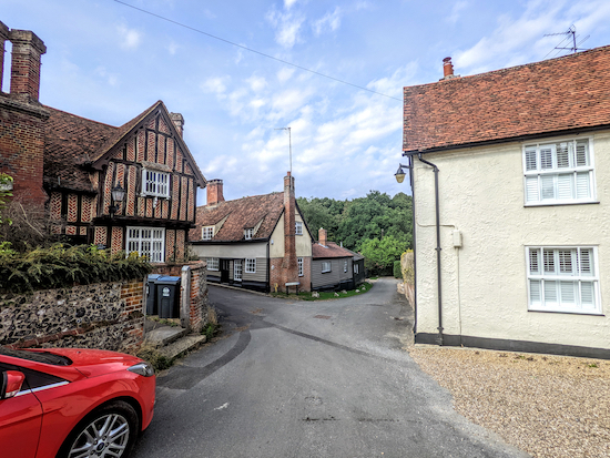 |
| Cross the junction then keep heading W along Fleece Lane |
Continue along Fleece Lane for 75m until you cross the River Quin (location -
https://w3w.co/tuned.typist.accordion), see image below.
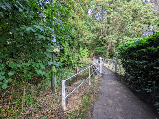 |
| The Fleece Lane footbridge across the River Quin |
Cross the River Quin then continue heading W now on Braughing
footpath 36 for 170m until you reach Green End (location -
https://w3w.co/princes.slung.snacks). On the right you will see
The Golden Fleece, see image below.
 |
| The Golden Fleece alongside Braughing footpath 36 |
3: Turn left on Green End then head S for 95m until you reach Hull Lane on the right (location -
https://w3w.co/steered.tablet.troll), see image below.
 |
| Turn right on Hull Lane then head WNW |
Turn right on Hull Lane then head WNW for 180m until you reach a footpath on the right (location -
https://w3w.co/fewer.ambushed.swept), see image below.
 |
| Turn right on Braughing footpath 1 |
4: Turn right on Braughing footpath 1 then head N for 175m at which point the footpath bends right then heads E for 40m before reaching a gate on the left (location -
https://w3w.co/ethic.wordplay.punters), see image below.
Turn left at the gate then head N then NNW along a lovely footpath across what a woman who was gathering blackberries told us is referred to locally as The Heath. It's a wonderful stretch with excellent views to the right and left as well a few benches along the way.
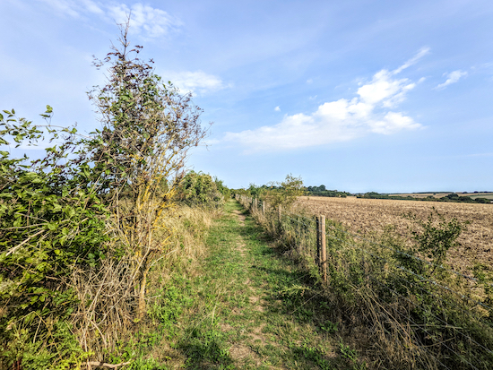 |
| Braughing footpath 1 heading N |
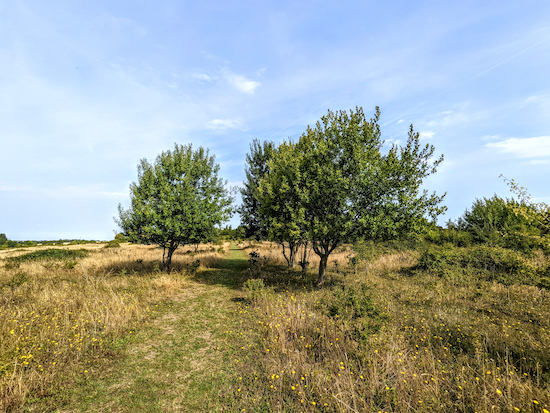 |
| Look out for the two benches along Braughing footpath 1 |
Continue along Braughing footpath 1 for 860m until you reach Hay Lane (location -
https://w3w.co/diverting.fruitcake.native).
5: Turn right on Hay Lane then head E for 350m until you reach Hay Street, the B1368 (location -
https://w3w.co/liners.upwardly.pines).
* This stretch of lane doesn't have a pedestrian pavement, but there is a verge where you can step aside to avoid traffic.
6: Turn right on Hay Street then head S for 90m until you reach a byway on the left (location -
https://w3w.co/decimal.invoices.stun), see image below.
 |
| Turn left on Braughing byway 29 |
7: Turn left on Braughing BOAT 29 (
byway open to all traffic) then head E for 320m until you reach a footpath on the right (location -
https://w3w.co/legs.forks.buying), see image below.
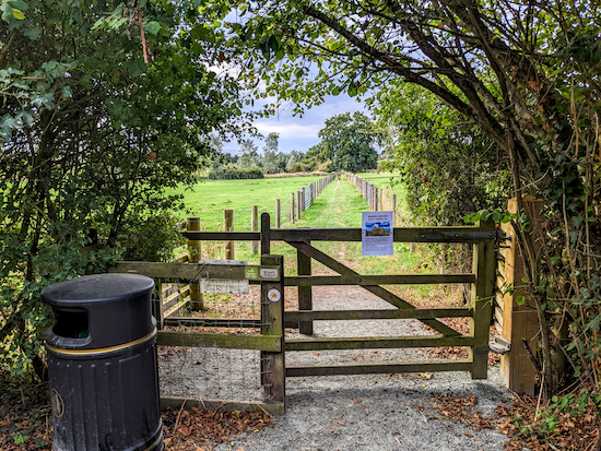 |
| Turn right on Braughing footpath 25 |
8: Turn right on Braughing footpath 25 then head SSW for 200m to a junction (location -
https://w3w.co/feasts.replayed.mull), see image below.
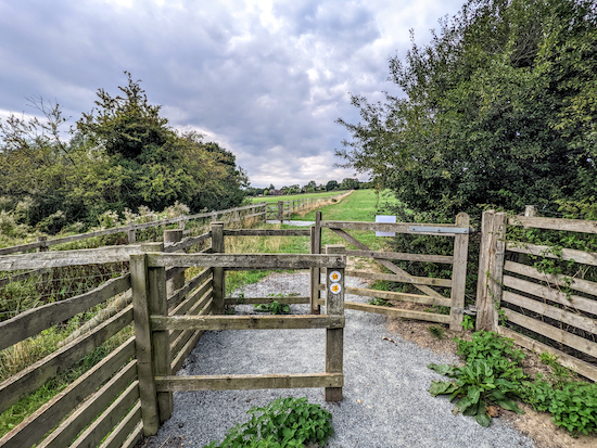 |
| Go through the gate then keep left at the junction on Braughing footpath 25 |
9: Keep to the left at the junction, still on Braughing footpath 25, then head SSE for 360m until you reach Gravelly Lane (location -
https://w3w.co/connector.cross.scariest).
10: Turn left on Gravelly Lane then head E for 40m until you reach a footbridge across the River Quin at a ford (location -
https://w3w.co/hospitals.whirlwind.pasta), see image below.
 |
| There is a bench on the left after the footbridge |
Cross the footbridge then continue heading E along Gravelly Lane until you reach the junction with The Street (location -
https://w3w.co/guru.mulls.necklaces).
11: Turn right on The Street then head S for 350m back to the start of the walk.
* There is another pub, The Brown Bear (location - https://w3w.co/thin.poem.toads), which is 60m S of the starting point.
Interactive map


No comments:
Post a Comment