2.3 miles (3.7 km) with 13m of total ascent
 |
| The view between points 4 & 5 |
This a short loop from Datchworth Green which we have created in response to a number of followers of Hertfordshire Walker who asked for shorter routes. A few of the rights of way used in this walk also feature in some of our longer routes but walked in reverse, so the views will be different. This walk involves a stretch along a country lane, but it is quiet and there are opportunities to step aside in the case of traffic. The walk starts and finishes at
The Plough in Datchworth Green opposite
The Tilbury. There is also a popular cafe in the village,
Datchworth Coffee. The route passes
The Horns in Bulls Green at the halfway point. The starting point is 2.8 miles NE from Welwyn North station by road.
Directions
 |
Map for Walk 189: Datchworth Short Loop
Click here or on the map for a larger version
Created on Map Hub by Hertfordshire Walker
Elements © Thunderforest © OpenStreetMap contributors
There is an interactive map below the directions |
Those with GPS devices can download
GPX or
KML files for this walk. We've added
What3Words location references for those who use that system. If you print these walks you might want to use the green
PrintFriendly icon at the bottom of these directions to delete elements such as photographs.
 |
| Datchworth Coffee and The Plough at the start of the walk |
1: With your back to The Plough (location -
https://w3w.co/flap.joined.snow), turn left then head WSW, with the cottages on your left and Datchworth cricket field on your right for 290m until you reach a junction to the right of a cottage and to the left of the pavilion (location -
https://w3w.co/sculpture.chops.hung), see image below.
 |
| Take the path to the right of the cottage and left of the sign |
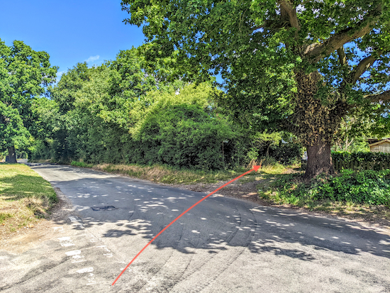
2: Take Datchworth restricted byway 26, see orange arrow on image above, then head SW for 520m until you reach Coltsfoot Lane (location -
https://w3w.co/safety.wicked.ladder), see image below.
 |
| Turn left on Coltsfoot Lane |
3: Turn left on Coltsfoot Lane, then follow it SE, S, then E for 990m until you reach Bramfield Lane (location -
https://w3w.co/change.bags.payer).
The Horns will be on your left (location -
https://w3w.co/corn.hiking.jolly), see image below.
 |
| The Horns at Bulls Green |
4: When you reach Bramfield Lane cross the road looking for a footpath opposite the junction with Coltsfoot Lane, see image below.
 |
| Datchworth footpath 18 heading NE off Bramfield Lane |
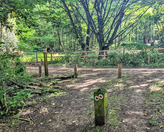
Take this footpath, Datchworth footpath 18, then head NE for 90m until the path crosses the parish boundary (location -
https://w3w.co/humans.slate.ramp) and becomes Watton-at-Stone footpath 27 which you continue to follow as it heads NE for 360m to the point where the path bends to the right and descends down some wooden steps (location -
https://w3w.co/unit.villa.zooms), see image below.
 |
| Continue heading ENE on Watton-at-Stone footpath 27 for 100m |
Continue heading ENE on Watton-at-Stone footpath 27 for 100m to a junction (location -
https://w3w.co/reject.caller.trap), see image below.
 |
| Turn left on Watton-at-Stone BOAT 30 |
5: Turn left on Watton-at-Stone BOAT 30 (
byway open to all traffic), which is also known locally as Back Lane, then head NNW for 630m until you reach Watton Road (location -
https://w3w.co/violin.boil.tapes), see image below.
 |
| Cross Watton Road then head NNW along Hawkins Hall Lane |
6: Cross Watton Road then take the lane opposite, Hawkins Hall Lane, which you follow NNW for 210m until you reach a lane on the left called Nutcroft (location -
https://w3w.co/crunch.sport.relay), see image below.
 |
| Turn left on Nutcroft, then head WSW |
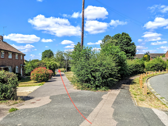
7: Turn left on Nutcroft, then head WSW for 120m until Nutcroft bends to the right (location -
https://w3w.co/chill.bottle.notion) and a path continues heading WSE, see image below.
 |
| Head WSW now on Datchworth footpath 27 |
Continue heading WSW, now on Datchworth footpath 27, for 130m until you reach Brookbridge Lane (location -
https://w3w.co/ever.rush.lists).
8: Turn left on Brookbridge Lane then head S for 180m until you reach The Tilbury on the left (location -
https://w3w.co/faded.select.lucky) then Watton Road and the starting point at The Plough. Next door to The Plough you will find Datchworth Coffee (location -
https://w3w.co/soup.caged.spend), a popular cafe with cyclists and walkers. And on the opposite side of the road is a small shop (location -
https://w3w.co/boost.former.late).
Interactive map


No comments:
Post a Comment