6.1 miles (9.8 km) with 54m of total ascent
 |
| The route between points 17 & 18 |
This is our second walk from Bramfield, this time exploring the countryside N and W of the village, passing through the lovely Bramfield Woods then returning via Tewin following bridleways and footpaths over rolling open countryside with views on all sides. The walk starts and finishes at
The Grandison then passes
The Plume of Feathers and
The Rose & Crown in Tewin. The starting point is 5.4 miles NE from Welwyn Garden City station by road.
Directions
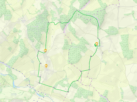 |
Map for Walk 188: Bramfield West Loop
Click here or on the map for a larger version
Created on Map Hub by Hertfordshire Walker
Elements © Thunderforest © OpenStreetMap contributors
There is an interactive map below the directions |
Those with GPS devices can download
GPX or
KML files for this walk. We've added
What3Words location references for those who use that system. If you print these walks you might want to use the green
PrintFriendly icon at the bottom of these directions to delete elements such as photographs.
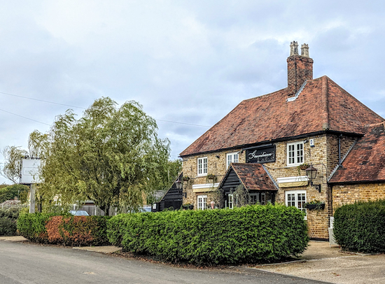 |
| The Grandison on Bury Lane, Bramfield |
1: With your back to The Grandison on Bury Lane (location -
https://w3w.co/range.deny.cross), turn left then head E on Bury Lane for 100m until you reach the main road, which is called Winding Shott (location -
https://w3w.co/sling.trio.length).
Turn left on Winding Shott, then head N for 210m until you reach Gobions Lane on the right (location -
https://w3w.co/aura.begins.lost). Cross Gobions Lane then continuing along Winding Shott, walking against the traffic, for another 110m until you reach a bridleway on the right (location -
https://w3w.co/stem.swim.acting), see image below.
 |
| Turn right on Bramfield Bridleway 1 |
2: Turn right on Bramfield Bridleway 1, then follow it N then WNW for 920m to a junction (location -
https://w3w.co/assist.senses.bridge), see image below.
 |
| Cross the junction and keep heading W, still on Bramfield Bridleway 1 |
Continue heading W at the junction, still on Bramfield Bridleway 1, for 650m until you come to another junction (location -
https://w3w.co/page.stick.other). Cross this junction then continue, now heading NW for 150m to another junction (location -
https://w3w.co/gains.feeds.gravel), see image below.
 |
| Turn left at the junction, still on Bramfield Bridleway 1 |
3: Turn left at the junction, still on Bramfield Bridleway 1, then head SW for 500m until you reach a road (location -
https://w3w.co/flap.lined.fund), see image below.
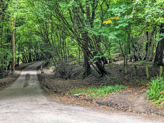 |
| Cross Winding Shott then head SW along Tewin Hill |
4: Cross the road, Winding Shott, then head SW along Tewin Hill for 120m looking out for a footpath on the right (location -
https://w3w.co/rarely.fish.lower), see image below.
 |
| Take Tewin footpath 30 through Brickground Wood |
Take this path, Tewin footpath 30, then follow it W into Brickground Wood. The path is not clear at first, but atter 45m you will come to a junction where a path joins from the right and leaves on the left (location -
https://w3w.co/assets.from.jolly), see image below.
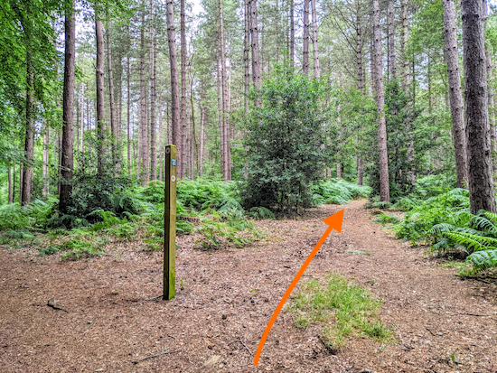 |
| Cross the first junction then keep heading W |
Cross the junction, ignoring the path on the right and left, (see orange arrow on image above) then keep heading W for 240m to a second junction (location -
https://w3w.co/angle.grants.hooked), see image below.
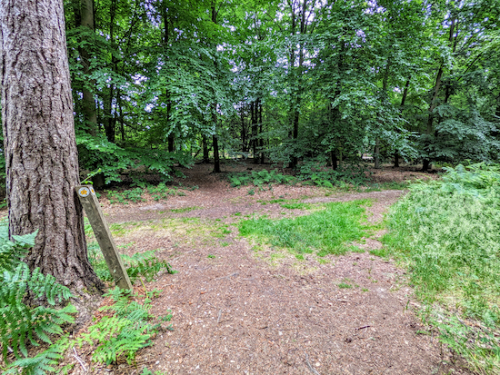 |
Keep right at the second junction
|
Keep right then head N for 30m to a third junction (location -
https://w3w.co/yoga.camps.mouth), see image below.
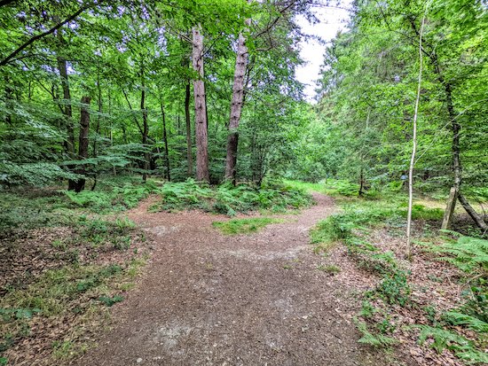 |
| Keep left at the third junction |
Turn left then head W for 35m to reach Queen Hoo Lane (location -
https://w3w.co/rank.drag.beats).
5: Cross Queen Hoo Lane then head WSW, still on Tewin footpath 30, for 230m until you reach a right turn (location -
https://w3w.co/composers.salads.joke), see image below.
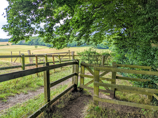 |
| Turn right after the gate |
Here Tewin footpath 30 turns right then heads NNW for 100m before bending left then heading W for 190m then NNW for 40m to a footpath junction immediately after a chain-linked fence bends left (location -
https://w3w.co/shall.issues.taking), see image below.
 |
| Turn left at the junction |
6: Turn left at the junction immediately after the chain fence (see image above) then head SW for 15m, with the chain fence on your left, until you reach the point where a path goes off to the right, see image below. Ignore the path on the right.
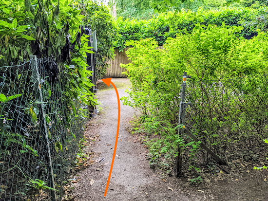 |
| Keep the chain fence on your left, pass a gate, then turn left on the footpath |
Continue heading SW with the chain fence on your left for 8m (see orange arrow on the image above) until you reach Firs Walk and pass a metal gate on your left. Then, when you reach a wooden fence, take the footpath on the left just beyond the metal gate, see orange arrow on image below.
 |
| Turn left immediately after the gate on Tewin footpath 32 |
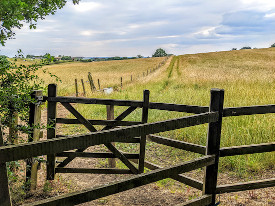
Turn left on Tewin footpath 32 then follow it as it weaves S between houses for 420m to a gate (location -
https://w3w.co/sugars.rental.heat), see image below.
 |
| Go through the gate then head S with the fence on your left |
Go through the gate then continue heading S, still on Tewin footpath 32, with the fence on your left and the field on the right for 460m until you reach another gate (location -
https://w3w.co/hatch.wakes.event), see image below.
 |
| Go through the gate then continue heading S |
Go through the gate then continue to head S for 270m, keeping to the right of the large tree in the field, see image below, until you reach The Plume of Feathers (location -
https://w3w.co/cans.farmer.sunk).
 |
| Cross the field keeping to the right of the large tree |
7: Turn right at The Plume of Feathers then follow the footpath round the side of the pub to the car park where you turn right then head WSW for 40m until you reach Upper Green Road (location -
https://w3w.co/trunk.courier.oppose), see image below.
 |
| Turn right on Upper Green Road |
Turn right on Upper Green Road then, keeping the cricket club on your left, head WNW for 200m until you reach a path on the left immediatley beyond the cricket pitch (location -
https://w3w.co/flag.overnight.marker), see image below.
 |
| Turn left then head SW for 40m to a junction |
8: Turn left on this path then head SW for 40m until you reach a junction (location -
https://w3w.co/remove.sharp.landed).
Turn left on Tewin BOAT 2 (byway open to all traffic) then follow it heads S then SW for 160m to another junction (location -
https://w3w.co/shift.most.teach).
9: Keep left at the junction then head SSE, still on Tewin BOAT 2, for 300m looking out for a footpath on the right (location -
https://w3w.co/notion.begin.drill), see image below.
 |
| Turn right on Tewin footpath 13 |
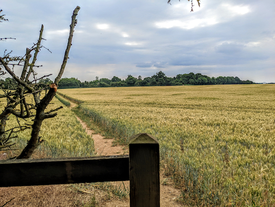
10: Turn right on Tewin footpath 13, then head WSW for 40m to a gate (location -
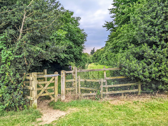
https://w3w.co/renew.thin.stable), see first image below. Go through the gate then head S for 240m until you reach a gate in the hedgerow (location -
https://w3w.co/sizes.ideas.eagle), see second image below.
 |
| Go through the gate then cross a field until you reach a gate |
 |
| Go through the gate then continue heading S |
Cross through the gate then keep heading S, still on Tewin footpath 13, until you reach Churchfield Road (location -
https://w3w.co/stow.asks.menu). Turn left on Churchfield Road then head E for 75m looking for a footpath on the right (location -
https://w3w.co/posed.rock.taped), see image below.
 |
| Turn right on Tewin footpath 14 then head S |
11: Turn right on Tewin footpath 14 then head S for 240m ignoring a path on the left and continuing to a junction (location -
https://w3w.co/paths.refuse.apple).
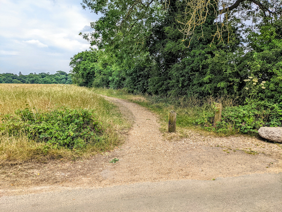
12: Turn left at the junction on Tewin footpath 18 then head ESE for 110m to Archers Green Lane (location -
https://w3w.co/string.fines.breath), see image below.
 |
| Cross Archers Green Lane then continue along Tewin footpath 18 |
Cross Archers Green Lane then continue heading ESE, still on Tewin footpath 18, for 460m ignoring a path which crosses your way. Continuing until you reach Lamb Dell Wood (location -
https://w3w.co/wool.edit.senior).
13: Continue through the wood heading ESE, still on Tewin footpath 18, for 70m to a junction (location -
https://w3w.co/tour.linked.cases) see image below.
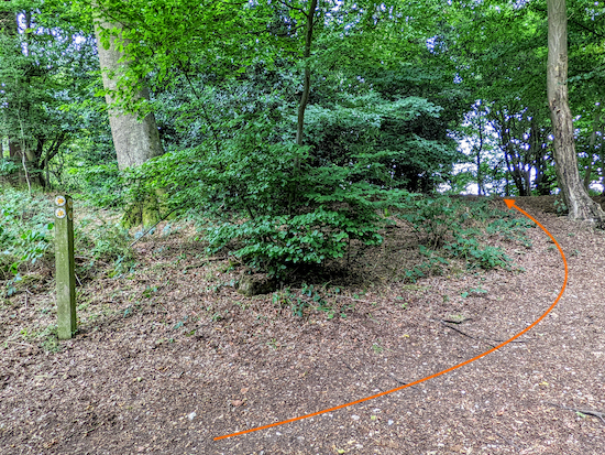 |
| At the junction turn right then immediately left (see orange arrow) |
At the junction turn right then turn immediately left (following the line of the orange arrow on the image above). Continue heading ESE for 250m until you reach a gate (location -
https://w3w.co/scarf.shady.army), see image below.
 |
| Go through the gate then continue heading ESE to a junction |
Go through the gate then continue heading ESE for 270m until you reach a junction (location -
https://w3w.co/kick.remind.wiring), see image below.
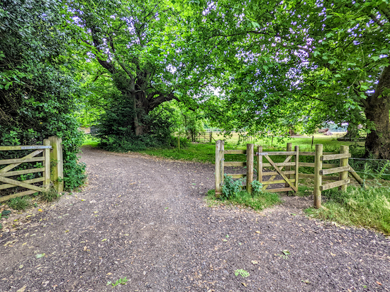 |
| Turn left on Tewin footpath 37 |
14: Turn left on Tewin footpath 37 then head NNE for 280m to Hertford Road (location -
https://w3w.co/lives.deputy.round), see image below.
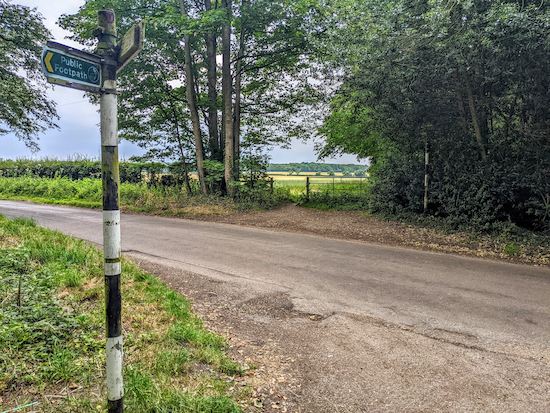 |
| Cross Hertford Road then continue on Tewin bridleway 25 |
Cross Hertford Road then continue heading NNE on Tewin bridleway 25, with Red Wood on your right for 230m before you leave the woodland (location -
https://w3w.co/shift.manage.hoot) and then head ENE and cross a field to reach a junction (location -
https://w3w.co/unit.trucks.coherent), see image below.
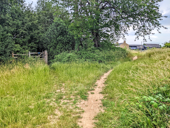 |
| Turn left on Bramfield footpath 6 then head NE |
15: Turn left on Bramfield footpath 6 then head NE for 300m to a junction (location -
https://w3w.co/basin.pets.exist). Turn left on Bramfield footpath 5 then head N for 90m to a junction (location -
https://w3w.co/curving.leaves.sulk).
16: Turn right at the junction on Bramfield bridleway 3, then head ENE for 320m to a junction (location -
https://w3w.co/atomic.front.cans), see image below.
 |
| Turn left at the junction on Bramfield footpath 8 |
17: Turn left at the junction on Bramfield footpath 8 then head N for 510m until the path bends to the right (location -
https://w3w.co/mobile.chew.radar) then heads NNE for 75m until you reach a field (location - https://w3w.co/actors.rigid.safely), see image below.
 |
| Cross the field, still on Bramfield footpath 8 |
18: Cross the field, still on Bramfield footpath 8, then head NE for 430m to Bury Lane and the starting point.
Interactive map


No comments:
Post a Comment