6.3 miles (10.1 km) with 54m of total ascent
This is our third walk from Ickleford, this time exploring the countryside to the NW of the village following well-defined footpaths and bridleways over rolling countryside with excellent views. There is one short stretch along a main road, but it is along a pedestrian footpath and takes about five minutes. The walk starts outside The Plume of Feathers pub. There is a second pub, The Old George, a short detour from the start/finish point. The starting point is 1.9 miles NW from Hitchin station by road.
Directions
 |
Map for Walk 187: Ickleford North Loop
Click here or on the map for a larger version
Created on Map Hub by Hertfordshire Walker
Elements © Thunderforest © OpenStreetMap contributors
There is an interactive map below the directions |
Those with GPS devices can download
GPX or
KML files for this walk. We've added
What3Words location references for those who use that system. If you print these walks you might want to use the green
PrintFriendly icon at the bottom of these directions to delete elements such as photographs.
We parked along Chambers Lane where there were no parking restrictions at the time of writing (June 2022). Please check in case the situation has changed.
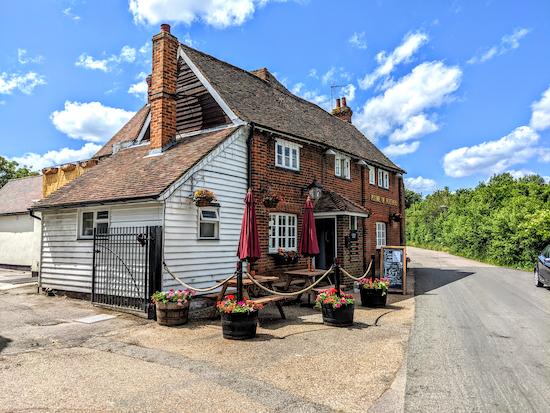 |
| The Plume of Feathers at the start of the walk |
1: With your back to
The Plume of Feathers turn left then head NW for 100m until you reach a footpath on the right (location -
https://w3w.co/midwinter.shame.invent), see image below.
 |
| Turn right on Ickleford footpath 12 |
Turn right on Ickleford footpath 12 then head NNE passing a car park on the left then continuing for 260m until the path bends to the right (location -
https://w3w.co/vegetable.bookmark.boarding), then continues for another 60m to a junction (location -
https://w3w.co/seriously.roaring.galloped), see image below.
 |
| Turn left on Ickleford footpath 5 |
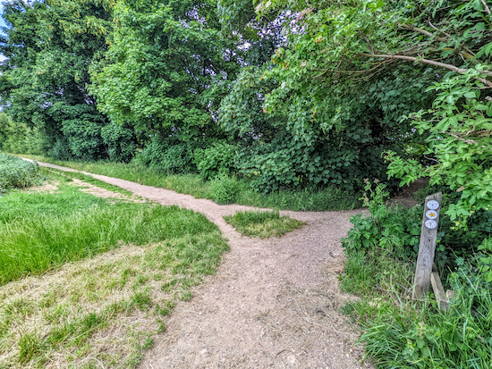
2: Turn left on Ickleford footpath 5 then head NNE for 300m to a footpath junction (location -
https://w3w.co/poster.coupler.plotter), see image below.
 |
| Head N on Ickleford footpath 5 |
Cross the junction, still on Ickleford footpath 5, then head N with the hedgerow on your right and field on your left. Continue for 540m to a footpath T-junction (location -
https://w3w.co/panting.tweezers.modest), see image below.
 |
| Head E on Ickleford bridleway 4 for 70m |
3: Turn right at the T-junction then head E on Ickleford bridleway 4 for 70m to another junction (location -
https://w3w.co/cleans.gloom.picture), see image below.
 |
| Turn left on Ickleford footpath 3 then head NNW |
Turn left on Ickleford footpath 3 then head NNW for 140m until the path forks right (location -
https://w3w.co/coats.placidly.fries), see image below.
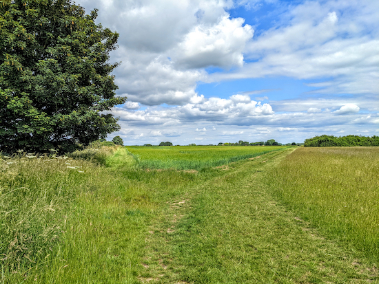 |
| Follow Ickleford footpath 3 as it bends to the right then heads NNE |
Head NNE, still on Ickleford footpath 3, for 450m until the path goes through the hedgerow (location -
https://w3w.co/fractions.glitz.freedom), see image below, then heads NNW for 380m to New Ramerwick Farm (location -
https://w3w.co/toast.heartburn.sculpture).
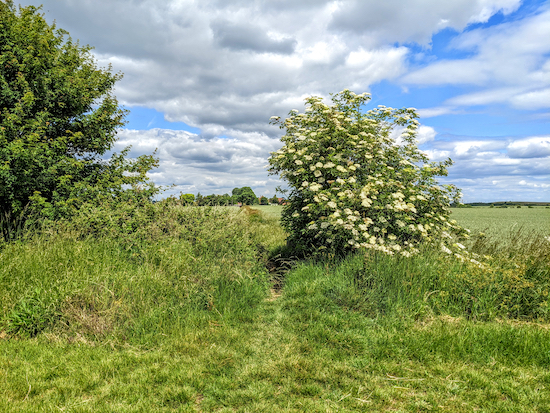 |
| Continue on Ickleford footpath 3 through the hedgerow then head NNW |
4: Continue heading NNW passing the farmhouse on the right. Look out for the footpath markers on the wooden fence on your right then go through a gap (see orange arrow on image below) to a footpath marker post.
 |
| Continue heading NNW, still on Ickleford footpath 3 |
As you leave the farm (location -
https://w3w.co/damage.regress.universes), keep left still on Ickleford footpath 3 just before a line of trees, see orange arrow on image below.
 |
| At the junction keep left still on Ickleford footpath 3 |
Continue heading NNW, with the trees on your right and the field on your left for 100m until you come to the end of the trees (location -
https://w3w.co/adventure.divided.behave), see image below.
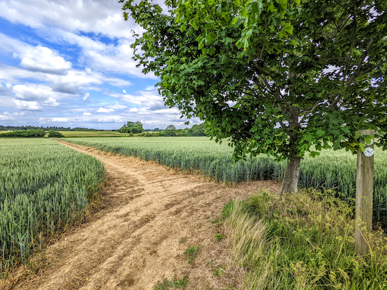 |
| At the end of the trees head NW across the field |
Continue across a field, now heading NW, for 190m to the hedgerow and a footbridge (location -
https://w3w.co/kinds.whirlpool.single), see image below.
 |
| Cross the footbridge, then turn right and head NNE for 70m |
5: Cross the footbridge, then turn right and head NNE for 70m to a marker post (location -
https://w3w.co/fittingly.breezy.faster). Continue heading NNE for another 30m until the path bends left (location -
https://w3w.co/arrives.spouse.unique), see image below, then heads N across a field for 410m to a track (location -
https://w3w.co/animals.evolving.reactions).
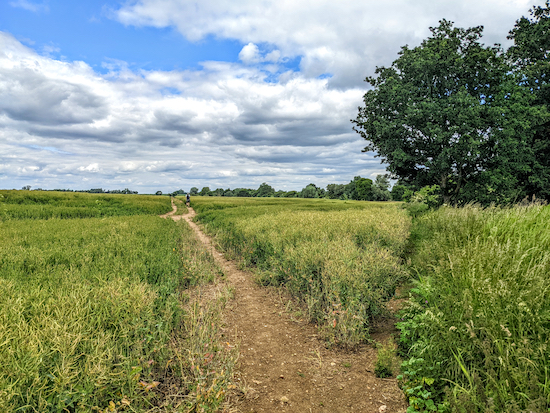 |
| Head N across a field for 410m to a track |
6: Cross the track then cross a footbridge, see image below, then continue across another field, still on Ickleford footpath 3 but now heading NNW, for 70m to another footbridge (location -
https://w3w.co/slam.sprint.questions).
 |
| Cross the footbridge then head NNW across the field |
Cross the footbridge then head N across a field for 410m until you reach a junction just before a footbridge (location -
https://w3w.co/skyrocket.nips.straws), see image below.
 |
| Turn left at the junction BEFORE the footbridge then head W |
7: Turn left at the junction (
do not cross the footbridge) then head W on Ickleford footpath 1 with the field on your left and hedgerow on the right for 510m. We saw some lovely poppies along this stretch, see image below.
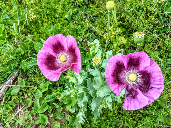 |
| Poppies along the path between points 7 & 8 |
Continue on Ickleford footpath 1 until you pass farm buildings on the left (location -
https://w3w.co/spray.tested.elevates). Go through a metal gate then continue on Ickleford footpath 1, now heading WSW for 510m until you reach the A600 (location -
https://w3w.co/himself.appealing.burden).
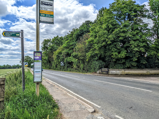 |
| Head SSE on the pedestrian footpath alongside the A600 |
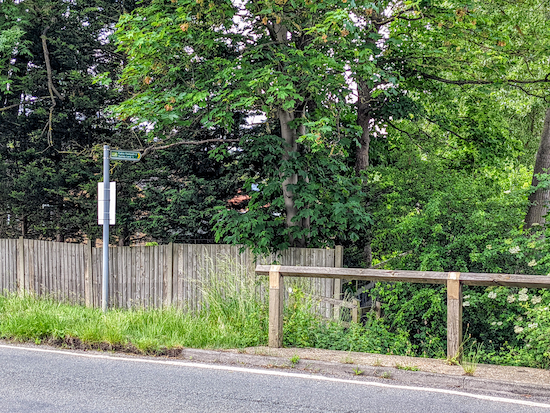
8: Turn left at the A600 then head SSE along the pedestrian footpath alongside the main road for 420m (about five minutes) looking out for a footpath on the right (location -
https://w3w.co/playfully.author.spindles).
 |
| Holwell footpath 2 heading SW off the A600 |
9: Cross the road, then take Holwell footpath 2 and head SW, with the stream on your right, for 440m until you reach a field (location -
https://w3w.co/committee.rural.howler), see image below.
 |
| Head SW on Holwell footpath 2 with the hedgerow on your right |
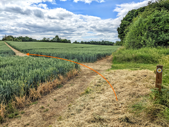
Continue heading SW, still on Holwell footpath 2, with the field on your left and the hedgerow on your right for 320m until the path bends left and crosses the field (location -
https://w3w.co/quicksand.cliff.giggles), see image below.
 |
| Turn left then head S, still on Holwell footpath 2 |
10: Turn left then head S, still on Holwell footpath 2, for 530m until you read Holwell Road in Holwell (location -
https://w3w.co/freshest.milder.debit).
11: Turn left on Holwell Road then head E for 150m until you reach a footpath on the right which is just to the right of the gate to Holwell Bowls Club (location -
https://w3w.co/cemented.beats.riches), see image below.
 |
| Take Holwell footpath 4 which is to the right of the gate |
Take this path, Holwell footpath 4, then head S for 240m passing the pavilion on your right then head for the right-hand corner of the field to a green staggered barrier (location -
https://w3w.co/odds.scramble.expensive), see image below.
 |
| Go through the green metal barrier then head S on Holwell footpath 4 |
Go through the barrier then continue heading S, still on Holwell footpath 4, for 250m until you reach a junction (location -
https://w3w.co/shield.school.freely).
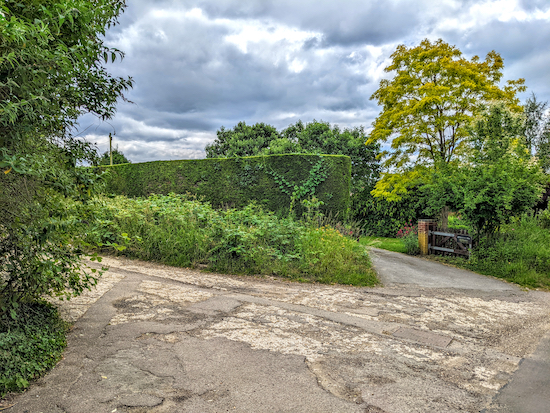
12: Turn right on Holwell bridleway 5 then head W for 200m to a road (location -
https://w3w.co/informal.beamed.incensed). Turn left on the road then head S for 40m looking out for a track on the left (location -
https://w3w.co/smirking.repay.parent), see image below.
 |
| Turn left on Holwell footpath 13 |
13: Turn left on Holwell footpath 13 then head SSE for 500m until you cross the parish boundary (location -
https://w3w.co/after.kidney.conductor) where the path you are on becomes Pirton footpath 6. Continue heading SSE on Pirton footpath 6 for 610m until you come to a field (location -
https://w3w.co/prime.sidelined.anyone), see image below. Cross the field and continue heading SSE for 270m to a junction (location -
https://w3w.co/possibly.novelists.film).
 |
| Continue across the field Pirton footpath 6 until you reach a junction |
14: Turn left at the junction, see image below.
 |
| Turn left on Pirton bridleway 21 |
Follow Pirton bridleway 21 E for 460m to a junction (location -
https://w3w.co/trustees.remembers.pleasing), see image below.
 |
| Keep left at the fork then head ENE on now on Ickleford bridleway 16 |
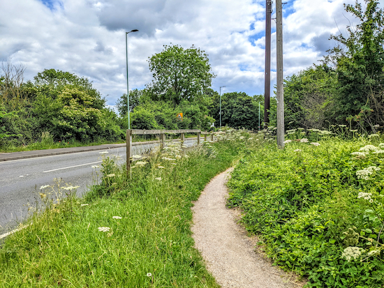
Keep to the left and the junction then head E then ENE at the junction, now on Ickleford bridleway 16, for 490m until you reach the A600 (location -
https://w3w.co/each.internal.wordplay), see image below.
 |
| Turn right on the bridleway alongside the A600 |
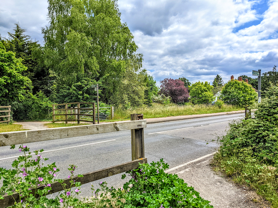
15: Turn right at the A600 then follow the bridleway alongside the main road and head S for 150m until the track ends then turns left to cross the road (location -
https://w3w.co/fizzled.daunted.amps), see image below.
 |
| Cross the road then head ENE on on Ickleford bridleway 15 |
Cross the road, then continue heading ENE, now on Ickleford bridleway 15, for 550m back to the starting point.
* The Old George pub/restaurant (location - https://w3w.co/snippets.vague.obstruct) is a short detour from finish point. To get there, walk past the Plume of Feathers then turn left on Greenfield Lane and head SW for 140m to a footpath that leads to the pub.
Interactive map


No comments:
Post a Comment