6 miles (9.6 km) with 104m of total ascent
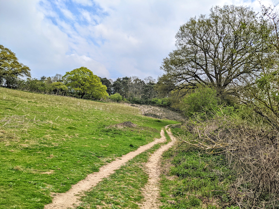 |
| Wheathampstead footpath 67 between points 12 & 13 |
This walk includes sections of four of the walks in our collection, numbers
40,
94,
111, and
143, but with many of the paths walked in reverse, so offering different views of the wonderful rolling countryside S and W of Ayot St Lawrence. The walk starts and finishes at
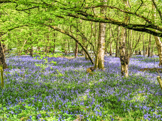
The Brocket Arms. It is now one of our favourites. The bluebells in the woods between points 15 and 16 are stunning in late April.
Directions
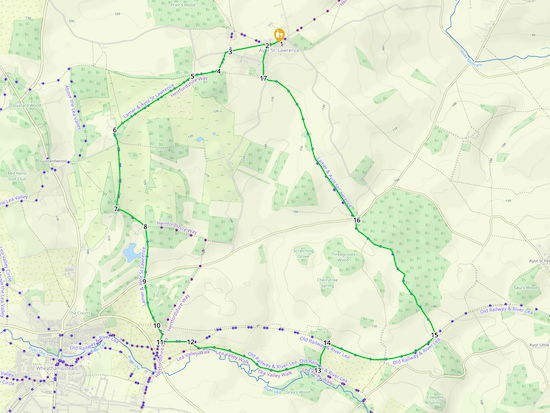 |
Map for Walk 174: Ayot St Lawrence South-West Loop
(click here or on the map for larger version)
Created on Map Hub by Hertfordshire Walker
Elements © Thunderforest © OpenStreetMap contributors
There is an interactive map below these directions |
Those with GPS devices can download
GPX or
KML files for this walk. We've added
What3Words location references for those who use that system. If you print these walks you might want to use the green
PrintFriendly icon at the bottom of these directions to delete elements such as photographs.
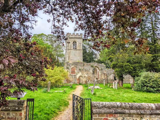 |
| The 12th century church ruins at Ayot St Lawrence |
1: With your back to
The Brocket Arms (location -
https://w3w.co/both.universally.city) turn left then head WSW along Hill Farm Lane for 110m passing the site of the old church on your right (location -
https://w3w.co/grapes.basket.flips), see image above. The runs are
a Grade II listed building dating back to the 12th century. Continue until you reach a lefthand bend (location -
https://w3w.co/mull.cave.boring).
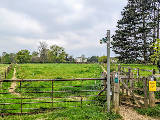 |
| Take the left fork, Ayot St Lawrence footpath 6, then follow it WSW |
2: Turn right at the bend just beyond the cottages then head WNW for 30m until you reach a gate (location -
https://w3w.co/unrealistic.boxer.dash). Go through the gate then take the left fork, Ayot St Lawrence
footpath 6, then follow it WSW for 145m until you go through a gate (location -
https://w3w.co/couches.darker.gifts).
 |
| Head WSW to the left of a large tree, see yellow arrow above |
Keep heading WSW for another 130m keeping to the left of a large tree (see image above) and continuing until you reach a track (location -
https://w3w.co/cute.lift.spray). On your right you will see the
new church (location -
https://w3w.co/beans.given.orbit) which you can visit via a short detour N from this point.
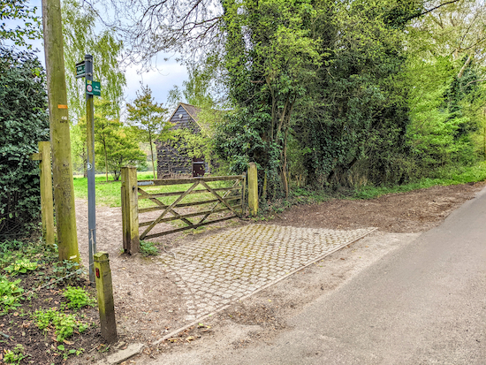 |
| Head SSW on Kimpton footpath 13 |
3: Turn left on the track then immediately turn right on Bibbs Hall Lane (location -
https://w3w.co/noble.awake.pills) then head WSW for 40m until you reach a footpath on your left (location -
https://w3w.co/skins.driver.player), see image above. Take this path, Kimpton footpath 13, then head SSW for 160m until you reach a junction (location -
https://w3w.co/bricks.powder.filed), see image below.
 |
| Turn right at the junction, still on Kimpton footpath 13 |
4: Turn right at the junction, still on Kimpton footpath 13, then head WSW for 220m until you reach another junction (location -
https://w3w.co/leader.trials.stand), see image below.
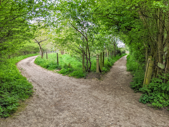 |
| Turn left on Wheathampstead footpath 37 |
5: Turn left on Wheathampstead footpath 37 then head SW for 810m until you reach a gate leading to a lane (location -
https://w3w.co/plant.facing.stole), see image below.
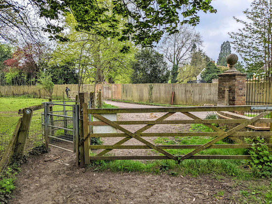 |
| Turn left on the lane then head S |
6: Turn left on the lane then head S for 100m until the lane bends to the right (location -
https://w3w.co/margin.gently.healers) and you continue heading S on Wheathampstead footpath 41 for 580m until you reach a track on the left (location -
https://w3w.co/gravel.store.oasis), see image below.
 |
| Turn left on Wheathampstead footpath 38 |
7: Turn left on Wheathampstead footpath 38 then head ESE for 300m to a junction (location -
https://w3w.co/scope.pigs.focal).
 |
| Head S on Wheathampstead footpath 39 |
8: Turn right then head S on for 470m on Wheathampstead footpath 39 until you reach Codicote Road (location -
https://w3w.co/cigar.lawn.files).
 |
| Follow Wheathampstead footpath 63 SSE |
9: Cross Codicote Road then take Wheathampstead footpath 63, see image above. Head SSE for 390m until you reach Ayot Greenway (location -
https://w3w.co/card.judge.yappy), see image below.
 |
| Wheathampstead footpath 63 approaching Ayot Greenway |
10: Cross Ayot Greenway, which is the track of
a former railway branch line that ran from Welwyn Garden City to Luton and Dunstable. Continue heading SSE, still on Wheathampstead footpath 63, for 90m until you reach a junction (location -
https://w3w.co/unit.voters.that), see image below.
 |
| Turn right at the junction on Wheathampstead BOAT 4 |
Turn right at the junction then head SSE on Wheathampstead
BOAT 4 (byway open to all traffic) for 60m looking out for a
bridleway on the left (location -
https://w3w.co/copies.strike.first).
11: Turn left on Wheathampstead bridleway 18 then head W for 270m until you reach a gate leading to a footpath on your right (location -
https://w3w.co/shape.eagles.chop), see image below.
 |
| Turn right on Wheathampstead footpath 69 then head SE |
12: Turn right, go through the gate, then turn left
on Wheathampstead footpath 69 and head SE for 100m until the path bends to the left (location -
https://w3w.co/calculating.popped.vibe) and joins Wheathampstead footpath 67 then heads E and ESE for 1km until it reaches a junction (location -
https://w3w.co/poster.juror.useful), see image below.
 |
| Turn left on Wheathampstead bridleway 18 then head NNE |
13: Turn left on Wheathampstead bridleway 18 then head NNE for 240m until you meet Ayot Greenway again (location -
https://w3w.co/report.toxic.sunset), see image above.
 |
The possible detour in orange mentioned in point 14 - click to enlarge
Created on Map Hub by Hertfordshire Walker
Elements © Thunderforest © OpenStreetMap contributors |
14: Turn right on Ayot Greenway then follow it ESE for 420m until you reach a footpath on the left just before a bridge spanning the Greenway. This path offers a nice shortcut N and NE with great views, but it can be waterlogged in bad weather and very muddy after rain (see detour in orange in the map above).
 |
| Continue heading E then ENE on Ayot Greenway |
If you choose not to take the detour, keep following the main route (in green on the map) and head E under the bridge then ENE, still on Ayot Greenway, ignoring a footpath on the right and continuing for another 480m looking out for a footpath on the left just before the Greenway goes over a bridge (location -
https://w3w.co/comet.flip.weep), see image below.
 |
| The path on the left leaving Ayot Greenway just before the bridge |
Take this footpath which leaves the route of the old railway line, see image above, then drops down the embankment to reach a track with a bridge on the right (location -
https://w3w.co/field.agent.ankle).
 |
After leaving Ayot Greenway drop down to a track then turn left
|
15: Turn left on the track then head NNE for 1.3km on a bridleway along the parish boundary that is both Wheathampstead bridleway 11 and Ayot St Peter bridleway 16. You will pass through some woodland where you will see some amazing displays of bluebells if you visit in late April (we did this on 23 April 2022), see images below (location -
https://w3w.co/unit.term.forks), see images below.
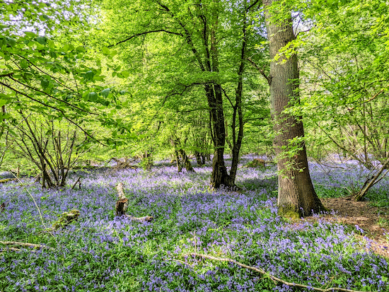 |
| Bluebells in the woods between points 15 & 16 |
 |
| Bluebells in the woods between points 15 & 16 |
Continue until you reach Codicote Road (location -
https://w3w.co/spins.amused.liked).
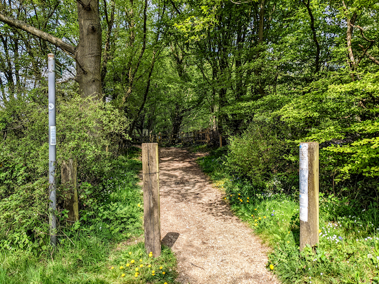 |
| Cross Codicote Road then take the bridleway on the opposite side |
16: Cross Codicote Road then take the bridleway on the opposite side. At this point you have two choices, both lead to the same place.
You can either head NW through the lovely
Stocking Spring Wood nature reserve, (location -
https://w3w.co/passes.closes.yours) which is managed by the
Herts & Middlesex Wildlife Trust, and which is rich in bluebells and wood anemones in the spring, or you can use a parallel bridleway.
Either way you head NW, both tracks converge later on. We always like walking through Stocking Spring.
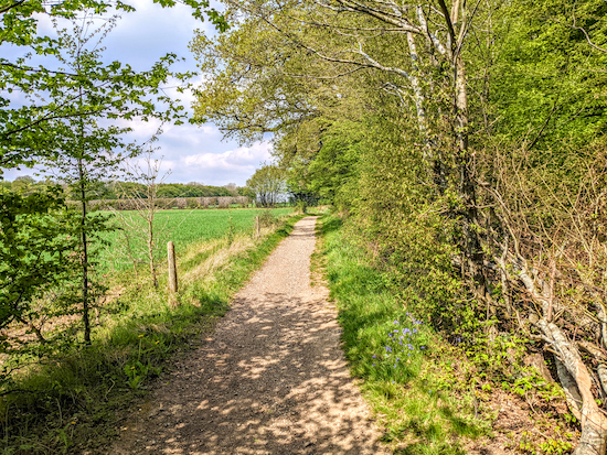 |
| The bridleway heading NW to the left of Stocking Spring Wood |
If you choose to stay on the bridleway then keep heading NW on a continuation of Wheathampstead bridleway 11 (which is also Ayot St Lawrence bridleway 2 at this stage) for 820m until the path through Stocking Spring merges from the right (location -
https://w3w.co/signal.pass.skins).
At this point the bridleway you are on is both Wheathampstead bridleway 1 and Ayot St Lawrence bridleway 2. Keep following it NW for 810m until you reach Bride Hall Lane (location -
https://w3w.co/frog.teeth.forks).
 |
| Shaw's Corner, Ayot St Lawrence |
17: Turn right then follow Bride Hall Lane N for 140m until you reach
Shaw's Corner on the left (location -
https://w3w.co/charge.hung.mull). This is
the former home of the author George Bernard Shaw, and is now managed by
The National Trust.
Continue heading N for 140m then follow the road as it bends right then heads E back to the start/finish point (location -
https://w3w.co/angel.stores.letter).
This walk was recommend by our occasional walking companions Sophie and Mike Brewer who suggested the route and tested it with us over the Easter weekend 2022.
Interactive map


Comments
Post a Comment