6.9 miles (11 km) with 122m of total ascent
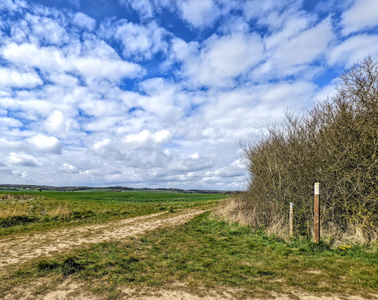 |
| The view at point 17 on the walk |
This walk explores the countryside between Hitchin and Stevenage by creating a loop that links Titmore Green, Little Wymondley and Great Wymondley. However, to do so we had to include a section where you will be aware of the noise of the A1(M) and have to pass through a built-up area. We felt that it was worth it for the access it gives to some parts of the countryside that are quiet and offering excellent views. We have checked and re-routed this walk twice. There is one part where the route crosses a dual carriageway via a pedestrian island, but, on both occasions we've done it there wasn't a problem because of the frequent breaks in the traffic. There are seven pubs on, or close to, the route.
Directions
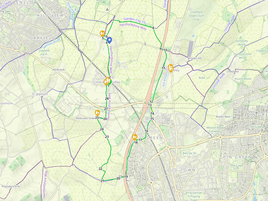 |
Map for Walk 173: Little Wymondley Loop
(click here or on the map for larger version)
Created on Map Hub by Hertfordshire Walker
Elements © Thunderforest © OpenStreetMap contributors
There is an interactive map below these directions |
Those with GPS devices can download
GPX or
KML files for this walk. We've added
What3Words location references for those who use that system. If you print these walks you might want to use the green
PrintFriendly icon at the bottom of these directions to delete elements such as photographs.
 |
| Wymondley footpath 2 leaving Great Wymondley |
1: With your back to
The Plume of Feathers (location -
https://w3w.co/host.artist.broom) turn left on Priory Lane then head N. After 120m you will go under a railway bridge (location -
https://w3w.co/still.yard.these). Continue for 80m looking out for a
footpath on your left (location -
https://w3w.co/toned.spoken.moving).
 |
| Wymondley footpath 2 going through the gap in the hedge |
2: Turn left on Wymondley footpath 2 then head NNW for 250m to a gap in the hedge (location -
https://w3w.co/desk.bucks.goal), see image above. Go through the gap then cross the next field heading NNE for 260m until you reach woodland where you will pass a pond on your left and reach a gate (location -
https://w3w.co/sends.fonts.chops).
 |
Cross the field in the direction of the yellow arrow
The yellow star shows the site of the motte and bailey |
3: Go through the gate then walk NNE for 360m across a field, still on Wymondley footpath 2, heading to the right of a white building in the distance, see image above with yellow arrow. As you walk this section you will pass
a motte and bailey and the site of the former Wymondley Castle on your right (location -
https://w3w.co/fever.client.trace), shown with a yellow star on the image above and with a blue marker with a white dot just to the right of point 4 on the maps above and below.
 |
| Wymondley footpath 2 leaving the NW corner of the churchyard |
4: Enter the churchyard of the church of
St Mary The Virgin (location -
https://w3w.co/loss.pipes.bench). Head N through the churchyard for 60m, still on Wymondley footpath 2, with the hedgerow on your left looking for a gap in the hedge in the NW corner (location -
https://w3w.co/harp.spicy.pull), see image above. Go through the gap then follow Wymondley footpath 2 WNW for 100m until you reach Arch Road opposite
The Green Man pub/restaurant (location -
https://w3w.co/total.pasta.fuels).
5: Turn right on Arch Road then head NNE for 30m until you reach the junction with Hitchin Road (location -
https://w3w.co/during.smiles.sunk). Continue heading NNE along Arch Road for another 30m until you reach the junction with Graveley Road (location -
https://w3w.co/trains.young.unwanted) on your right. Turn right on Graveley Road then head ESE for 90m looking for a track on the left that runs alongside sports fields (location -
https://w3w.co/ready.asking.crush).
 |
| Great Wymondley Community Orchard |
 |
The list of all the contributors to Great Wymondley Community Orchard
Click here or on image to enlarge |
6: Turn left on the track then head NNE for 240m until you reach a gate (location -
https://w3w.co/pasta.income.stones). Before you reach the gate you will see
Great Wymondley Community Orchard on your right (location -
https://w3w.co/hardly.sketch.dinner). It's worth having a look at the sign. Click on the image above to enlarge.
 |
| Go through the gate then continue heading NNE to a T-junction |
Go through the gate then continue heading NNE for 210m until you reach a T-junction (location -
https://w3w.co/loyal.keys.pills).
 |
| Head E for 1km until you reach a T-junction |
7: Turn right at the T-junction then follow the track E for 1km, ignoring paths to your right or left, and continuing until you meet a T-junction (location -
https://w3w.co/crisp.empire.uses).
 |
| Wymondley bridleway 1 heading SE towards Graveley Lane |
8: Turn right at the T-junction on Wymondley
bridleway 1 then head SE for 600m until you reach Graveley Lane (location -
https://w3w.co/cove.finger.undulation).
9: Turn left on Graveley Lane then head ESE for 120m, passing under the A1(M), then looking out for a footpath on your right (location -
https://w3w.co/strict.tulip.ideal).
 |
| Graveley bridleway 21 heading SSE of Graveley Lane |
10: Take this path, Graveley bridleway 21, then head SSE for 190m until you reach a junction where Milksey Lane leaves to the left (location -
https://w3w.co/caged.salt.ridge). Keep to the right at the junction then head SSW for 280m until you reach Oak Lane on the left (location -
https://w3w.co/sling.debate.roses).
* At this point you have the option turning left on Oak Lane and heading ESE for 210m to visit either The Waggon and Horses or The George and Dragon on High Street Graveley (location - https://w3w.co/wants.hired.crown).
11: If you don't want to take the detour to the pubs, continue heading SSW on Turf Lane for 940m until you reach Graveley Road at a large and busy roundabout (location -
https://w3w.co/globe.stud.wide).
 |
| The route between points 12 & 15 ** |
12: Cross Graveley Road then turn right towards the roundabout then turn left and head SSW and then S alongside Hitchin Road (location -
https://w3w.co/flesh.create.penny), see satellite image above.
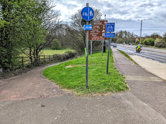 |
| The path on the left leading to the underpass beneath Hitchin Road |
13: Continue along the footpath running along the side of Hitchin Road for 170m until you reach a path on your left (location -
https://w3w.co/soaks.slower.deflection) which leads downhill to an underpass under Hitchin Road (location -
https://w3w.co/gentle.outer.manliness).
14: Go through the underpass then turn left and head S for 130m looking out for a track on the right just past the Sainsbury's car park (location -
https://w3w.co/branded.blocks.draw).
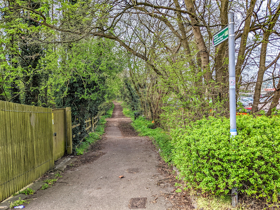 |
| Stevenage restricted byway 57 |
15: Take this track, Stevenage
restricted byway 57, then follow it SSW for 360m until it turns right then goes over the railway line (location -
https://w3w.co/senses.help.still).
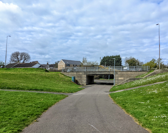 |
| Go under the underpass, keep right then follow the path W |
16: After crossing the railway line continue heading SSW, still on Stevenage restricted byway 57, for 160m until you reach an open grassy area. At this point you continue heading SW along a metalled stretch for 140m until the path goes through an underpass beneath Fishers Green (location -
https://w3w.co/lasted.empty.scare).
 |
| The Fisherman pub/restaurant |
17: Once through the underpass keep right then follow the path W for 90m before it joins a lane (location -
https://w3w.co/item.voters.nurses) where you keep right and head W for 30m before the lane bends to the left (location -
https://w3w.co/pilots.wipe.tummy) then heads S for 70m until you reach the entrance to
The Fisherman pub/restaurant car park on your right (location -
https://w3w.co/events.transfers.ticket).
 |
| Take the footpath from the SW corner of The Fisherman car park |
18: Head W through The Fisherman car park for 60m looking out for a footpath in the SW corner (location -
https://w3w.co/nails.fish.sector), see image above. Leave the car park then turn left and follow the footpath S through woodland.
 |
| The path heading S from point 18 |
This stretch was carpeted in wood anemone, celandine, and bluebells when we tested this walk on 13 April 2022.
 |
| The bend leading to a tunnel under the A1(M) |
Continue heading S for 930m until you reach a righthand bend where the path heads W to reach a tunnel under the A1(M) (location -
https://w3w.co/butter.yappy.trout), see image above.
 |
| The junction where Stevenage footpath 34A meets Ippollitts footpath 23 |
19: Go through the tunnel following Stevenage footpath 34A then head straight and WSW across a field to a footpath junction (location -
https://w3w.co/chimp.suffice.chief), see image above.
 |
| Head WSW on Ippollitts footpath 23 |
20: Continue heading WSW at the junction, now on Ippollitts footpath 23, for 410m until you reach a junction (location -
https://w3w.co/rival.slower.sleep). We loved this stretch as we finally left the sound of the A1(M) behind and were able to enjoy wide open views across the Hertfordshire countryside.
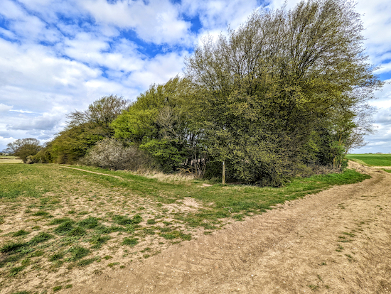 |
| Turn left at the woodland still on Ippollitts bridleway 24 |
21: Turn right at the junction then head NNE for 260m, now on Ippollitts
bridleway 24, until you reach woodland (location -
https://w3w.co/store.maybe.throw) where Ippollitts bridleway 24 bends left then heads WNW for 150m before reaching a right turn at the end of the woodland (location -
https://w3w.co/hers.price.daisy).
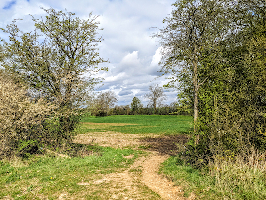 |
| Turn right at the end of the woodland on Wymondley bridleway 22 |
22: At the end of the woodland turn right then head NNE on Wymondley bridleway 22 for 680m then NNW for 280m until you reach a lane called Lower Titmore Green (location -
https://w3w.co/heads.youth.album).
 |
| Follow Wymondley bridleway 22 until you reach a lane |
23: Continue heading NNW along the lane for another 230m until you reach a footpath on your left (location -
https://w3w.co/bunks.calls.owners).
 |
| Wymondley footpath 17 heading NNW |
24: At a footpath junction take Wymondley footpath 17 through a gate and keep to your right to follow it NNW for 320m, with the hedgerow on the right and the field on your left, until you reach Stevenage Road in Titmore Green. The path will emerge opposite The
Hermit of Redcoats pub (location -
https://w3w.co/spend.bunk.storm). We've had two really good meals at The Hermit of Redcoats, the first when mapping another walk in this area,
Walk 138: The Titmore Green Loop, and the second when testing this route.
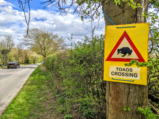 |
| Look out for toads crossing as you walk along Stevenage Road |
25: When you reach Stevenage Road turn right then walk E for 200m looking out for a footpath on the left (location -
https://w3w.co/points.jazzy.proof). There isn't a pedestrian pavement along this stretch but there are some sections of grass verge where you can step aside to avoid oncoming traffic.
 |
| Wymondley footpath 8 heading N off the road |
26: Turn left on Wymondley footpath 8 then follow it N for 250m until you reach the A602 (location -
https://w3w.co/candy.slip.spin). Take care crossing this dual carriageway. There is a pavement for pedestrians at the midway point which makes crossing easier. We didn't have a problem.
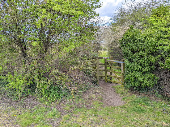
27: Continue heading N, still on Wymondley footpath 8, for 250m passing sports buildings on your right (location -
https://w3w.co/cloud.talent.smiled). Continue round the sports building until you reach a footpath on the left (location -
https://w3w.co/peanut.steep.oval).
 |
| The gate where Wymondley footpath 8 continues heading N |
28: Go through the gate then follow Wymondley footpath 8 N for 370m until you reach
The Buck's Head on Stevenage Road (location -
https://w3w.co/bounty.author.atom), where you turn right and head back to the starting point.
Interactive map
Note: The satellite image at point 11 is courtesy of: Esri, DigitalGlobe, GeoEye, Earthstar Geographics, CNES/Airbus DS, USDA, USGS, AEX, Getmapping, Aerogrid, IGN, IGP, swisstopo, and the GIS User Community


Comments
Post a Comment