6.2 miles (9.9km) with 135m of total ascent
This is a lovely walk which starts and finishes at the excellent Lordship Arms in Burn's Green. It follows footpaths, bridleways, and byways over rolling countryside with wide, open views across north Hertfordshire.
Directions
 |
Map for Walk 169: Burn's Green North Loop
Created on Map Hub by Hertfordshire Walker
Elements © Thunderforest © OpenStreetMap contributors
There is an interactive map below these directions |
Those with GPS devices can download
GPX or
KML files for this walk. We've added
What3Words location references for those who use that system. If you print these walks you might want to use the green
PrintFriendly icon at the bottom of these directions to delete elements such as photographs.
The landlord at The Lordship Arms told us that walkers following our walks can park in the pub car park if it's not busy and if they intend to buy refreshments after their walk. And if the pub is closed when you arrive, please put a note through the letterbox saying you have parked on the premises. Check
the pub's website for opening hours.
1: With your back to The Lordship Arms cross Whempstead Road then head E along Hebbing End for 340m until you reach a large pond on your right and a track (location -
https://w3w.co/included.spite.gossiping).
 |
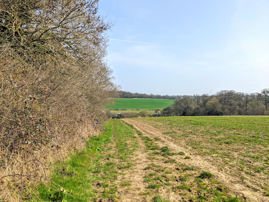
| From point 2 head downhill with the hedge on the left and field on the right |
2: Turn right on Benington bridleway 25 then head ESE for 90m then follow the path round to the left and head ENE for 570m until you reach a junction in the track at the bottom of the hill (location -
https://w3w.co/pram.safest.whiplash).
 |
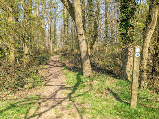
| Benington bridleway 26 heading into Witness Wood |
3: Head NE and uphill, now on Benington bridleway 26 for 670m until you reach Witness Wood (location -
https://w3w.co/licks.songbirds.acoustics). Continue through Witness Wood, still on Benington bridleway 26, for 140m until you reach a field (location -
https://w3w.co/televise.underline.drumbeat).
 |
| Follow Walkern bridleway 3 NE for 410m |
4: Continue heading NE (following the line of the red arrow above to the right of a line of trees) now on Walkern bridleway 3 for 410m until you reach a junction (location -
https://w3w.co/mulls.brains.group).
 |
| Walkern bridleway 3 bending to the right (see point 5 below) |
5: Turn left, still on Walkern bridleway 3, then head NW for 140m before the footpath bends right (see image above) and heads N for 470m until it reaches a junction
(location -
https://w3w.co/eagle.invisible.shelf).
 |
| Turn left on Walkern bridleway 2 |
6: Turn left on Walkern bridleway 2 then head WNW for 720m until you reach Walkern Park Farm (location -
https://w3w.co/shovels.wager.lamps).
 |
| Walkern bridleway 7 is to the left of the hopper with the hedge on the right |
7: When you reach the farm turn left and head SW then turn right and head W between the farm buildings, then left again until you reach Walkern bridleway 7 on your left (location -
https://w3w.co/guideline.stack.blank). Head SW on Walkern bridleway 7 for 520m until you reach an open field. Your way is SW on Benington bridleway 20 which goes off to the right over the field (location -
https://w3w.co/deflated.fairy.differ), see image below.
 |
| Benington bridleway 20 heading SW across a field |
8: Head SW on Benington bridleway 20 for 380m passing a pit on the right (location -
https://w3w.co/boils.rags.desktops) before reaching an irrigation ditch at the bottom of the hill (location -
https://w3w.co/openly.flood.treaty).
 |
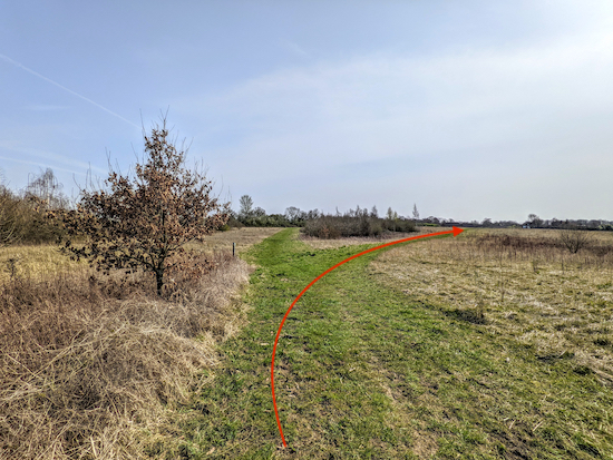
| Follow Benington bridleway 20 to the hedgerow then bridleway 11 NE |
9: Cross the irrigation ditch then continue heading SW for 100m until you reach the hedgerow and a junction (location -
https://w3w.co/matter.juggled.catapult), see red arrow on image above. Turn right on Benington bridleway 11 then head NE for 260m until you reach woodland and a junction (location -
https://w3w.co/posting.ripen.novel).
 |
| Benington bridleway 10 heading SW |
10: Turn left on Benington bridleway 10 then follow it SW for 320m to a junction location -
https://w3w.co/breezes.crowbar.clotting).
11: Turn left on Benington bridleway 16 then follow it SE for 230m until you reach a junction (location -
https://w3w.co/stroke.obstruction.workbench).
 |
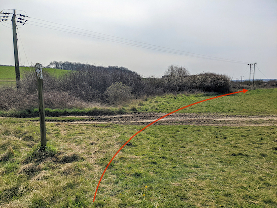
| Head S on Benington footpath 17 (following the direction of red line) |
12: Turn right then head S on Benington footpath 17 (see image above) following the path for 320m until you reach Town Lane, Benington (location -
https://w3w.co/smooth.huts.luxury).
13: Cross Town Lane then take Benington footpath 32 that heads SW for 740m until you reach a junction (location -
https://w3w.co/structure.dive.factually).
 |
| Head straight and SW, still on Benington footpath 32 |
14: Keep heading straight and SW, still on Benington footpath 32, for 100m until the path you are on drops down to the left to join a bridleway at a junction (location -
https://w3w.co/frogs.tailwind.bravest) where you turn right and continue heading SW, now on Benington bridleway 31 for 320m until you reach a track on your left (location -
https://w3w.co/venturing.suitcase.searches).
15: Turn left on Benington byway open to all traffic (BOAT) 34, which is also known locally as Cotton Lane, then head S for 1.3km until you reach a junction (location -
https://w3w.co/candy.workroom.scarcely).
16: Turn left on High Elms Lane then head NE for 400m looking out for a track on the left (location -
https://w3w.co/riders.flamenco.wicked).
 |
| Benington restricted byway 39 towards the end of the walk |
17: Take this track, Benington restricted byway 39, then follow it NE for 1.3km back to Burn's Green and The Lordship Arms at the starting point
(location -
https://w3w.co/lawns.modest.jigsaw).
Interactive map


Comments
Post a Comment