8.7 miles (14 km) with 153m of total ascent
This walk includes parts of a shorter walk on this site,
Walk 125: Weston NE Loop, with the added advantage of starting and finishing at the
Weston Hills nature reserve where there is a small car park off Chalk Hills (location -
https://w3w.co/tiger.hurray.dose). We have embedded an information brochure at the bottom of these directions showing all the paths in the reserve.
The walk passes three pubs, The
Red Lion (location -
https://w3w.co/panels.putty.same) and
The Cricketers (location -
https://w3w.co/jazzy.crew.pines) in Weston, and
The Rising Sun (location -
https://w3w.co/stubborn.fuzz.airports) in Halls Green. The
George IV (location -
https://w3w.co/alone.mice.sugar) is 370m from the start/finish point.
We have been told that the Red Lion pub, mentioned in the following directions, is currently closed (February 2024), we will update these directions and maps when we know more.
Directions
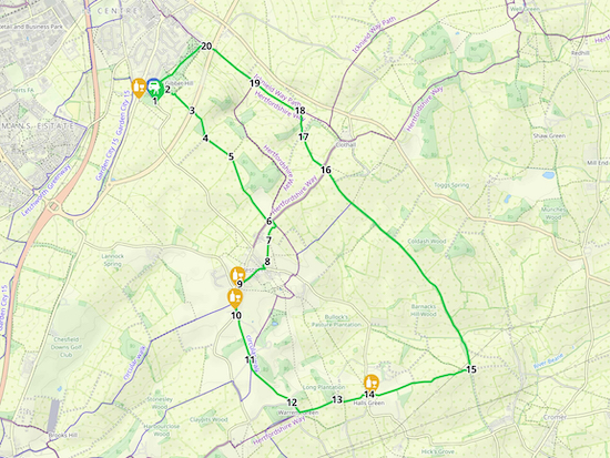 |
Map for Walk 168: Baldock South-East Loop
Created on Map Hub by Hertfordshire Walker
Elements © Thunderforest © OpenStreetMap contributors
There is an interactive map below these directions |
Those with GPS devices can download
GPX or
KML files for this walk. We've added
What3Words location references for those who use that system. If you print these walks you might want to use the green
PrintFriendly icon at the bottom of these directions to delete elements such as photographs.
 |
| The steps in the Chalk Hills car park at the start of the walk |
1: From the car park off Chalk Hills face the road then turn left and head SE to the staircase in the corner of the car park (location -
https://w3w.co/scale.create.follow). Climb the stairs until you reach a junction (location -
https://w3w.co/slope.swung.dame) where you keep left then head NE for 210m to a junction in the paths (location -
https://w3w.co/cloud.grades.edge), see image below.
 |
| Weston footpath 3 heading SE out of the nature reserve |
2: Turn right at the junction and follow Weston footpath 3 as it heads out of the nature reserve and continues heading SE for 420m until you cross the Baldock Bypass on a footbridge (location -
https://w3w.co/visa.brush.stove).
 |
| Continue heading SE on Weston footpath 3 |
3: Continue heading SE, still on Weston footpath 3, for 400m until you reach a junction at the end of a stretch of woodland (location -
https://w3w.co/hits.jobs.labels), see image above.
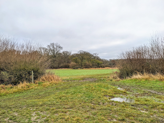 |
| At the junction continue to follow Weston footpath 3 and head SE |
4: Continue heading SE, still on Weston footpath 3, for 390m until you reach another junction (location -
https://w3w.co/office.evenly.tile), see image above.
5: Go through the gap at the junction then continue to head SE, still on Weston footpath 3, following the path across fields for 950m until you reach Green End (location -
https://w3w.co/oven.protester.jetliner).
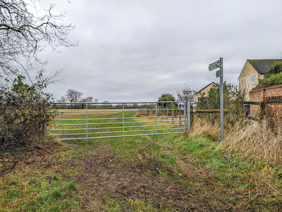 |
| Turn right on Weston footpath 10 |
6: Turn left on Green End then take the footpath on the right (location -
https://w3w.co/smoker.highlight.thigh), see image above. This is Weston footpath 10 which you first follow SE for 75m with houses on the right and field on the left until you reach a junction where footpath 12 goes off to the left and you keep to the right (location -
https://w3w.co/poet.revisits.pursue), see image below.
 |
| Keep right at the junction, still on Weston footpath 10 |
Keep right, still on footpath 10, but now heading SSW for 210m to a junction (location -
https://w3w.co/rungs.spiking.unlisted), see image below.
 |
| Head S on Weston footpath 10 following the line of the yellow arrow above |
7: Go through the gate then continue on Weston footpath 10, now heading S for 270m until you reach a gate at the corner of the field (location -
https://w3w.co/chops.funky.slippery), see yellow line in image above.
 |
| Leave the field then head SW for 80m to reach Mill Lane |
8: Once through the gate, see image above, head SW for 80m until you reach Mill Lane (location -
https://w3w.co/butterfly.jingles.instructs). Turn left on Mill Lane then head SE for 50m until you reach Maiden Street, Weston (location -
https://w3w.co/compelled.screaming.spiking). Turn right on Maiden Street then head SW for 370m until you reach the junction of Fore Street and Damask Green Road (location - https://w3w.co/worry.quench.wages).
9: Turn left then head S on Damask Green Road for 400m first passing The Red Lion on the right and then The Cricketers, also on the right, before reaching a bend in the road where you take the track on the left (location -
https://w3w.co/bunk.spine.native).
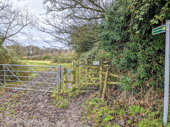 |
| Turn right on Weston footpath 23 |
10: Follow the track SE for 60m looking out for a footpath on the right (location -
https://w3w.co/slope.woof.gravel). Take this footpath, Weston footpath 23, then head SSE for 500m until you reach a junction (location -
https://w3w.co/honey.exile.expect).
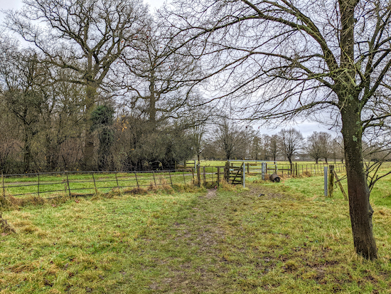 |
| After the junction continue heading SSE, still on Weston footpath 23 |
11: Cross the junction then continue heading SSE, still on Weston footpath 23, for 110m until you come to a junction in the path (location -
https://w3w.co/hype.crop.driver). Keep left at the junction then head SE for 670m until you reach Warrens Green Lane (location -
https://w3w.co/glider.reference.concerned).
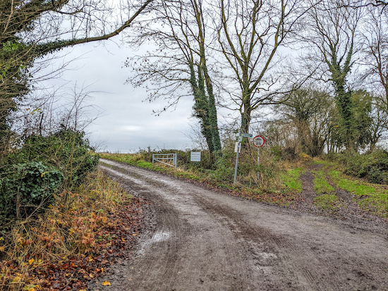 |
| Turn left on Weston footpath 28 off Warrens Green Lane |
12: Continue heading SE along Warrens Green Lane for 160m until you reach a track on the left (location -
https://w3w.co/boggles.marked.licks), see image above. Turn left on Weston footpath 28 then head ENE for 480m until you reach a junction (location -
https://w3w.co/bronzed.smoothly.serenade), see image below.
 |
| Keep right on Weston footpath 28 and head ENE |
13: Keep right at the junction then continue heading ENE, still on Weston footpath 28, for 420m until you pass through a farmyard (keeping to the left of the farm buildings) before reaching Dane End Road (location -
https://w3w.co/toothpick.resemble.breakfast), opposite The Rising Sun at Halls Green.
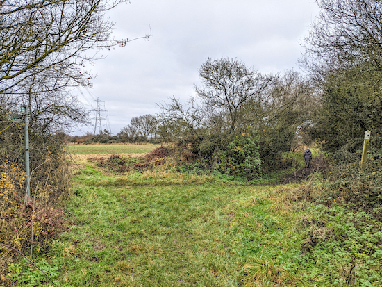 |
| Keep right at the junction and take Weston bridleway 36 - point 14 |
14: Cross Dane End Road then take the footpath to the left of The Rising Sun (location -
https://w3w.co/fanfare.crusaders.fans) then head ESE then ENE for 1.2km on Weston footpath 15 until you reach a junction (location -
https://w3w.co/slipping.cropping.finger), see image above. Keep right at the junction, now on Weston bridleway 36, and head E for 95m to a junction (location -
https://w3w.co/spite.drummers.preheated).
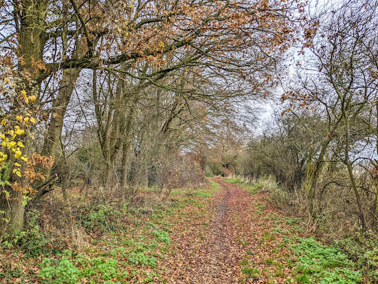 |
| Clothall BOAT 12 which is also Weston BOAT 39 heading NNW |
15: Turn left on a byway which is both Clothall BOAT 12 (byway open to all traffic) and Weston BOAT 39 then head NNW for 3.2km until you reach Hickman's Hill at its junction with Ashanger Lane (location -
https://w3w.co/mystery.proves.relatives).
 |
| Turn left off Ashanger Lane |
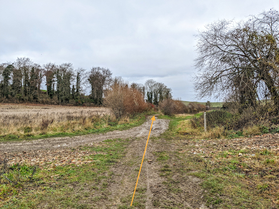
16: Turn right on Ashanger Lane then head NW for 50m then take the track on the left (location -
https://w3w.co/flickers.conga.hurray), see image above.
 |
| At the junction mentioned below ignore the paths to the right and left |
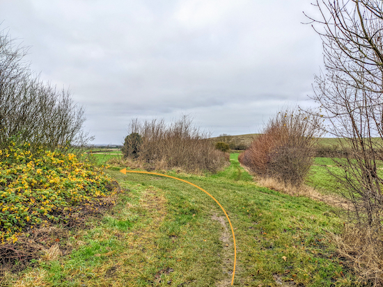
Continue heading NW, still on Clothall BOAT 12 and Weston BOAT 39 for 460m until you reach a junction (location -
https://w3w.co/flight.amicably.tightrope), see image above.
 |
| Turn left when you reach the junction |
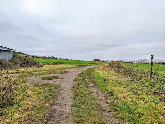
17: Keep straight at the junction and head NNW for 300m until you reach a junction in the track (location -
https://w3w.co/tell.bolsters.student), see image above.
 |
| Continue heading NW now on Weston bridleway 1 |
18: Turn left at the junction, now on Weston footpath 1, then head NW for 660m until you pass farm buildings on the left (location -
https://w3w.co/level.locate.soccer), see image above. At this point the path you are on becomes Weston bridleway 1.
 |
| Turn left at the fork in the path |
19: Continue heading NW, now on Weston bridleway 1, for 670m until you reach a footbridge crossing the Baldock Bypass again (location -
https://w3w.co/cracks.envy.burst). Cross the footbridge then continue heading NW, still on Weston bridleway 1, for 90m until the path splits (location -
https://w3w.co/feast.attend.zips), see image above.
 |
| Take the footpath on the right to enter the Weston Hills nature reserve |
20: Take the left fork then head W for 60m until you reach a gate leading to the Weston Hills nature reserve (location -
https://w3w.co/lace.still.ranch), see image above.
 |
| Keep left at the bench then head SW |
Enter the nature reserve then follow the path as it bends to the left of a bench (location -
https://w3w.co/monks.fuels.game), see image above, then follows the contours as it heads SW for 880m crossing several paths off to the right and left (see detailed map below) and continuing back to the carpark (location -
https://w3w.co/trout.tests.orbit).
 |
Route of track through Weston Hills nature reserve
Created on Map Hub by Hertfordshire Walker
Elements © Thunderforest © OpenStreetMap contributors
|
Interactive map
Weston Hills nature reserve brochure


I think you had the same what3words reference for points 8 and 9.
ReplyDeleteHi,
DeleteThanks for that. I have fixed the double reference. Thanks for taking the trouble to let me know. It's appreciated.
David
Hi Mrs DR,
DeleteI just deleted your first comment by mistake. I blame it on being sleepy after a long walk in the wind today. :-)
Sorry about that. I still have the email notification of your post so I am copying it below so it is not lost. Apologies for messing up. You wrote:
"Did part of this walk yesterday - bit cold and blustery so we didn't want to walk the whole thing. Started at point 10 then walked round to 16 and cut across to 6. Lovely walk, mostly very open and so quiet, just birdsong - I think we only saw 4 people! Will do the full walk when the weather gets warmer."
Thanks for posting all these walks - we really enjoy them.
DeleteWe love sharing our hobby and really enjoy reading the comments. David
Delete