6.2 miles (9.8 km) with 135m of total ascent
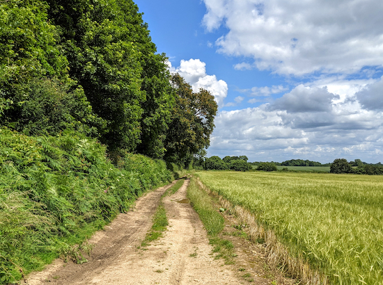 |
| Great Gaddesden footpath 35 between points 4 & 5 |
This walk explores the area around Water End and Briden's Camp following footpaths, bridleways, and byways through rolling countryside with open views. It passes two pubs. Some paths will be muddy after rain.
Directions
 |
Map for Walk 147: Water End North-East Loop
Created on Map Hub by Hertfordshire Walker
Elements © Thunderforest © OpenStreetMap contributors
There is an interactive map below these directions |
Those with GPS devices can download
GPX or
KML files for the walk. We've added
What3Words references for those who use that system. If you print these walks you might want to use the green
PrintFriendly icon at the bottom of these directions to delete elements.
Parking is difficult for this walk, but management at the two pub/restaurants along the route,
The Red Lion at Water End (point
1 on the walk) and
The Crown & Sceptre at Briden's Camp (point
4 on the walk) say that walkers who intend to buy refreshments before or after the walk are welcome to park in their car parks. Please check before setting off to ensure this facility is still available. The Crown & Sceptre would appreciate a call on 01442-234660 because space is limited. If you park there you should join the route at point 4. The Red Lion can be contacted on 01442 213594.
1: From The Red Lion on Leighton Buzzard Road (location -
https://w3w.co/doctor.became.kicks), cross the road and head NE along Red Lion Lane which is directly opposite the pub and continue for 70m looking out for a bridleway on the right (location -
https://w3w.co/late.funny.happy), see image below. Take this path, Great Gaddesden bridleway 39 and head E, ESE, then ENE for 410m until you reach a junction in the track (location -
https://w3w.co/slips.varieties.coats).
 |
| Great Gaddesden bridleway 39 off Red Lion Lane - point 1 |
2: Turn left on Great Gaddesden footpath 38 and head NNW for 410m until the path cuts to the left through woodland then heads NNW again for 310m until you reach Red Lion Lane (location -
https://w3w.co/unions.wiping.butter).
3: Turn right on Red Lion Lane and head NNE for 190m until you reach
The Crown & Sceptre pub on the right (location -
https://w3w.co/menu.design.help).
There is no footpath along this section of the lane so proceed with caution. The Crown & Sceptre is a welcoming, popular, unspoilt traditional pub which served a superb pint of Tring Moongazing. They also serve food at certain times. Please check opening times to avoid disappointment.
 |
| The Crown & Sceptre at Briden's Camp |
4: Turn right immediately before The Crown & Sceptre and head SE and then E on Great Gaddesden bridleway 37 for 300m to a junction (location -
https://w3w.co/guards.energy.pumps), see image below.
 |
| Great Gaddesden footpath 35 heading NE |
5: Head NE on Great Gaddesden footpath 35 for 1.1km ignoring the first track on the left (location -
https://w3w.co/stupidly.disposal.nuptials) and continuing until you reach a gap in the hedgerow on the left opposite a gate on the right (location -
https://w3w.co/idealist.pace.basket), see image below. At this point Great Gaddesden footpath 35 bends to the left and continues to the left of the hedgerow with the field on the left.
 |
| The path goes to the left of the hedgerow, not to the right - point 5 |
Continue heading NE with the hedgerow on the right and the field on the left for 550m until you reach a lane called Gaddesden Row (location -
https://w3w.co/goods.customers.galleries).
6: Turn right on Gaddesden Row and head SE for 90m until you reach a footpath on the left (location -
https://w3w.co/blues.revisit.suspends), see image below.
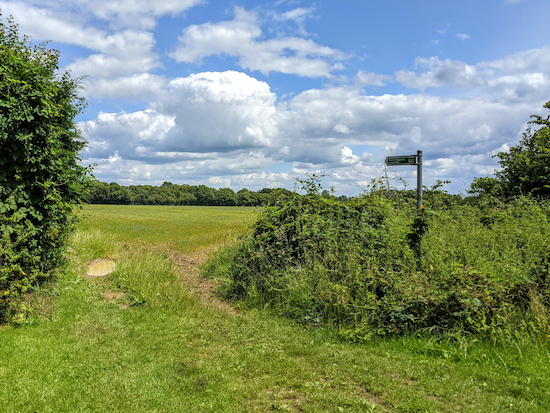 |
| Great Gaddesden footpath 43 off Gaddesden Row - point 6 |
Take this path, Great Gaddesden footpath 43, and head NE for 340m until the path bends to the right and heads SE for 50m before bending left (location -
https://w3w.co/community.vibes.profiled) and then heading NE for 190m to a junction (location -
https://w3w.co/gulped.surpasses.hoofs).
* Warning: This short section of Great Gaddesden footpath 43 has been churned over by horse riding. As a result the footpath is extremely muddy and slippery, even in the summer months. It's also not wide enough for walkers and horses. However we managed to walk the section without incident. There is a sign along the footpath saying the route is part of the Gaddesden Estate Ride. We've written to Gaddesden Estate asking whether the horse ride route could be diverted so that it doesn't go along such a narrow public footpath. We've also asked Hertfordshire County Council's Rights Of Way (ROW) officer for the area to check the status of this path and see if anything can be done.
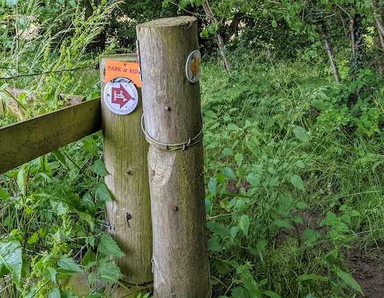 |
| Gaddesden Estate Ride sign on Great Gaddesden footpath 43 |
7: When you reach the junction, turn right on Great Gaddesden bridleway 42 and head SE for 830m until you reach Gaddesden Lane (location -
https://w3w.co/taps.hills.amount).
8: Turn right on Gaddesden Lane and head SW for 310m until the lane turns to the right (location -
https://w3w.co/impact.circle.pulse). Here you continue heading SW along Cupid Green Lane for 380m until the lane bends to the left and Great Gaddesden bridleway 39 continues heading SW (location -
https://w3w.co/heap.trial.blank), see image below.
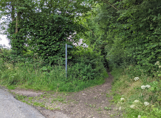 |
| Great Gaddesden bridleway 39 heading SW off Cupid Green Lane |
9: Continue heading SW along Great Gaddesden bridleway 39 for 2.1km until you reach the junction you passed at point 2 in the walk.
10: Turn left and head SE on Great Gaddesden footpath 38, with the hedgerow on the left and the field on the right, for 280m until you reach woodland. Here the footpath turns right and heads SW for 280m until it reaches Leighton Buzzard Road (location -
https://w3w.co/leaps.into.venue).
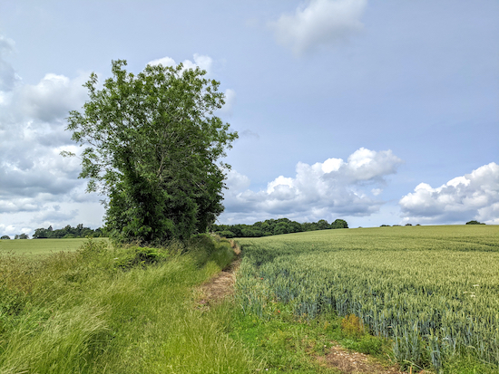 |
| Great Gaddesden footpath 38 runs to the right of the hedgerow |
11: Cross Leighton Buzzard Road and take Noake Mill Lane on the opposite side. This is also Great Gaddesden BOAT (byway open to all traffic) 58. Follow it SW for 350m, crossing the River Gade and passing Noake Mill before climbing uphill to a footpath.
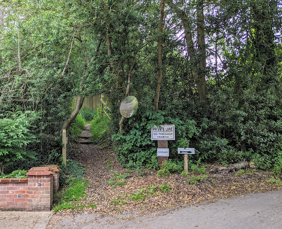 |
| The footpath at the end of Noake Mill Lane |
12: Take the footpath then turn right, on Great Gaddesden footpath 57 and head NNW for 560m until the path becomes a paved section of Willow Lane (location -
https://w3w.co/picked.trader.copy). Continue along Willow Lane and head NNW for 150m you reach Potten End Hill (location -
https://w3w.co/enable.talent.spice).
13: Turn right on Potten End Lane and head NE for 180m until you reach Leighton Buzzard Road (location -
https://w3w.co/flesh.frock.caller).
There is no footpath along this section of Potten End Lane. Turn right on Leighton Buzzard Road and head SE for 140m back to The Red Lion at the starting point, where we had an excellent meal at the end of our walk. Really good food served by friendly and attentive staff in a lovely setting.
Interactive map


Comments
Post a Comment