4.4 miles (7.1 km) with 98m of total ascent
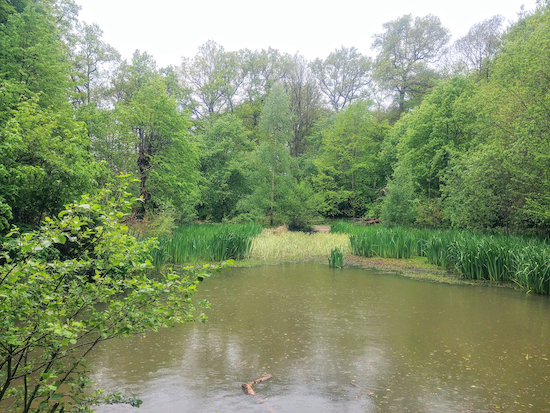 |
| The pond at Chipperfield Common on the return leg |
Fly through preview of walk
If you want to check what sort of landscape you will be crossing before you set off on this walk you can view a short 3D video of the route below. It's created using the free version of Relive.
Directions
GPX and KML files for this walk. We've added What3Words location references for those who use that navigation system. If you print these walks you might want to use the green PrintFriendly icon at the bottom of these directions to delete elements you don't need.
Park on Chipperfield Common (location - https://w3w.co/gasp.wash.chew). There are several parking spots on the northern and western edges of the common. We parked close to The Two Brewers pub/restaurant (location - https://w3w.co/giving.calms.finger). Blackwell's cafe is close by (location - https://w3w.co/driven.tested.pans).
1: From Chipperfield Common head SSW down a path that runs between the rear of St Paul’s Church and the cricket pitch (location - https://w3w.co/cube.dogs.pile), see image below. This is Chipperfield footpath 5 which starts running alongside the church wall before forking to the left. Continue on Chipperfield footpath 5 for 240m.
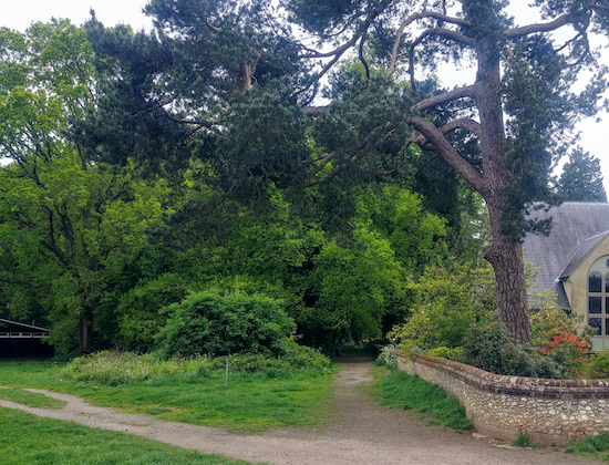 |
| Take Chipperfield footpath 5 at the back of the church |
 |
| Turn left on the track then head SW for 260m |
4: As you approach the junction with houses beyond you will see two footpaths on your right (location - https://w3w.co/intro.branch.castle), see image below.
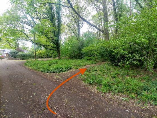 |
| Chipperfield footpath 3 is the first path on the right before the houses |
Turn right on the track then head NW for 40m until you reach a track on your left just before Windmill Hill (location - https://w3w.co/nails.sulk.pink).
5: Turn left on this track, still Chipperfield footpath 3, then follow it NNW for 30m until it bends sharp left and heads SSW for 50m at which point it becomes Sarratt footpath 1 (location - https://w3w.co/shall.unity.belly).
Follow this path SSW for 550m as it crosses a couple of junctions then passes alongside a few houses before reaching a lane called Penman’s Hill (location - https://w3w.co/looked.others.lodge).
Turn right on Penman’s Hill, still Sarratt footpath 1, then continue heading SW for 200m until you reach the bottom of the hill.
* When you reach the bottom of Penman’s Hill you have the option of turning right for a short detour to the The Plough pub/restaurant on Dunny Lane (location - https://w3w.co/paints.police.sport.6: At the bottom of Penman’s Hill (location - https://w3w.co/clip.dusty.mime) cross diagonally over Plough Lane then head SSW along Poles Hill for 100m looking for a footpath on the left (location - https://w3w.co/later.olive.crop).
Take this path, Sarratt footpath 21, then head SSE for 180m until you reach woodland. Head SSW through the woodland for 180m until you reach Bragmans Lane (location - https://w3w.co/added.hurry.marker).
7: Turn right on Bragmans Lane then head NW for 80m until you reach a track on your left (location - https://w3w.co/dinner.bride.solo). This is the only part where you will be walking with traffic, but there is a narrow pavement on the left you can follow.
When you reach the track turn left then head SW for 200m until you reach a footpath on the left (location - https://w3w.co/laying.windy.plots), see image below.
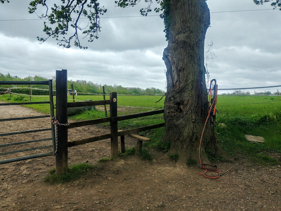 |
| Sarratt footpath 24 heading SE |
9: Cross Moor Lane then take the footpath directly opposite, still Sarratt footpath 24, then continue heading SE for 370m until you enter woodland and reach a junction (location - https://w3w.co/button.strong.mount), see image below.
 |
| Turn left on Sarratt footpath 52 |
11: Turn right at The Green then head SE for 230m before turning left and heading towards The Boot pub/restaurant (location - https://w3w.co/casino.fines.linen).
* There is another pub/restaurant, The Cricketers, 320m SE of this spot (location - https://w3w.co/fire.desire.sharp).12: When you reach The Boot, take the footpath immediately to the right of the pub, Sarratt footpath 48, then head NE, then E for 430m.
13: When you reach a footpath junction (location - https://w3w.co/lion.comet.taking) turn left on Sarratt footpath 49 then head NNE for 340m to Bottom Lane (location - https://w3w.co/usual.scuba.half).
14: At Bottom Lane turn left then head WNW for 20m before turning right then heading NNW along a lane for 40m looking out for a footpath on the right (location - https://w3w.co/inner.coffee.theme), see image below. This is a Sarratt parish footpath, which you won't find marked on an Ordnance Survey map.
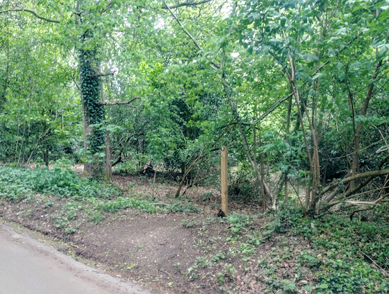 |
| Take the Sarratt parish footpath on the right and head through the woods |
Turn right on Sarratt footpath 8 then head NE for 65m before reaching another junction (location - https://w3w.co/force.sector.move), see image below.
 |
| Turn left at the tree then turn right at the first fork |
15: Turn right on Quickmoor Lane then head NNE for 270m until you reach the Cart and Horses pub/restaurant on your left (location - https://w3w.co/fork.flips.vest) at the point where Quickmoor Lane bends to the right.
16: Here you leave Quickmoor Lane then head NNE following a track for 160m until it bends to the left and you reach a footpath straight ahead (location - https://w3w.co/raves.counts.mason).
17: Take this path, Sarratt footpath 5, then head N for 380m until you reach Chipperfield Common (location - https://w3w.co/supper.design.cost).
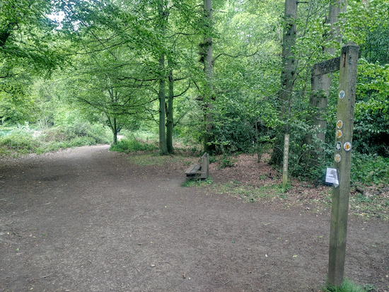 |
| Take Chipperfield footpath 8 across the common |

Comments
Post a Comment