7.2 miles (11.6km) with 134m of total ascent
 |
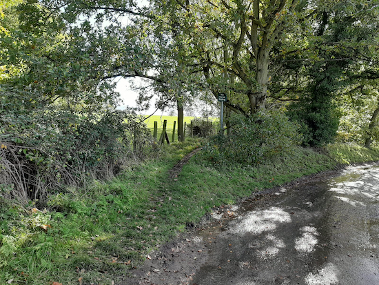
| Scene from Walk 118 at point 9 |
Directions
Note: This walk crosses over a golf course
 |
| Map for Walk 118: Dane End North-East Loop Click here or on the map above for a larger version Created on Map Hub by Hertfordshire Walker Elements © Thunderforest © OpenStreetMap contributors There is an interactive map below the directions |
Park in Dane End. We found a car park on the edge of the village (location - https://w3w.co/peanut.alien.sizes) which is owned by Little Munden Parish Council who told us that people using our walks are welcome to park there. The car park is sometimes locked at night but I am told they won't lock it if a car is still there.
 |
| Cross the bridge and head E on Little Munden footpath 6 |
 |
| Head for the post in the bushes still on Little Munden footpath 6 |
3: When you reach a lane (location - https://w3w.co/youth.crash.flute) continue heading E taking Little Munden footpath 6 immediately opposite, cross a footbridge, walk along an elevated wooden walkway, through a gate, over another footbridge and continue heading E until you reach Potter's Green (location - https://w3w.co/sooner.divide.plans).
4: Turn left on Little Munden footpath 25 and head NE for 500m crossing a field that can be muddy after being ploughed and continue NE heading for a post on the edge of woodland. Continue along a grass track and through two large gates for 670m until you reach a junction in the track (location - https://w3w.co/vivid.form.delays).
 |
| Great Munden BOAT 37 off Beggerman's Lane |
6: When you reach Levens Green turn left on the lane and head NW for 170m looking out for a track on the right (location - https://w3w.co/dream.foreheads.cubic). Take this track, Great Munden footpath 34, and head NW for 410m until the track drops down to a gate with a footpath on your left. Ignore this path and continue on Great Munden footpath 34 NW and uphill for 170m until you reach a footpath on your right (location - https://w3w.co/impulse.gravel.captions).
7: Take this path, Great Munden footpath 29 and head E across a field for 240m until you reach a junction with Great Munden footpath 31. Turn left and head first NNE then NW on Great Munden footpath 31 for 680m until you reach a lane (location - https://w3w.co/countries.scores.repair).
8: Cross the lane and head NW then W on Great Munden bridleway 13 for 1.7km. Ignore footpaths off to your left and right until you reach Great Munden bridleway 16 on your left just before a pond on your left (location - https://w3w.co/spray.spans.chart).
9: Take Great Munden bridleway 16 and head SSE for 120m then follow the track as it swings to the right and heads SW for 100m (on your right is a moat deep in woodland). At the end of the woodland Great Munden bridleway 16 crosses a field that can be muddy if recently ploughed (location - https://w3w.co/framework.copiers.puts). Continue heading SW across this field for 270m until you reach a footbridge. Cross the footbridge and continue, now heading S, across another field for 120m. Once across the field head SW, still on Great Munden bridleway 16, for 160m until you reach a junction in the track (location. You continue heading SW, now on Great Munden BOAT 20, which becomes Froggs Hall Lane for 250m until you reach The Street (location - https://w3w.co/dolly.home.frightens).
10: Turn left on The Street and head SE for 250m looking out for a track on the right opposite Yew Tree House (location - https://w3w.co/balconies.goats.fancy). Turn right here on Little Munden footpath 3 and head SW then SE then SW for 310m until you reach a junction where a footpath joins from the left just after an oak tree. Here you continue heading SW, now on Little Munden footpath 2, for 880m until you reach Green End (location - https://w3w.co/convert.winemaker.talkers).
 |
| Little Munden footpath 5 mentioned in point 11 below |
12: Continue heading S, now on Little Munden footpath 14, for 420m until you reach a junction with Little Munden footpath 1 (location - https://w3w.co/swaps.could.costumed) where you turn right. Follow the path S for 160m through the houses, and emerge on Munden Road, Dane End (location - https://w3w.co/blaze.cheek.available). Turn right and head back to where you parked the car.
* At this point you could turn left to visit The Boot pub/restaurant.
Comments
Post a Comment