3.1 miles (5.1 km) with 24m of total ascent
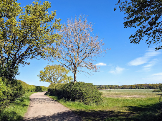 |
| Sacombe footpath 15 between points 8 & 9 |
This is a really lovely and easy walk along the valley of the River Beane. It includes rights of way that feature in other walks in our collection but they are walked in reverse, which results in a totally new walking experience.
There are several sections of this walk where you are well away from any traffic noise and where you can enjoy uninterrupted birdsong. We tested this route at the end of April 2024 and there were abundant colonies of wild garlic in the woodland along the final leg.
Fly through preview of walk
If you want to check what sort of landscape you will be crossing before you set off on this walk you can view a short 3D video of the route below. It's created using the free version of
Relive.
Directions
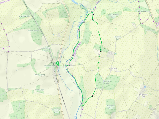 |
Map for Walk 263: Stapleford East Loop
Click on the map above for a larger version
Created on Map Hub by Hertfordshire Walker
Elements © Thunderforest © OpenStreetMap contributors
There is an interactive map below these directions |
Those with GPS devices can download
GPX or
KML files for this walk. We've added
What3Words location references for those who use that system. If you print these walks you might want to use the green
PrintFriendly icon at the bottom of these directions to delete elements such as photographs.
.jpeg) |
| Head E along Church Lane |
1: With your back to High Road, Stapleford (location -
https://w3w.co/star.broke.strut), head E along Church Lane for 190m until you cross the River Beane (location -
https://w3w.co/guess.rival.ample), then reach the church of St Mary the Virgin on the right (location -
https://w3w.co/still.bride.patch), see image below.
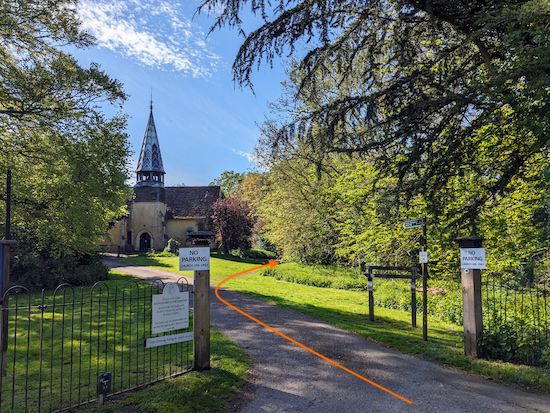 |
| Turn right through the church gate then follow Stapleford footpath 3 |
2: Turn right through the church gate then follow Stapleford
footpath 3 as it bends to the right of the church then heads S with the River Beane on the right.
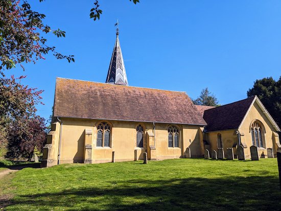 |
| The church of St Mary the Virgin from the south |
St Mary the Virgin is
a Grade II* listed building dating back to the mid 12 century. Continue heading in a south-easterly direction on Stapleford footpath 3. This is a really nice stretch and you will pass two perfectly positioned benches along the way, ideal for those who want to pause and watch the flow of the River Beane.
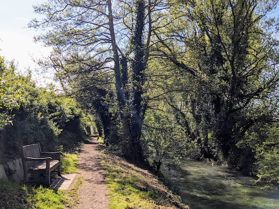 |
| One of the two benches along Stapleford footpath 3 |
Continue on Stapleford footpath 3 for 1k until you reach a junction (location -
https://w3w.co/lend.plot.count), see image below.
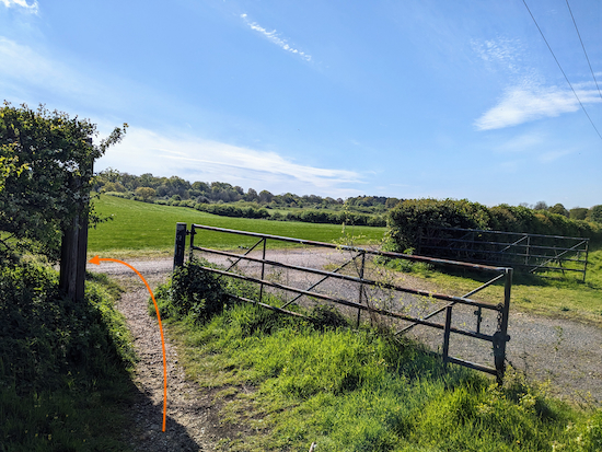 |
| Turn left on Stapleford bridleway 12 |
3: Turn left on Stapleford
bridleway 12 then head NE for 325m with the hedgerow on your left.
Continue until you reach a junction (location -
https://w3w.co/pirate.grace.drama), see image below.
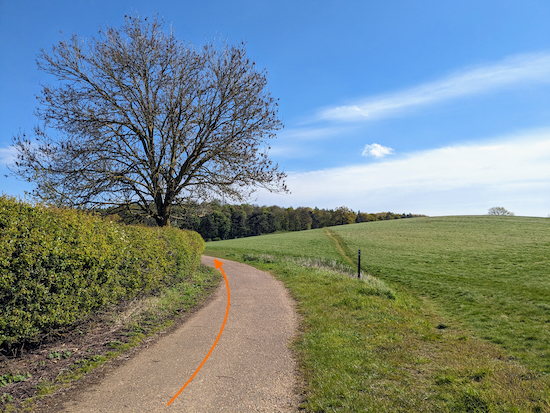 |
| Keep left at the junction then follow a permissive path |
4: Keep left at the junction then head NNE along a really nice
permissive path (see orange arrow on the image above).
.jpeg) |
| The rules for using the permissive path |
Continue along the permissive path for 180m until you reach woodland (location -
https://w3w.co/juror.moves.risks) see image below.
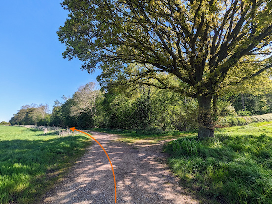 |
| Continue along the permissive path with the woodland on the right |
5: Continue along the permissive path, now heading N and with the woodland on the right, for 280m until the path bends right (location -
https://w3w.co/rental.tender.debit). Follow the path as it heads NE for 90m, still with the woodland on the right, and then bends left (location -
https://w3w.co/grace.sofa.lived) before heading N for 50m to a gate leading to a lane junction (location -
https://w3w.co/milky.cooks.taker), see image below.
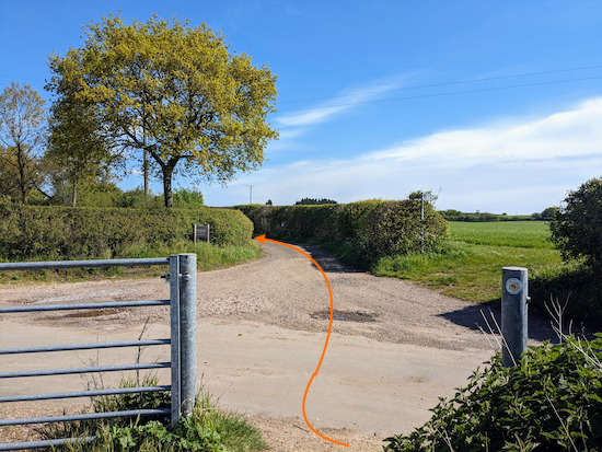 |
| Cross the junction then follow Sacome footpath 15 |
6: Cross the junction then head in a northerly direction on Sacome footpath 15, which is also a metalled lane at this point. Continue for 350m until you reach a gate (location -
https://w3w.co/rush.reason.spell) see image below.
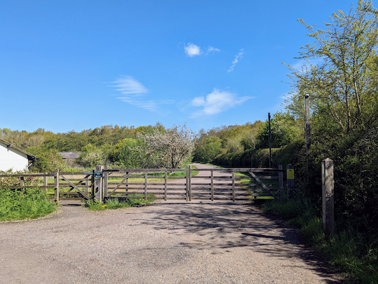 |
| Go through the gate then continue on Sacome footpath 15 |
7: Go through the gate then continue heading in a northerly direction until you reach a junction (location -
https://w3w.co/ocean.anyone.neat), see image below.
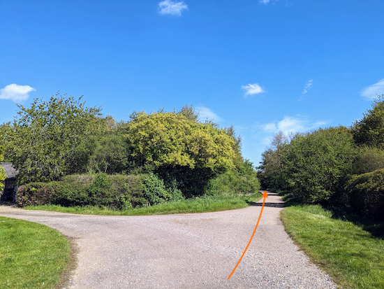 |
| Keep straight still on Sacome footpath 15 |
8: Keep straight heading in a northerly direction, still on Sacome footpath 15, for 750m until the footpath and the track you are on goes between two walls (location -
https://w3w.co/fats.dared.unit) see image below.
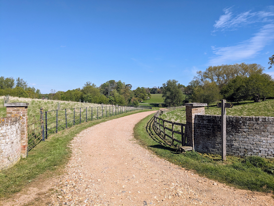 |
| Continue, still on still on Sacome footpath 15 |
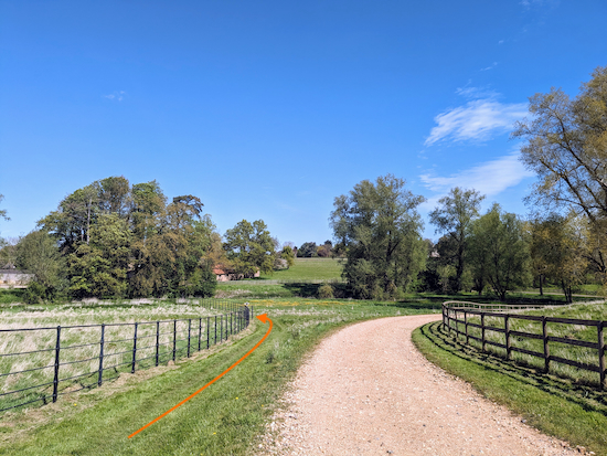
9: Continue, still on Sacome footpath 15 and now heading N, for 125m until you reach a junction (location -
https://w3w.co/gloves.slices.rent), see image below.
 |
| Here you leave the track and follow a grassy path |
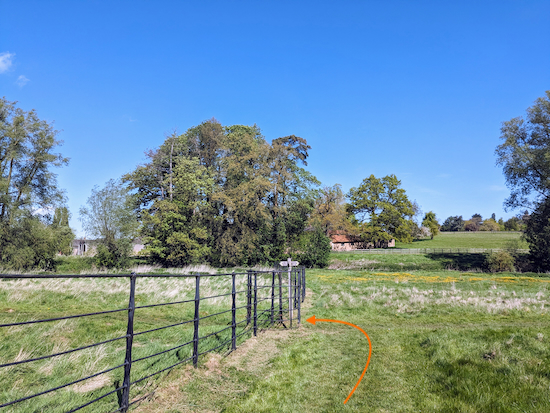
10: Here you leave the gravelled track and follow a grassy path with the metal fence on the left (see orange arrow on the image above). Continue heading N for 35m until you reach a gate on the left (location -
https://w3w.co/today.fallen.museum), see image below.
 |
| Turn left on Watton-at-Stone footpath 12A |
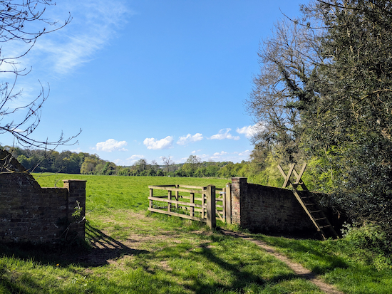
11: Turn left on Watton-at-Stone footpath 12A then head SW for 110m until you reach a waymark post on the parish boundary (location
https://w3w.co/stop.gaps.stars). Continue heading SW but now on Sacombe footpath 18, for 195m until you reach a gate and wooden steps over a wall (location -
https://w3w.co/brave.losses.luxury), see image below.
 |
| Go through the gate to continue on Sacombe footpath 18 |
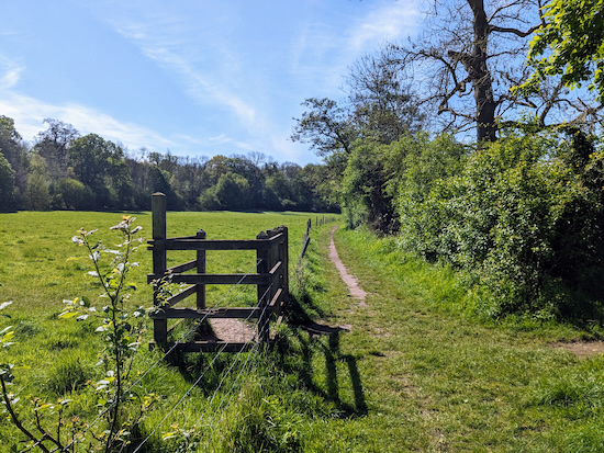
12: Go through the gate or climb the steps to continue on Sacombe footpath 18 with the River Beane on your right for 210m until you reach a footpath crossing (location -
https://w3w.co/loss.trap.highs), see image below.
 |
| Continue heading in a southerly direction |
13: Continue heading in a southerly direction on Sacombe footpath 18 with the River Beane on the right for 275m until you reach woodland.
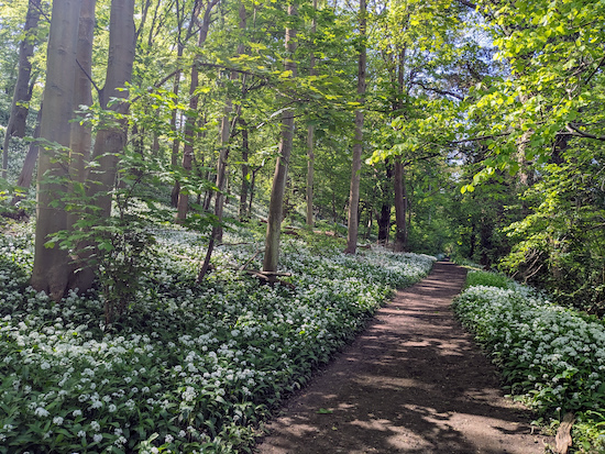 |
| Wild garlic both sides of Sacombe footpath 18 |
Continue through the woodland, still on Sacombe footpath 18. When we walked this stretch at the end of April 2024 it was an amazing mix of wild garlic and bluebells.
There is a sign in this woodland asking dog owners to keep their pets under control because the area is used as an outdoor classroom.
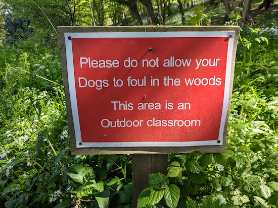 |
| Woodland is used as an outdoor classroom |
Continue on Sacombe footpath 18 until you leave the woodland and meet a residential area (location -
https://w3w.co/grape.they.relax) and a road called Clusterbolts.
14: Follow Clusterbolts SSW for 230m until you reach Church Lane (location -
https://w3w.co/margin.glass.switch).
15: Turn right on Church Lane then head W for 245m until you return to the starting point.
If you enjoyed this walk please consider joining our
Hertfordshire Walker members-only Facebook Group where you can share photos and comments on your walking experiences.
Interactive map

.jpeg)


.jpeg)


No comments:
Post a Comment