5.4 miles (8.7 km) with 101m of total ascent
 |
| Knebworth footpath 10 between points 4 and 5 |
This is a shortened version of a longer route across rolling countryside north-west of Knebworth. The original route,
Walk 199: Knebworth North-West Long Loop, is 7.6 miles (12.3km) with 153m of total ascent.
Both routes follow well-defined paths crossing open farmland and passing through woodland. The walk starts and finishes at Knebworth train station and is one of several in our collection of
linear walks which have been added for those who want to access walks via public transport rather than taking a car.
The route involves 1.4 km of road walking at the start and 1.5 km at the end. However, once you are west of the A1(M) the route mostly follows footpaths and bridleways.
You will walk through the grounds of the
Knebworth House estate on
public rights of way. You do not have to pay an admission charge to use the public footpaths that cross the estate so long as you don't stray from them and don't visit any of the estate facilities, which includes the cafe and toilets.
The Knebworth House Estate stages concerts and other events, and, in some cases, the public rights of way will be closed while events take place. Please check on
the estate's website before you set off to avoid disappointment.
You will pass close to two pubs along the route,
The Lytton Arms in Old Knebworth and
The Robin Hood & Little John in Rabley Heath. The walk starts and finishes at
The Station pub/restaurant opposite Knebworth station. All serve tea and coffee. There are several cafes in Knebworth.
There are signs along the route advising dog walkers to keep their pets on a lead.
Fly through preview of walk
If you want to check what sort of landscape you will be crossing before you set off on this walk you can view a short 3D video of the route below. It's created using the free version of
Relive.
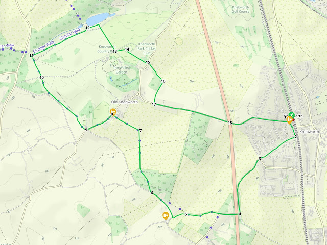 |
Map for Walk 255: Knebworth North-West Short Loop
Click on the map above for a larger version
Created on Map Hub by Hertfordshire Walker
Elements © Thunderforest © OpenStreetMap contributors
There is an interactive map below these directions |
Those with GPS devices can download
GPX or
KML files for this walk. We've added
What3Words location references for those who use that system. If you print these walks you might want to use the green
PrintFriendly icon at the bottom of these directions to delete elements such as photographs.
 |
| The Station free house at the start/finish of the walk |
1: With your back to Knebworth station (location -
https://w3w.co/rock.oddly.system) and facing
The Station free house, turn left then head S along Station Approach for 50m until you reach Gun Lane (location -
https://w3w.co/ally.noise.driver), see image below.
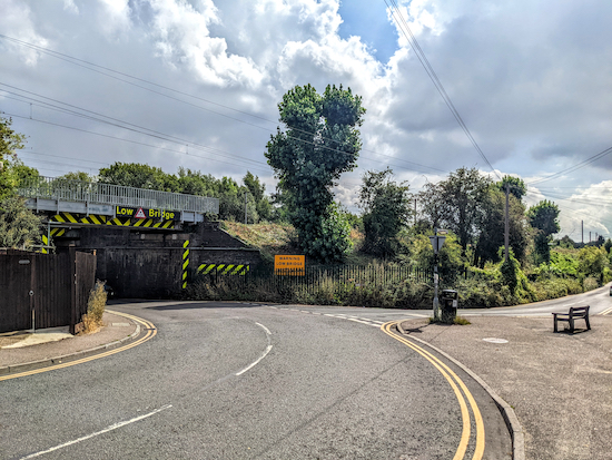 |
| Head S on Gun Lane, with the railway on your left |
Head S on Gun Lane, with the railway on your left, for 100m until you reach the British Legion social club on your right. Immediately after the club is a
footpath on the right (location -
https://w3w.co/tunnel.spark.critic), see image below.
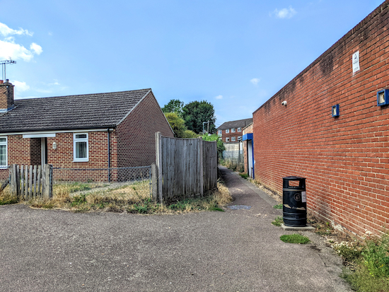 |
| Turn right on Knebworth footpath 8 then head SW |
2: Turn right on Knebworth footpath 8 then head SW for 120m walking between houses until you reach a road called Lytton Fields (location -
https://w3w.co/locate.pines.reform). Cross Lytton Fields then continue along Knebworth footpath 8 for 95m with a play area on your right until you reach a road called Stockens Dell (location -
https://w3w.co/loving.label.urgent). Continue heading SW along Stockens Dell, still on Knebworth footpath 8, for 240m until you reach the end of the road and a footpath on the right which cuts between houses to reach Gypsy Lane (location -
https://w3w.co/reward.ants.member), see image below.
 |
| Heads SW on Gypsy Lane for 400m |
3: Heads SW on Gypsy Lane for 400m until the lane bends left as it meets the A1(M) (location -
https://w3w.co/never.scared.cotton), then heads S with the A1(M) on the right. After 290m you will reach a junction on the right (location -
https://w3w.co/serves.detail.swung) and a bridge over the A1(M) (location -
https://w3w.co/privately.cycles.decks), see image below.
* There isn't a pedestrian pavement along the first part of Gypsy Lane but there are options to stand aside on the verge if traffic approaches.
 |
| Wych Elm Lane turning off Gypsy Lane |
4: Turn right at the junction then head W along Wych Elm Lane for 200m, crossing the A1(M) and continuing to the point where the lane bends left and you reach a footpath on the right (location -
https://w3w.co/luck.shiny.sticks), see image below.
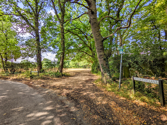 |
| Knebworth footpath 10 heading off Wych Elm Lane |
Turn right on Knebworth footpath 10 then head W for 370m until you reach a footpath junction in the hedgerow on the right (location -
https://w3w.co/fact.flat.grand), see image below.
 |
| Turn left on Codicote footpath 29 |
5: Once through the hedgerow turn left at the metal gate on Codicote footpath 29 then head SW for 160m until you reach Slip Lane (location -
https://w3w.co/across.wheels.salad).
* At this point you could head SW for 65m to visit The Robin Hood & Little John.
 |
| The Robin Hood & Little John at Rabley Heath |
If you don't want to visit the pub, turn right when you reach Slip Lane then head NW. After 140m you will pass a footpath on the right (location -
https://w3w.co/charmingly.rots.zips). Ignore this path and continue along Slip Lane for another 230m until you reach a footpath on the right heading into New Wood (location -
https://w3w.co/else.comical.sunk), see image below.
 |
| Turn right on Knebworth footpath 13 |
6: Turn right on Knebworth footpath 13 then head NNW through woodland for 300m, ignoring paths to your left and right, until you reach a field (location -
https://w3w.co/else.codes.rise), see image below.
 |
| When you reach the field head N on Knebworth footpath 13 |
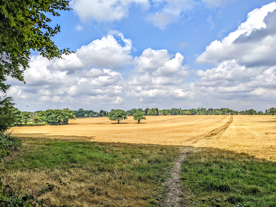
When you reach the field head N on Knebworth footpath 13 for 430m, ignoring a footpath crossing from left to right, and continuing until you reach a footpath on the left in the middle of the field (location -
https://w3w.co/window.noted.count), see image below.
 |
| Turn left on Knebworth footpath 14, then head NW |
7: Turn left on Knebworth footpath 14, then head NW for 220m until you reach a footpath junction at the edge of a garden on your right (location -
https://w3w.co/translated.basis.mouth). Continue heading NW on Knebworth footpath 14 for 130m until you reach Park Lane (location -
https://w3w.co/racing.tidy.congratulations).
8: Turn left on Park Lane then pass
The Lytton Arms on the left (location -
https://w3w.co/oval.sake.vivid), see image below.
 |
| The Lytton Arms in Old Knebworth |
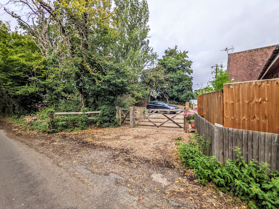
Continue heading SW along the pedestian pavement that runs along the northern side of Park Lane for 340m until you reach a footpath on the right (location -
https://w3w.co/desks.define.search), see image below.
 |
| Turn right on Knebworth footpath 20 |
9: Turn right on Knebworth footpath 20 then head NW, with the hedgerow on the right and field on the left for 190m until you reach a footbridge (location -
https://w3w.co/damage.stored.drag), see image below.
 |
| Cross the footbridge then go through a gate into the Knebworth Estate |
Cross the footbridge then continue heading NW for 600m through the Knebworth Estate with the hedgerow on the left and field on the right. As you enter the estate you will see warning signs advising dog owners to keep their pets on the lead.
 |
| The signs are not ornamental, we met a large herd of deer |
The signs are not ornamental, we saw a large herd of deer about 400m to the NW immediately after passing through the gate. Whenever we have walked any of our routes that cross the estate we have encountered deer, see image below.
 |
| Photograph of deer at Knebworth courtesy of Sarah Hurst-Cox |
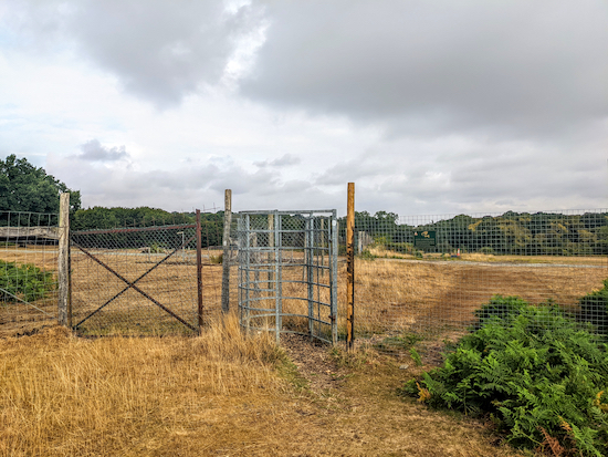
Continue heading NW until you reach a high fence (location -
https://w3w.co/buddy.copies.handle), see image below.
 |
| The gate along Knebworth footpath 20 signifying the restricted area |
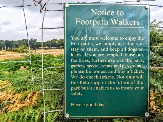
To the right of the gate is a notice informing walkers that they are welcome to enjoy the public rights of way but that they must stay on them and keep all dogs on leads. It goes on...
"If you are tempted to use our facilities, further explore the park, gardens, special events, and playground, please be honest and buy a ticket. We do check tickets. Not only will this help support the future of the park but it enables us to insure your safety."
 |
| Notice to footpath walkers |
10: Continue heading NW, still on Knebworth footpath 20, with the fence on the left and field on the right for 260m until you reach a footpath junction (location -
https://w3w.co/tracks.tolls.nodded), see image below.
 |
| Turn right at the junction on Knebworth footpath 22 |
Turn right at the junction on Knebworth footpath 22, then head ENE for 810m until you reach a tree-lined avenue on the right (location -
https://w3w.co/space.king.vocab), see image below.
 |
| Turn left then head E for 120m, now on Knebworth footpath 22 |
11: Turn right then heads SSE on a paved road, which is also Knebworth footpath 21, through an avenue of trees for 330m to a junction (location -
https://w3w.co/caked.jets.host).
 |
| Follow Knebworth footpath 21 through an avenue of trees |
13: When you reach the crossroads at the end of the line of trees ignore the road on your left but instead take the footpath on the left, Knebworth footpath 19, (location -
https://w3w.co/upper.agree.slows) which heads diagonally across a field to
the Church of St Mary and St Thomas, see the image below.
 |
| Head towards the church on Knebworth footpath 19 |
Knebworth footpath 19 heads E for 125m until you reach a gate leading into the churchyard (location -
https://w3w.co/entry.venues.script), see image below.
 |
| The gate leading to the Church of St Mary and St Thomas |
14: Go through the gate then enter the church. Turn right at the church then head S through the churchyard on Knebworth footpath 18 and continue until you reach Old Knebworth Lane (location -
https://w3w.co/drape.being.amber), see image below.
* You might meet a member of the Knebworth House estate staff checking tickets at this point. Just tell them that you are walking through the estate on public rights of way and that you are not visiting or using the facilities.
 |
| Take Knebworth footpath 16 across Old Knebworth Lane |
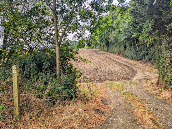
15: Leave the Knebworth House estate, cross Old Knebworth Lane then take Knebworth footpath 16. Head SE for 130m to a footpath junction at the point where the path dips then rises (location -
https://w3w.co/they.couches.wanted), see image below.
 |
| Continue heading SE with the woodland on the right and field on the left |
Ignore the footpath on the left and continue heading SE, still on Knebworth footpath 16, and with the woodland on the right and field on the left, for 120m until the path bends right through the hedgerow (location -
https://w3w.co/breath.hunt.eager), see image below.
 |
| Turn right, still on Knebworth footpath 16, then head SSW |
16: Turn right, still on Knebworth footpath 16, then head SSW for 270m until you reach Park Lane (location -
https://w3w.co/mild.music.fans).
17: Turn left on Park Lane then head ESE for 850m until you cross the A1(M) (location -
https://w3w.co/scary.hill.them).
18: Continue heading along Park Lane for 660m back to the starting point.
* There is a pedestrian pavement along the entire stretch of road back to Knebworth station.
Interactive map


No comments:
Post a Comment