3.8 miles (6.2km) with 5m of total ascent
 |
| Nast Hyde Halt on The Alban Way |
We have created this short loop to enable walkers to explore the lovingly restored
Nast Hyde Halt along
The Alban Way, the route of the former
Hatfield to St Albans railway line. You will start at
Smallford Station, pass Nast Hyde Halt, then loop around
Ellenbrook Fields, which is the site of the former
Hatfield Aerodrome. There is one short stretch along the western edge of Hatfield and past the university, but you are soon into open fields with excellent views.
There is currently free parking (at the time of writing in November 2023) in the former LNER car park at Smallford Station and alongside the approach road to the car park from Station Road. Please check this has not changed before leaving your car.
There are refreshment opportunities at the
Three Horshoes (location -
https://w3w.co/really.rinse.hush), the
Notcutts Garden Centre Cafe (location -
https://w3w.co/custom.fell.rank), and the
Smallford Farm Shop Cafe (location -
https://w3w.co/glaze.reef.making). All three are close to the start/finish point. There is another pub,
The Plough at Sleapshyde (location -
https://www.ploughstalbans.com), which is 440m SE of the start/finish point via a footpath.
Fly through preview of walk
If you want to check what sort of landscape you will be crossing before you set off on this walk you can view a short 3D video of the route below. It's created using the free version of
Relive.
Directions
 |
Map for Walk 247: Nast Hyde Halt Loop
Click on the map above for a larger version
Created on Map Hub by Hertfordshire Walker
Elements © Thunderforest © OpenStreetMap contributors
There is an interactive map below these directions |
Those with GPS devices can download
GPX or
KML files for this walk. We've added
What3Words location references for those who use that system. If you print these walks you might want to use the green
PrintFriendly icon at the bottom of these directions to delete elements such as photographs.
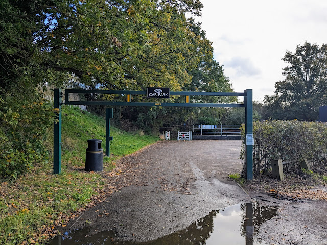 |
| The LNER car park at Smallford Station |
1: From the LNER car park at Smallford Station (location -
https://w3w.co/solve.heats.scouts), exit through the white railway gates with the large red circles (see image below), join The Alban Way (location -
https://w3w.co/waddled.aura.palm), turn left, then head ENE under the railway bridge (location -
https://w3w.co/puff.stiff.above), see images below.
 |
| Exit Smallford Station car park through the railway gates |
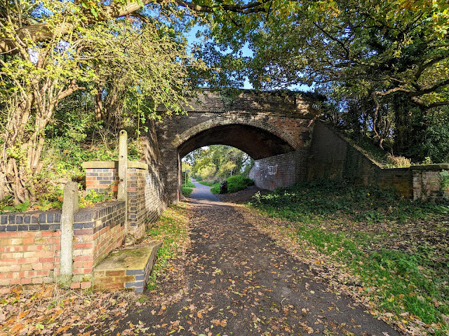 |
| Head ENE under the railway bridge following The Alban Way |
 |
The information board at Smallford Station on The Alban Way
Click on the image for a larger version |
Head ENE along The Alban Way for 605m until you reach a junction (location -
https://w3w.co/formed.never.year), see image below.
 |
| Continue along The Alban Way ignoring paths on the left and right |
Continue along The Alban Way for 670m, ignoring paths on the left and right, until you reach Nast Hyde Halt (location -
https://w3w.co/laser.bets.chain).
Rail enthusiasts will enjoy pausing here and taking time to study the restoration work carried out by postman Mike Izzard, or Nast Hyde Mike as he is known locally.
Apart from the amazing work Mike has carried out on Nast Hyde Halt, he has also been responsible for raising more than £30,000 for good causes and for the ongoing restoration for Smallford Station at the start and finish of the walk.
Those interested in knowing more about Nast Hyde Mike's work can read
an interview I carried out with him in November 2023 (It was too long to include in the walk).
 |
| Level crossing gate at Nast Hyde Halt |
 |
Luggage at Nast Hyde Halt
|
 |
| Station sign at Nast Hyde Halt |
 |
| The platform at Nast Hyde Halt |
 |
| Milk churns at Nast Hyde Halt |
2: Exit Nast Hyde Halt at the level crossing gate at the far end of the platform, see image below.
 |
| Turn left after the level crossing gate then head NW on Ellenbrook Lane |
Turn left after the level crossing gate then head NW on Ellenbrook Lane for 110m until you reach the junction with Wilkin's Green Lane on the left (location -
https://w3w.co/limit.logic.vest).
Continue heading NNW along Ellenbrook Lane for 310m until you reach a roundabout (location -
https://w3w.co/fish.weeks.stud), see image below.
 |
| Cross the roundabout then head N along Albatross Way |
3: Cross the roundabout then head N along Albatross Way, with the university on the right and playing fields on the left, for 290m until the road bends to the right and you reach a gate on the left (location -
https://w3w.co/depend.cool.rings), see image below.
 |
| Turn left through the gate then turn right |
4: Turn left through the gate then turn right (see orange line on the image above). You are now on the Hatfield Aerodrome Heritage Trail. Look out for the fascinating information board along the way, see image below.
 |
Information board for the Hatfield Aerodrome Heritage Trail
Click on the image for a larger version |
The information board above charts the history of the Hatfield Aerodrome including its association with Hollywood glamour.
"Stephen Spielberg shot several scenes for his feature film Saving Private Ryan (1998) at the site just as it was scheduled for demolition. He returned to conduct even more extensive filming for his epic World War II television series Band of Brothers (2001). A set representing twelve different European towns, and a major river, was constructed on the open grassland around the runway."
Continue following this surfaced track in a northerly direction, with lakes and waterways on the left and houses behind the shrubs on the right, until the track bends left leading to a footbridge (location -
https://w3w.co/coast.advice.asleep), see image below.
 |
| Cross the footbridge then turn right leaving the gravelled track |
5: Cross the footbridge then turn right, leaving the gravelled track. You are now in Ellenbrook Fields.
 |
Information board at Ellenbrook Fields
Click on the image for a larger version |
Head N along a grassy track, with open fields on the left and hedgerow with houses behind on the right. Continue heading N for 270m until you reach a T-junction (location -
https://w3w.co/limes.misty.blur), see image below.
 |
| Turn left at the T-junction then head W along a surfaced track |
6: Turn left at the T-junction then head W along a surfaced track for 400m until you reach a gate (location -
https://w3w.co/bother.admits.notice). Go through the gate then continue along the track, now heading SW for 210m to another gate (location -
https://w3w.co/claim.prices.trail), see image below.
 |
| Go through the gate then continue heading SW |
Go through the gate then continue heading SW, now with woodland on the right and fields on the left, for 215m until the path bends left (location -
https://w3w.co/sheep.soap.grand). Continue, now heading SE, for 155m until the path reaches a junction (location -
https://w3w.co/oval.economies.noon), see image below.
 |
| Keep right at the junction then head SW |
7: Keep right at the junction then continue along the track now heading SW, for 436m until you reach a junction (location -
https://w3w.co/eating.choice.memo), see image below.
 |
| Head SW with the hedgerow on the right and fields on the left |
8: Leave the surfaced track at this point then continue heading SW on a grassy track (see line of orange arrow on the image above). Continue, with the hedgerow on the right and fields on the left, for 510m until you reach the corner of the field where the path bends left (location -
https://w3w.co/cloth.expect.sank), see image below.
 |
| Turn left at the corner of the field then head SSE |
9: Turn left at the corner of the field then head SSE for 395m, with the hedgerow on the right and field on the left, until you reach the SW corner of the field (location -
https://w3w.co/placed.motor.kite), see image below.
 |
| Turn right at the corner of the field then turn left on Colney Heath footpath 15 |
10: Turn right at the corner of the field then turn left on Colney Heath footpath 15 (location -
https://w3w.co/wheels.last.lifted). Head SSE on Colney Heath footpath 15 for 65m until you reach Hatfield Road (location -
https://w3w.co/flips.prices.tamed), see image below.
 |
| Cross Hatfield Road then head SSE on Colney Heath footpath 12 |
Cross Hatfield Road then head SSE, now on Colney Heath footpath 12, for 335m until the footpath runs down the side of housing (location -
https://w3w.co/head.ruins.squad), see image below.
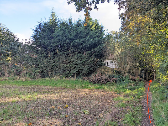 |
| Continue heading SSE on Colney Heath footpath 12 |
Continue heading SSE on Colney Heath footpath 12 for 115m until you reach Wilkin's Green Lane (location -
https://w3w.co/first.clock.lace).
11: Turn right on Wilkin's Green Lane then head WSW for 85m until just before you reach Smallford Lane (location -
https://w3w.co/bench.rich.ended). Look to your left to find a footpath called Peggy's Way, see image below.
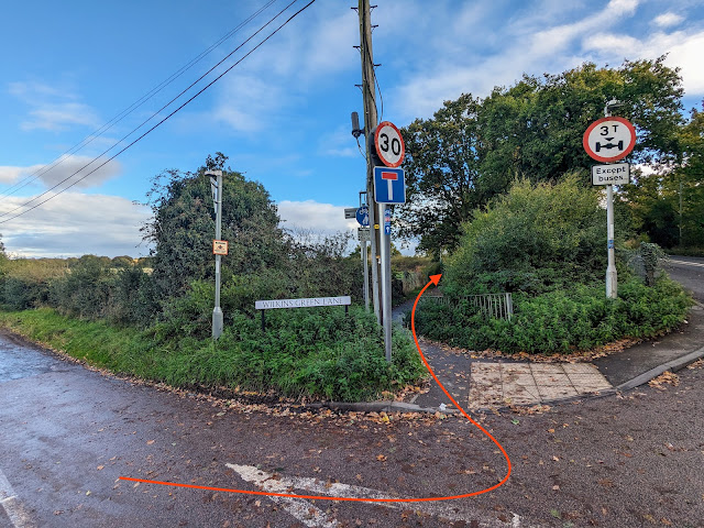 |
| Turn left on Peggy's Way |
Turn left on Peggy's Way then follow the path SSE for 85m down to The Alban Way (location -
https://w3w.co/healthier.study.gender), where you turn right and retrace your steps under the railway bridge and back to Smallford Station and the starting point.
 |
| Smallford Station looking west |
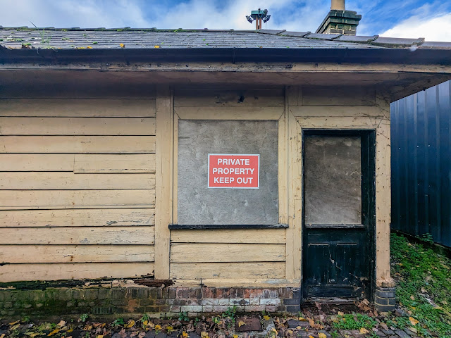 |
| Smallford Station ticket office |
.jpg) |
| Smallford Station waiting room |
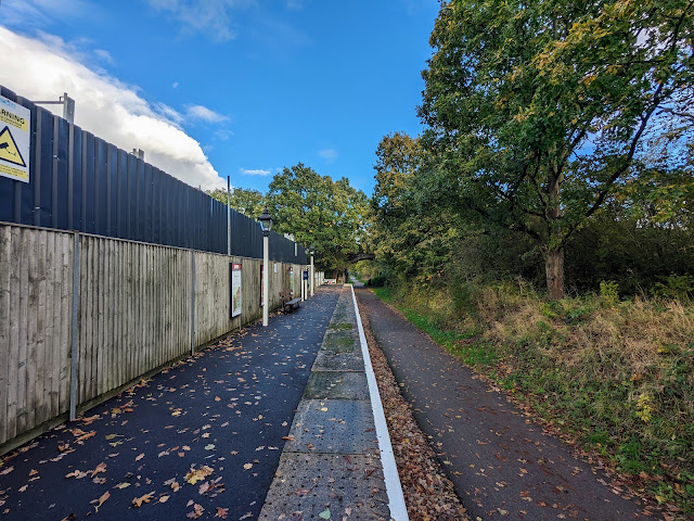 |
| Smallford Station looking east |
If you enjoyed this walk please consider joining our
Hertfordshire Walker members-only Facebook Group where you can share photos and comments on your walking experiences.
Interactive map


.jpg)


No comments:
Post a Comment