5.1 miles (8.2 km) with 106m of total ascent
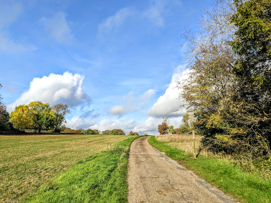 |
| The footpath turning at point 10 |
This is a really lovely walk which we have added to our personal favourites list. It starts in the village of
Furneux Pelham then passes through woodland and crosses arable fields before reaching the
Patmore Heath nature reserve close to
The Catherine Wheel pub/restaurant at Gravesend, Albury about a third of the way round. The countryside is undulating and there are great wide open views.
The Brewery Tap pub restaurant at Furneux Pelham is close to the start/finish point.
The starting point for this walk is 5.2 miles ESE from Buntingford town centre by road. We didn't cross any livestock fields on this walk.
Fly through preview of walk
If you want to check what sort of landscape this walk covers before setting off you can view a short 3D video of the route below. It's created using the free version of
Relive.
Directions
 |
Map for Walk 219: Furneux Pelham South Loop
Click on the map for a larger version
Map created on MapHub - copyright details here
There is an interactive map below the directions |
Those with GPS devices can download
GPX or
KML files for this walk. We've added
What3Words location references for those who use that system. If you print these walks you might want to use the green
PrintFriendly icon at the bottom of these directions to delete elements such as photographs.
 |
| The Church of St Mary, Furneux Pelham |
1: With your back to the Church of St Mary, a
Grade II* listed building, on The Street in
Furneux Pelham, turn right then head W for 30m before turning left then heading S along The Causeway for 75m until you reach a
footpath on the right (location -
https://w3w.co/projects.bugs.chainsaw), see image below.
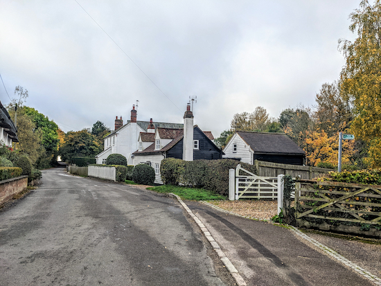 |
| Turn right on Furneux Pelham footpath 9 |
Turn right on Furneux Pelham footpath 9, then head SW, with the hedge on your left and what was The Star pub,
a grade II listed building and now a private house, on your right. Continue for 65m until you cross a footbridge then reach a junction (location -
https://w3w.co/budding.farmer.nerd), see image below.
 |
| Turn left on Furneux Pelham footpath 8 |
2: Turn left on Furneux Pelham footpath 8 then head S. This is a particularly pretty stretch of woodland where we spotted lots of interesting fungi when we tested the walk, see images below.
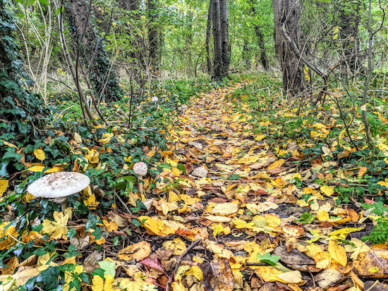 |
| Fungi along the woodland path |
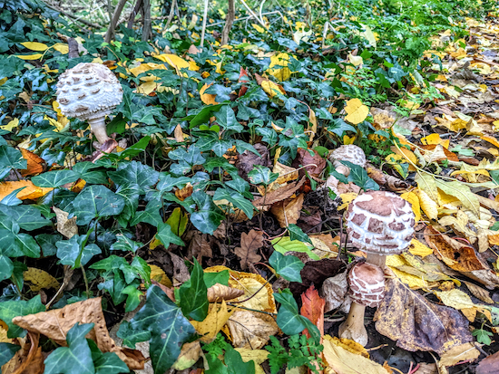 |
| Fungi along Furneux Pelham footpath 8 |
Continue through the woodland for 135m until the footpath leaves the woodland at a gate (location -
https://w3w.co/capers.crank.unrated). Turn left after going through the gate then continue heading S, with the hedgerow on the left and field on the right, for 715m until you reach a lane called The Causeway (location -
https://w3w.co/servers.burn.mirroring).
3: Turn left on The Causeway then head NE for 135m until you reach a footpath on the right (location -
https://w3w.co/laugh.mystified.waddle), see image below.
 |
| Turn right on Furneux Pelham footpath 11 |
Turn right on Furneux Pelham footpath 11 then head SE for 820m until you cross the
River Ash (location -
https://w3w.co/taps.melt.devalued), see image below.
 |
| Cross the River Ash on Furneux Pelham footpath 11 |
Cross the River Ash then continue heading SE across a field, still on Furneux Pelham footpath 11, for 290m until you reach Albury Road (location -
https://w3w.co/cartoons.sunblock.options).
4: Turn right on Albury Road then head S for 145m until you reach a footpath on the left immediately after a house on the left (location -
https://w3w.co/celebrate.mush.cubic), see image below.
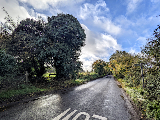 |
| Turn left on Albury footpath 5 |
Turn left on Albury footpath 5 then head E for 40m then SE for 320m until you reach Walnut Tree Cottage on the right (location -
https://w3w.co/mascots.chairing.visitor). Keep right when you pass the cottace then head SE, keeping the cottage on the right, and continue along a path through woodland for 80m until you reach a lane (location -
https://w3w.co/screaming.funded.shuttling).
Turn right on the lane then head W for 40m until you reach a lane on the left and an information board for
Patmore Heath, a
Herts & Middlesex Wildlife Trust nature reserve (location -
https://w3w.co/clip.swerves.paddlers), see image below. If you have time you might want to extend the walk slightly by walking around Patmore Heath.
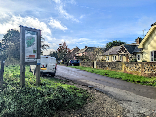 |
| Turn left on the lane then head S with Patmore Heath on the left |
* At this point you could take a short detour to The Catherine Wheel pub/restaurant (location - https://w3w.co/declining.alternate.fattest) if you want refreshments. Check the link for opening times. To visit the pub turn right when you reach Patmore Heath then head W and downhill for 175m. You will find the pub on the left at the junction with Albury Road.
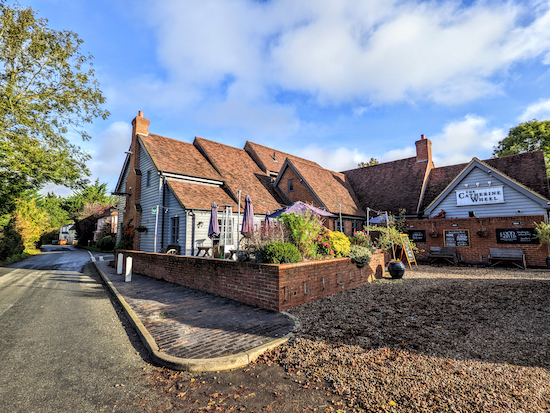 |
| The Catherine Wheel |
5: If you don't take the detour to visit The Catherine Wheel, follow the lane mentioned above S, with Patmore Heath on your left, for 360m until you reach a
bridleway on the right (location -
https://w3w.co/contents.kidney.neon). Turn right on Albury bridleway 33 then head SW for 35m until you reach a junction (location -
https://w3w.co/gems.fishnet.seasons), see image below.
 |
| Turn right Albury footpath 32 |
Turn right Albury footpath 32 then head WSW for 160m until you reach Albury Road (location -
https://w3w.co/craft.intervene.driftwood).
6: Turn left on Albury Road then head SSE for 50m until you reach a bridleway on the right (location -
https://w3w.co/reclaimed.slimy.balloons), see image below.
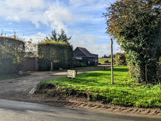 |
| Turn right on Albury bridleway 17 |
Turn right on Albury bridleway 17 then head SW for 350m down to the River Ash (location -
https://w3w.co/bordering.rope.decanter), see image below.
 |
| Albury bridleway 17 heading towards the River Ash |
7: When you reach the River Ash the official right of way, Albury bridleway 18, heads diagonally to the right across a field. However, when we tested this walk (25/10/2022) the bridleway had not been reinstated, and there was evidence that walkers and riders had taken a detour along a track to rejoin the right of way at the point where the track reaches woodland (location -
https://w3w.co/alive.salaried.lines).
On the map below the orange line shows the route Albury bridleway 18 should take across a field. The route we walked is in green. Also see photograph below where the route we took is in blue and the official right of way in orange.
 |
Detour in green because right of way in orange had not been reinstated
Map created on MapHub - copyright details here |
 |
| The detour we took at point 7 shown in blue, the right of way is in orange |
If you take the detour carry straight on after you cross the bridge and continue along a track that heads WSW for 80m then turned right and head NNW for 170m to the woodland, see image below.
 |
| Turn left when you reach the woodland |
Turn left when you reach the woodland (see image above) then head WSW for 320m until you reach a junction (location -
https://w3w.co/responds.fools.panel), see image below.
 |
| When you reach the junction ignore tracks to the right and left |
8: When you reach the junction ignore tracks to the right and left and instead cross the junction then continue heading WSW, now on Albury bridleway 24, see image below.
 |
| Cross the junction then head WSW, now on Albury bridleway 24 |
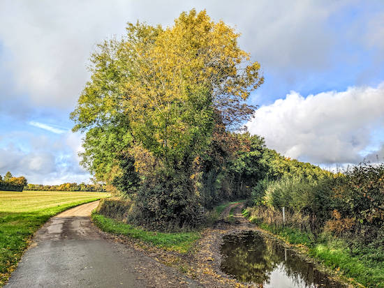
Continue on Albury bridleway 24 for 450m until you reach a junction with a paved lane (location -
https://w3w.co/sobbed.golf.jumbo), see image below.
 |
| Albury bridleway 24 turning right on the paved lane |
9: Turn right then head W for 50m until you reach a fork (location -
https://w3w.co/slimmer.chairs.tram), see image below.
 |
| Keep left at the fork, still on Albury bridleway 24 |
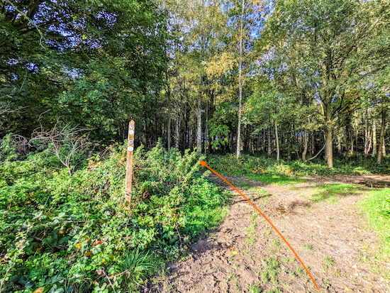
Keep left at the fork, still on Albury bridleway 24, then head WNW for 350m until you reach a footpath on the right (location -
https://w3w.co/overheard.saddens.elects), see image below.
 |
| The footpath turning at point 10 |
10: Turn right on Albury footpath 28 then head NNE for 205m until you reach a paved track where you turn right then follow NE (location -
https://w3w.co/showering.tycoons.dividers), see image below.
 |
| Keep heading NE still on Albury footpath 28 |
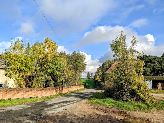
11: Keep heading NE still on Albury footpath 28 (which is also paved track at this point) for 550m until you reach a junction (location -
https://w3w.co/broker.mulled.carpeted), see image below.
 |
| Head NNE, now on Albury footpath 27 |
12: Cross the junction and continue heading NNE, now on Albury footpath 27, for 380m until you reach a junction (location -
https://w3w.co/mocking.member.sparrows).
13: Ignore the footpath on the right and head N, now on Furneux Pelham footpath 9A, for 250m until you cross a brook (location -
https://w3w.co/segregate.smug.orange), see image below.
 |
| Cross the brook then head NNW across a field |
Cross the brook then head NNW across a field, still on Furneux Pelham footpath 9A, for 450m until you reach The Causeway at Patients End (location -
https://w3w.co/hungry.lengthen.event), see image below.
 |
| Turn left on the lane, head WNW for 45m, then take the bridleway on the right |
14: Turn left on the lane then head WNW for 45m until you reach a bridleway on the right (location -
https://w3w.co/play.cookbooks.softly), see image below.
 |
| Turn right on Furneux Pelham bridleway 9A |
Turn right on Furneux Pelham bridleway 9A then head N for 190m until you reach a junction and a footpath on your right (location -
https://w3w.co/fines.outlooks.nods), see image below.
 |
| Head N on Furneux Pelham footpath 7 |
15: Take this footpath, Furneux Pelham footpath 7, then head N for 235m until the footpath goes through the hedgerow (location -
https://w3w.co/servants.harmlessly.opens), then crosses a field, see image below.
 |
| Furneux Pelham footpath 7 heading diagonally across a field |
Furneux Pelham footpath 7 then heads diagonally across a field heading NNE for 175m until it cuts through the hedgerow and reaches a junction (location -
https://w3w.co/finalists.twice.roadblock), see image below.
 |
| Continue heading NE, still on Furneux Pelham footpath 7 |
16: Once through the hedgerow continue heading NE, still on Furneux Pelham footpath 7, for 280m until you reach the junction with Furneux Pelham footpath 8 which you passed earlier in the walk as it emerges from the woodland (location -
https://w3w.co/weaved.emails.rave), see image below.
Follow Furneux Pelham footpath 8 N through the woodland for 115m until you reach the junction you passed at point 2 in the walk. Turn right then head E for 70m back to The Causeway (location -
https://w3w.co/tries.stitching.sage).
Turn left on The Causeway and retrace your steps N for 80m back to the starting point.
* The Brewery Tap pub/restaurant is 440m E of the start/finish point, check link for opening times.
 |
| The Brewery Tap at Furneux Pelham |
Interactive map


No comments:
Post a Comment