5.5 miles (8.8 km) with 106m of total ascent
This is a fairly hilly walk which has been rerouted (February 2022) to avoid a section that is waterlogged most of the year. The walk offers some wide open views across rolling Hertfordshire countryside. There are two pubs just past the halfway point.
Directions
 |
Map for Walk 163: Widfordbury Loop
Click here or on the map above for a larger version
Created on Map Hub by Hertfordshire Walker
Elements © Thunderforest © OpenStreetMap contributors
There is an interactive map below these directions |
Those with GPS devices can download
GPX or
KML files for this walk. We've added
What3Words location references for those who use that system. If you print these walks you might want to use the green
PrintFriendly icon at the bottom of these directions to delete elements such as photographs.
This walk starts and finished in one of two laybys either side of the Ware Road the B1004 (location -
https://w3w.co/rods.brand.blank). We are grateful to Judy from Wareside for suggesting this parking spot.
 |
| Go through the gate into the churchyard |
1: From the layby head ESE for 200m towards the church of St John the Baptist, Widford, with its green steeple (location -
https://w3w.co/owls.stud.strut). Turn left through the church gate and walk through the churchyard keeping to the left of the church. In the NW corner of the churchyard, behind the church, you will find a gate leading to a footpath (location -
https://w3w.co/scans.debate.pilots).
 |
| At the signpost ignore arrows left and right and, instead, head N and downhill |
2: Go through the gate then down a flight of wooden steps until you reach a signpost (location -
https://w3w.co/gross.newly.lawn), see image above.
 |
| Go through the gate then continue heading NE for 50m to a junction |
Ignore the arrows for bridleway 16 pointing left and right, but, instead, head N and downhill until you reach the valley bottom, then keep to the right and follow the path NE for 500m until you reach a gate (location -
https://w3w.co/guitar.dogs.bank), see image above.
Continue heading NE for another 50m until you reach a junction in the path (location -
https://w3w.co/reds.target.monks).
3: Keep right at the junction and keep heading NE on Widford bridleway 16 for 220m until you reach Pegs Lane (location -
https://w3w.co/grow.elite.stage).
4: Turn left on Pegs Lane then head NW for 35m crossing the River Ash then looking out for a footpath on the right (location -
https://w3w.co/wires.cheeks.adopt).
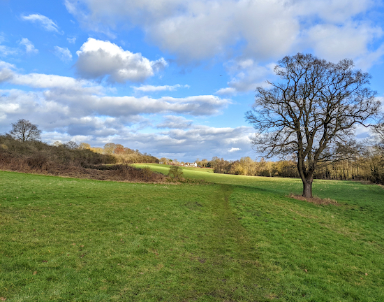 |
| Turn left at the tree, still on Widford footpath 13 |
Take this path, Widford footpath 13 then follow it N for 260m then NE for 100m until the path bends to the left opposite a tree (location -
https://w3w.co/rate.social.chemistry), see image above.
Turn left at this point then head NW for 70m until you climb up to the track of the former
Buntingford Branch Line (location -
https://w3w.co/wallet.farmer.lungs).
 |
| Cross the field heading towards Barrow Farm |
After crossing the former branch line (now a hedgerow), continue heading NW climbing up Barrow Hill for 350m, still on Widford footpath 13, until you reach Barrow Farm (location -
https://w3w.co/arrive.cling.tricks).
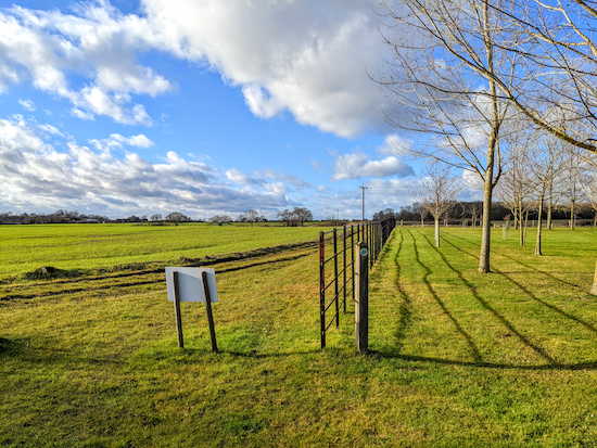 |
| Follow Widford bridleway 21 to the left of the metal fence |
6: Turn left at Barrow Farm then head WSW for 50m on Widford bridleway 21 before the bridleway bends to the right (location -
https://w3w.co/study.major.index), see image above.
The bridleway then heads NW to the left of a metal fence for 100m before becoming Wareside bridleway 17.
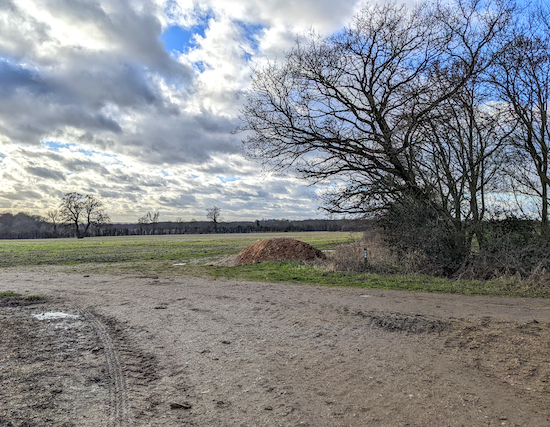 |
| Wareside bridleway 17 continues straight over the junction to the left of the trees |
Continue on Wareside bridleway 17 for 640m until you reach a junction (location -
https://w3w.co/moons.branch.years), see image above.
 |
| Take Wareside bridleway 66 on the right and follow for 50m |
7: Continue heading W on Wareside bridleway 17, keeping to the left of the hedgerow, for 560m until you reach woodland where you turn right to follow Wareside bridleway 66 for 50m before turning left on Wareside footpath 8 (location -
https://w3w.co/punks.goal.pool).
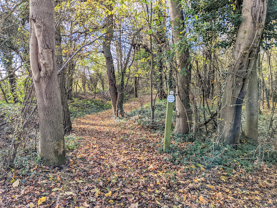 |
| Head WSW along Wareside footpath 8 |
8: Follow Wareside footpath 8 across a farm track then continue heading WSW for 170m until you meet a junction and a track on the left (location -
https://w3w.co/boil.under.snacks).
 |
| Wareside footpath 8 heading SSE from point 9 |
9: Turn left at the junction then head SSE on Wareside footpath 8 for 1.3km passing Cook's Farm on the right (location -
https://w3w.co/deputy.loans.policy) before reaching another junction (location -
https://w3w.co/goes.snows.composers).
 |
| Turn left on Wareside footpath 11 climbing the wooden steps |
10: Turn right at the junction then take Wareside footpath 10 and follow it WNW for 220m looking out for a wooden staircase on the left just before a wooden footbridge.
11: Turn left and climb the wooden staircase, which is Wareside footpath 11, then turn right at the top and head SSW, with the hedgerow on the right and the field on the left, for 550m until you reach Scholar's Hill (location -
https://w3w.co/charmingly.farms.toned).
Cross Scholar's Hill and follow a path heading S alongside Widford Village Hall for 50m until you reach Ware Road, the B1004 (location -
https://w3w.co/fuel.luxury.when).
* At this point you have the choice of visiting The Chequers Inn on your right (location - https://w3w.co/earth.humble.maps) or The White Horse, which is 70m further along Ware Road to the SW (location - https://w3w.co/eaten.foam.vocab). We stopped at The Chequers and sampled the excellent and well kept Treacle Mine IPA, brewed for the pub by Hadham Brewery to a recipe devised by the pub. We were told it is called Treacle Mine because "donkey's years ago" an old lady living behind the pub used to make toffee apples for the kids in the village. When asked what the coating was she would tell them that it came from a treacle mine in her garden. The Chequers also does food, although we didn't eat there. Apparently, this small village once had seven pubs. Now it has two. On a previous walk we've enjoyed a drink at The White Horse, which has a Greek menu.
 |
| Wareside footpath 32 heading E then SE off the Ware Road |
12: Turn left on the Ware Road, cross the road, then head E for 65m looking out for the second footpath on your right (location -
https://w3w.co/alive.wipes.lasted). At this point there is no footpath alongside the road, but there is a verge which you can step on to avoid oncoming traffic.
Take this footpath, Wareside footpath 32, then head E then SE for 540m eventually crossing the old disused
Buntingford branch line (location -
https://w3w.co/drama.scar.voters).
13: Once over the branch line continue heading SE, still on Wareside footpath 32, for 60m until you cross the Hertfordshire Way (location - ) at which point the path you are on becomes Wareside footpath 19 which you follow SE and uphill for 290m keeping to the left of the woodland and continuing until you reach a stile alongside a bench with excellent views (location -
https://w3w.co/scar.nurse.regard).
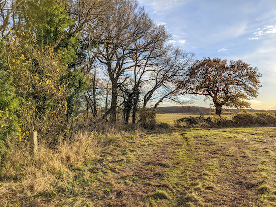 |
| Wareside footpath 19 approaching Thistly Wood |
14: Continue across the next field heading first SSE then S for 320m until you reach woodland (location -
https://w3w.co/formed.blame.object).
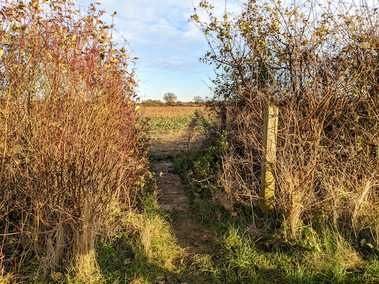 |
| Hunsdon footpath 13 crossing a footbridge |
Continue for 240m across another field and continue to the hedgerow at which point the path you are on reaches a footbridge through the hedgerow where it becomes Hunsdon footpath 13 (location -
https://w3w.co/focal.duck.fortunate).
15: Continue on Hunsdon footpath 13 heading SE for 440m crossing another field then continuing to a junction in the tracks (location -
https://w3w.co/rests.script.pits).
16: Turn left at the junction then head N, now on Hunsdon restricted byway 12, for 700m until you pass through then emerge from woodland (location -
https://w3w.co/pulled.scam.chief).
 |
| Approaching Widford at the end of the walk along restricted byway 20 |
17: At this point the track you are on becomes Widford restricted byway 20, which you continue to follow as it heads NNE for 660m until you reach Ware Road (location -
https://w3w.co/modern.trash.using), where you turn left then head W for 110m back to the start point.
Interactive map


Between WPs 6 and 7 along Crackney lane it is still waterlogged andwith ankle deep mud despite recent dry weather (3.2.22)
ReplyDeleteThanks for that. Did you manage to work round it. David
ReplyDeleteI think we should try to find an alternative route around those points. Ellie and I will go out there in the next few weeks and see if we can find a better way.
ReplyDeleteWe've rerouted this walk to avoid the waterlogged section.
ReplyDelete